The European Space Agency (ESA) last week released an animation showing deforestation in the Brazilian Amazon between 1986 and 2010.
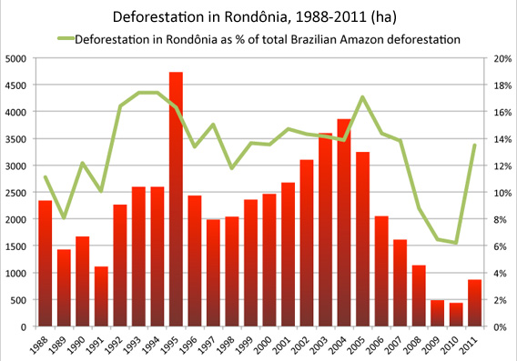
The satellite images show land cover change in Rondônia, a Brazilian state known for its high rate of deforestation since the 1970s. Forests have been cleared in Rondônia mostly for low productivity cattle ranches and industrial soy farms.
Overall, Rondonia lost more than half its forest cover since the late 1970s. Forest today covers 42 percent of the state.
The ESA time series was created using two cloud-free images, a 1986 image from NASA’s Landsat mission and a 2010 image from the Spanish Deimos mission. ESA simulated annual changes using other satellite data acquired during the 24 year period between 1986 and 2010.
Related articles
>