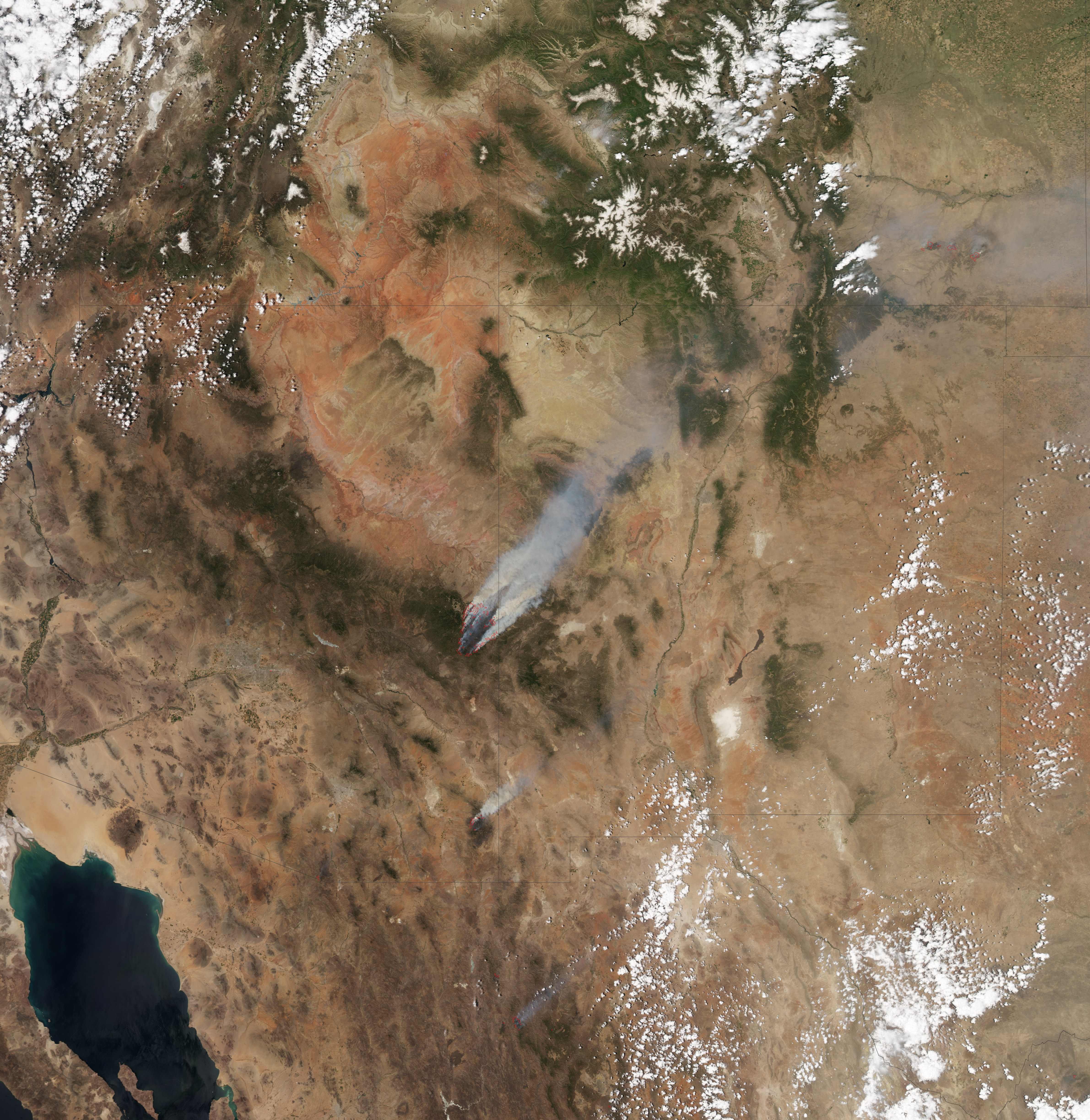
NASA Earth Observatory image created by Jesse Allen, using data provided courtesy of the University of Wisconsin’s Space Science and Engineering Center MODIS Direct Broadcast system. Click image to enlarge. The image is also available via Google Earth (KMZ).
NASA released a satellite image of the Wallow Fire that has become the largest fire in Arizona history.
This image, taken by the Moderate Resolution Imaging Spectroradiometer (MODIS) on the Aqua satellite, shows the fire at 1:25 p.m. local time on June 8, 2011, when the fire had burned 608 square miles, mostly in the Apache National Forest. According to the Forest Service, more than 730 square miles has now gone up in smoke. The first is presently 18 percent contained.
The Wallow Fire is thought to have resulted from a campfire on May 29.
The fire has triggered evacuations of thousands of people from the communities of Alpine, Blue River, Greer, Nutrioso, Sunrise, Springerville, and Eagar in Arizona.
The fire is causing air pollution across large areas east of the Rocky Mountains.
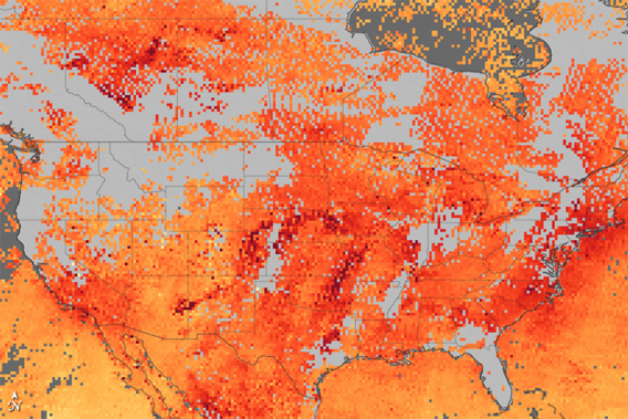
Hazy skies greeted many Americans on June 8, 2011, as poor air quality dominated from the Midwest to the Atlantic Seaboard. There were several causes, but Arizona’s Wallow Fire was a major contributor. Thick bands of smoke were visible in satellite images of the Midwest, and forecasts called for the smoke to move into the central and eastern United States. On top of that, weather conditions—high temperatures, calm winds—were just right for a classic summer pollution event in the East. One of the constituents of both smoke and urban pollution is carbon monoxide. This map, made with data from the Measurements of Pollution in the Troposphere (MOPITT) sensor on the Terra satellite, shows carbon monoxide concentrations over the United States and southern Canada between May 25 and June 8. Dark red pixels reveal high concentrations. NASA image created by Jesse Allen, using data provided by the National Center for Atmospheric Research (NCAR) and the University of Toronto MOPITT Teams. Caption by Holli Riebeek.
So far no deaths from the fires have been reported. More than 70 buildings have been destroyed.
Related articles