Google released satellite images revealing the devastation in Minamisanriku caused by the March 11 tsunami and earthquake.
The satellite images are available on Google Earth and Google Maps.
Minamisanriku 2002. Satellite picture courtesy of Google Earth / GeoEye.
Minamisanriku after the March 11, 2011 Sendai earthquake and tsunami. Satellite picture courtesy of Google Earth / GeoEye.
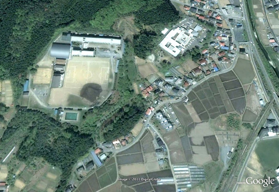
Minamisanriku SOS 2002. Satellite picture courtesy of Google Earth / GeoEye.
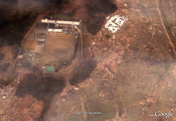
Minamisanriku SOS after the March 11, 2011 Sendai earthquake and tsunami. Satellite picture courtesy of Google Earth / GeoEye.
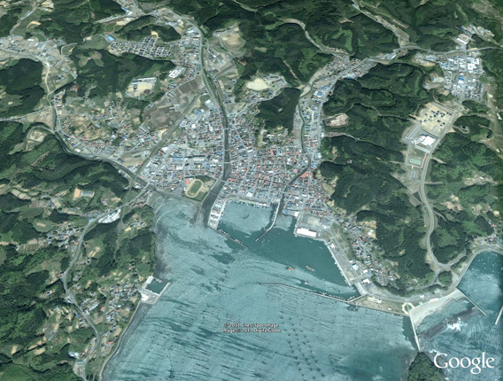
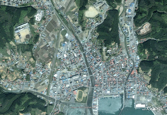
Minamisanriku wide angled 2002. Satellite picture courtesy of Google Earth / GeoEye.
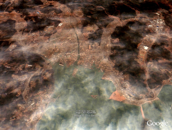
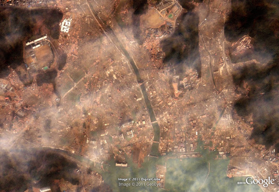
Minamisanriku wide angled after the March 11, 2011 Sendai earthquake and tsunami. Satellite picture courtesy of Google Earth / GeoEye.
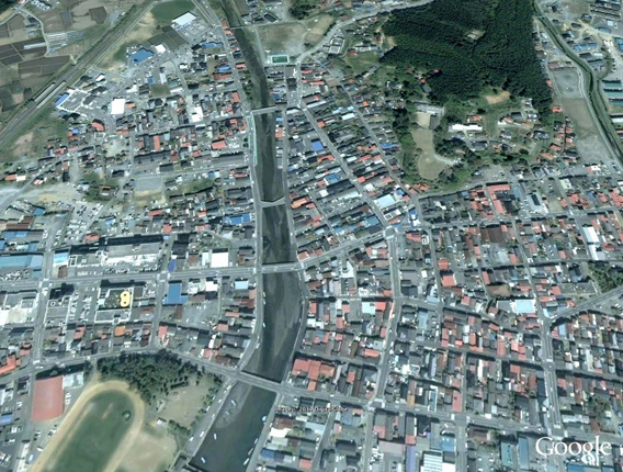
Minamisanriku detail 2002. Satellite picture courtesy of Google Earth / GeoEye.
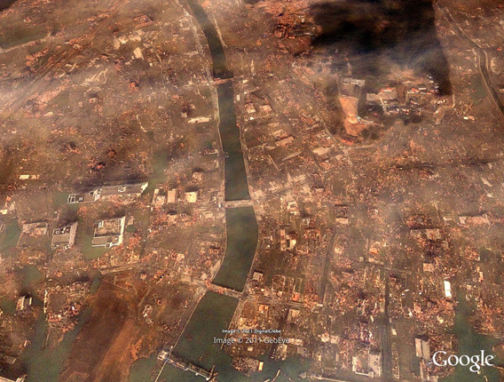
Minamisanriku detail. Satellite picture courtesy of Google Earth / GeoEye.