Reducing Emissions from Deforestation and Degradation (REDD), a climate change mechanism proposed by the U.N., has been widely lauded for its potential to simultaneously deliver a variety of benefits at multiple scales. But serious questions remain, especially in regard to local communities. Will they benefit from REDD?
While much lip-service is paid to community involvement in REDD projects, many developers approach local communities as an afterthought. Priorities lie in measuring the carbon sequestered in a forest area, lining up financing, and making marketing arrangements, rather than working out what local people — the ones who are often cutting down trees — actually need in order to keep forests standing. This sets the stage for conflict, which reduces the likelihood that a project will successfully reduce deforestation for the 15-30 year life of a forest carbon project.
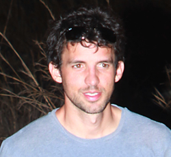 Brodie Ferguson. |
Brodie Ferguson, a Stanford University-trained anthropologist whose work has focused on forced displacement of rural communities in conflict regions in Colombia, understands this well. Ferguson is working to establish a REDD project in an unlikely place: Colombia’s Chocó, a region of diverse coastal ecosystems with some of the highest levels of endemism in the world that until just a few years ago was the domain of anti-government guerrillas and right-wing death squads.
Ironically, violence in the Chocó is one reason why the region’s ecosystems are in relatively good shape — armed conflict discouraged investment in the area. But waning guerrilla activity has ushered in commercial interest in the region leading to new conflicts between the traditional owners of land — indigenous and Afro-Colombian communities — and developers, notably ranchers and agribusiness. But thanks to Colombia’s 1991 constitution, which established a collective titling system for traditional land users, indigenous and Afro-Colombian communities have the upper hand, at least from a legal standpoint. Still, these communities are poor, marginalized, and subject to manipulation and intimidation by developers. Some groups have signed deals that have provided them with a small amount of money upfront at the expense of the ecosystems on which their livelihoods depend.
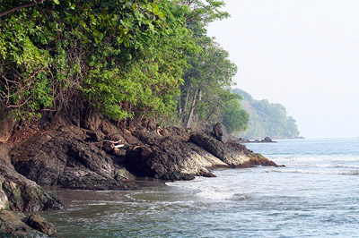 Coastal rainforest near Playeta Beach in Acandí, Chocó. Courtesy of Anthrotect / Brodie Ferguson. |
The emergence of payments for ecosystem services mechanisms like REDD now offers communities in the Chocó an alternative development model that could allow them to continue using their lands for traditional activities while gaining access to improved health and education, microfinance, and sustainable business opportunities. Ferguson says while NGOs have been working for decades in the Chocó to foster sustainable livelihoods, REDD could finally be the mechanism that generates sufficient funding to get projects off the ground.
In a November 2009 interview with mongabay.com, Ferguson discussed his work with communities the Chocó and the challenges of organizing a REDD project in a remote region.
AN INTERVIEW WITH BRODIE DAVID FERGUSON
Mongabay: What is your background and how did you become interested in forest carbon?
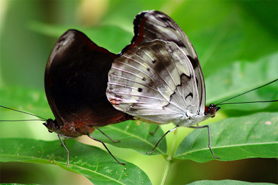 Butterflies near Loma del Cielo. Acandí, Chocó. Courtesy of Anthrotect / Brodie Ferguson. |
Brodie Ferguson:
I grew up in the southeastern United States and didn’t visit the tropics until I traveled to Bolivia for malaria research in college. That trip left a deep impression on me and I came back with a new interest in ecology and the different ways that people interact with the environment. After college, I worked in Switzerland for several years on health and development projects before returning to the U.S. to pursue a doctorate in anthropology at Stanford. My interest in conservation grew out of my travels over the years and from the profound realization that many of the world’s most fascinating languages, traditions, and ecosystems are quickly disappearing. I first visited Colombia in 2005 as part of my doctoral research on conflict, and I eventually came to focus on the Chocó region and the Darién in particular. I began exploring ecosystem service models for rural communities returning from conflict displacement, and forest carbon is perhaps the most promising tool for conserving tropical ecosystems.
Mongabay: What is your project and where is it located?
View Larger Map
Brodie Ferguson:
The Chocó-Darién Ecological Corridor is a carbon project being developed with Afro-Colombian and indigenous communities in the Darién region of northwest Colombia near the Panama border. The area lies within the upper limits of the Chocó biogeographic region, which extends along the Pacific slopes of the Andes from Panama through Colombia down into Ecuador. The Chocó is known for its high levels of biological diversity and endemism, but the Darién is particularly special. Over 400 species of birds inhabit the Daríen, which is nearly 25% of the total number of species registered for Colombia in an area less than 1% of the country’s total size. The region is home to endangered mammals like the puma, jaguar, tapir, and spectacled bear. Two adjacent national parks (Los Katíos in Colombia and Daríen in Panama) have been recognized by UNESCO as World Natural Heritage sites for their natural and cultural wealth.
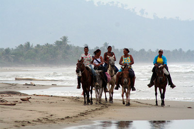 Catching up on the day’s gossip along Playona Beach. Acandí, Chocó. Courtesy of Anthrotect / Brodie Ferguson. |
What’s just as important about Colombia’s Pacific coast, however, is the socio-political trajectory of the region’s Afro-indigenous groups. The Constitution of 1991 was very progressive in that it recognized the pluralistic nature of Colombian society, decentralized certain functions of government, and paved the way for the titling of lands traditionally occupied by Afro-Colombian communities. The World Bank was a driving force behind this process, which has resulted in the collective titling of over 5 million hectares to over 120 community councils since 1996. This represents an extraordinary opportunity and challenge for both black and indigenous communities in the Chocó and elsewhere in Colombia, who now bear a much greater responsibility for social development and environmental conservation in their territories.
Mongabay: Is the forest in good shape?
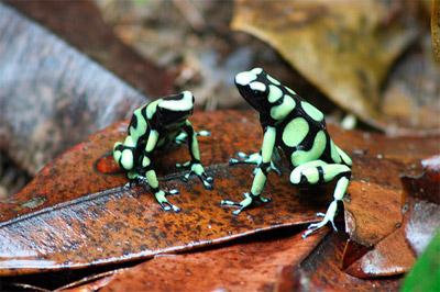 A pair of green and black poison dart frogs (Dendrobates auratus) near Triganá. Acandí, Chocó. Courtesy of Anthrotect / Brodie Ferguson. 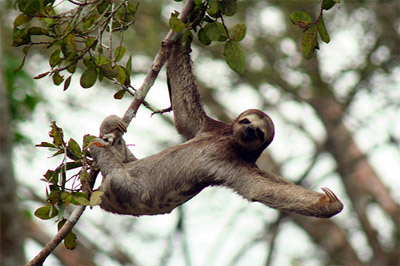 A three-toed tree sloth (Bradypus variegatus) along Perancho River. Riosucio, Chocó. Courtesy of Anthrotect / Brodie Ferguson. |
Brodie Ferguson:
Over half of the original forest cover in Colombia is still intact, and a substantial part of it lies in the Chocó region. This includes everything from coastal mangroves and seasonally flooded forests at sea level to lowland rainforest and cloud forest up to 1,500m. When you mention the Daríén, many people think of the break in the Panamerican Highway and imagine vast swamps and impenetrable jungles, but the reality is that the region has experienced profound human intervention on multiple scales. Since the 1950s, over half of the forest north of Los Katíos Park has been converted specifically for pasture, which, combined with small-scale clearing for crops, has led to a very visible pattern of mosaic deforestation in the region. In fact, part of the area which today constitutes Los Katíos National Park was once a large diversified farm, so the park includes thousands of hectares of secondary forest in regeneration. Further south, legal concessions for the large-scale exploitation of timber species such as cativo (Prioria copaifera), balsam (Miroroxylum balsamun), and arracacho (Montrichardia arborescens) have degraded the original forest and exacerbated sedimentation in the region’s rivers. At the same time, recent years have seen an acceleration of small-scale selective logging throughout the Darién that is gradually altering the composition of the forest and the species that inhabit it.
Mongabay: Who lives in the area and how do they earn a living now?
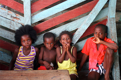
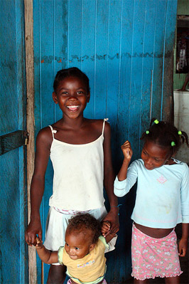 Children play in the fishing village of Tumaradó on the banks of the Atrato River. Unguía, Chocó. Courtesy of Anthrotect / Brodie Ferguson. |
Brodie Ferguson:
The area is mostly inhabited by Afro-Colombian communities, who gradually migrated north from the Chocó or westward from Caribbean areas such as Cartagena. They have generally settled the middle and lower river basins and get along well with the existing, more isolated populations of Kuna, Embera, and Wounaan. In addition to these groups, mestizo colonists have immigrated to the region over the last several decades from the neighboring departments of Antioquia and Córdoba. Historically, most Afro-Colombians and indigenous in the Darién have supplemented subsistence farming and fishing with other commercial activities as the opportunities arise. But toward the end of the 1990s, before the communities obtained legal title to their traditional lands, an escalation in conflict in the region saw thousands of people forcibly displaced. Some, such as the Kuna community at Arquía, took refuge in Panama while others fled to nearby cities like Turbo and Apartadó. Many have been able to return thanks to security improvements, but the impact on rural livelihoods has been enormous. Most crops, like rice, cassava, and plantain, are no longer grown in sufficient quantities to be sold to neighboring regions. So logging and fishing continue to be principal sources of income, although some find work on the ranches as well.
Mongabay: Has there been much conflict in the region? Is that a factor in why is the forest still standing?
Brodie Ferguson:
The armed conflict has been something of a double-edged sword for conservation in Colombia. On the one hand, heightened security risks in rural areas, along with the fact that nearly a third of the country’s land is titled to indigenous groups, have prevented the large-scale deforestation for agriculture that you see in places like Mato Grosso (Brazil) or Kalimantan (Indonesia). At the same time, the conflict is undoubtedly a factor in inefficient land use and low agricultural yields, especially where entire communities have been displaced. Coca cultivation results in the conversion of an estimated 100,000 hectares of forest each year in Colombia, and the chemicals used to process the leaf into cocaine have an indisputably negative impact on ecosystems. However, coca is more profitable per hectare than almost any other crop, so it’s a relatively optimal land use from an environmental perspective. Another issue is that profits from drug trafficking have often ended up reinvested in extensive ranching, with negative consequences for the country’s forests.
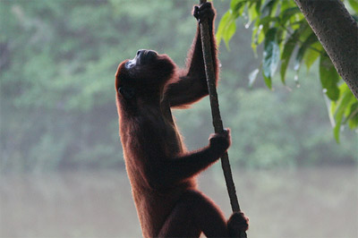 A red howler monkey (Alouatta seniculus), one of many primates found in the Daríen region. Courtesy of Anthrotect / Brodie Ferguson. |
The Darién and Urabá regions have been particularly affected by conflict, although conditions have improved quite a bit over the last five years. There has been very little coca cultivation, but the region’s proximity to Panama combined with virtually unlimited river and sea access have attracted smugglers and armed groups alike. In the 1990s, guerrillas targeted the Antioquian side of the Atrato River, which is the heart of the Colombian banana industry, as well as the extensive cattle ranches of the municipalities of Acandí and Unguía in the Chocó. Paramilitary self-defense groups formed in response, and the resulting dynamic led to the large-scale displacement of rural communities toward the end of the 1990s and early part of this decade. Essentially, Urabá has been the stage for a clash of development ideals emblematic of many of the social processes going on elsewhere in Colombia and in Latin America. The land titling process initiated by the World Bank and carried forward by INCODER, the demobilization of paramilitary groups, and the gradual development of government institutions in the region have all been key factors in the return of communities to their traditional lands. These factors have been crucial in paving the way for alternative development models based on ecosystem services.
Mongabay: What are the threats?
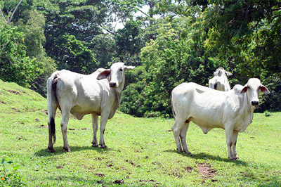 Cattle grazing in Acandí, Chocó. Acandí, Chocó. Courtesy of Anthrotect / Brodie Ferguson. |
Brodie Ferguson:
At the national level, the Colombian government clearly recognizes both the threats posed by climate change to the country and the opportunities the country has to help the world meet its emissions reductions targets. Institutions such as the Ministry for the Environment, Housing, and Territorial Development (MAVDT) and the Institute for Hydrology, Meteorology and Environmental Studies (IDEAM) are very active in international dialogues and are working to ensure that the right technical and regulatory mechanisms are in place. Positive measures have been taken to address corruption and Colombia compares very favorably to other tropical countries in terms of overall government transparency. Institutional capacity at the regional and local levels is still weak, however, especially in remote areas such as the Chocó.
As for the threats at the project level, it helps to think in terms of threats that are internal to the communities holding the land titles as well as external threats that the communities collectively face. The 1991 Constitution and Law 70 of 1993 have effectively relegated the responsibility of conserving the Chocó’s rich ecosystems to Afro-Colombian community councils who lack the resources and tools necessary to do the job. Some families, for instance, are unaware of their new rights and responsibilities, and continue to slash and burn for what they consider to be traditional or household use. Others engage in selective logging without the proper approval of either the community council or the regional environmental authority (CODECHOCO). Before forested lands were collectively-titled to specific communities, large-scale logging concessions were granted first by the national government and then later by CODECHOCO. Since titling, however, timber is typically purchased directly from members of the community by middlemen from Turbo or Cartagena. Improving the capacity of the community councils to monitor and manage these sorts of activities is key.
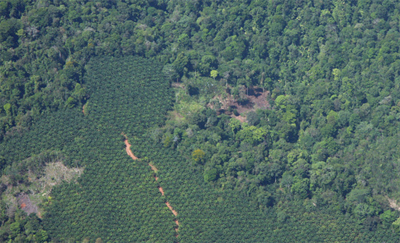 Oil palm cultivation. Photo by Rhett A. Butler. |
At the same time, the communities face a number external threats which will increase with further security improvements in the region. Among these are the expansion of cattle ranching and large-scale agriculture, particularly bananas, plantains, and oil palm. Colombia is the world’s fifth largest exporter of palm oil and the national government has aggressive plans to ramp up production for both export and domestic biofuel use. In 2005, the Colombian Institute for Rural Development (INCODER) called for the immediate restitution of some 5,000 ha of collectively-titled Afro-Colombian lands in the Curvaradó River basin which had been illegally acquired and planted by eight oil palm companies after the displacement of the local communities. While this is an exceptional case that’s unrepresentative of the industry as a whole, it does highlight the risks that are present in a region such as the Chocó. In addition to agricultural expansion, a number large-scale infrastructure projects threaten the social and environmental integrity of the Darién. The completion of the Panamerican Highway through the Cacarica River basin, for example, is likely to spark a new wave of colonization and land speculation in the region.
Mongabay: What have been the challenges in building a consensus among local communities to support the project? What have been the principle concerns?
Brodie Ferguson:
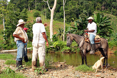 Discussing land use near the community of Batatilla in the Serranía del Darién. Acandí, Chocó. Courtesy of Anthrotect. Courtesy of Anthrotect / Brodie Ferguson. |
The first challenge is getting there, since the communities are widely dispersed and many are reachable only by dugout canoe or on horseback. Organizing meetings requires a lot of flexibility and patience, and communicating new ideas and concepts is a challenge in any setting. Payments for ecosystem services (PES) programs essentially introduce new incentives for activities that conserve or enhance particular ecosystem functions, in this case, carbon sequestration and storage. The communities understand this basic premise, that by modifying certain behaviors and implementing specific activities, they can provide a service to the world and receive benefits in return. One point requiring careful clarification is that community lands are neither purchased nor can they be foreclosed upon in the event of project non-compliance. Likewise, biopiracy is a sensitive issue and the communities have sought reassurance that no intellectual property rights are implicated in the project. Another legitimate concern has been whether or not carbon markets will actually result in real emissions reductions on the part of developed countries. Lastly, the communities are concerned that they might be held responsible for events beyond their control, such as deforestation authorized by the national government for road construction or mining. Overall, however, the real challenge has been not so much building consensus in the communities as striking the right balance between the interests of the communities, investors, and environmental groups.
Mongabay: Are you working with local NGOs?
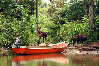 Unloading cargo along the Perancho River. Riosucio, Chocó. Courtesy of Anthrotect / Brodie Ferguson. |
Brodie Ferguson: A number of NGOs have been active in the region. WWF Colombia and Conservation International have been instrumental in calling international attention to the Chocó biogeographic region as a global biodiversity hotspot. Oxfam, the Norwegian Refugee Council and Justicia y Paz have done important work monitoring human rights and attending to the needs of displaced communities in Urabá and the Darién. Local environmental NGOs, such as Fundación Natura, Fundación Darién, and Fundación Amigos del Chocó have worked for decades in the Chocó to develop sustainable livelihoods for the region’s inhabitants. Overall, though, it’s been understandably difficult for these groups to compete with global demand for palm oil, timber, precious metals, and beef. On the academic side, we’re working with Prof. Orlando Rangel and his team at the National University in Bogotá on land cover analysis and plans for assessing and monitoring the project’s biodiversity impacts. We also work closely with the National Parks Service, since Los Katíos faces many of the same threats that we’re working to address in the surrounding communities, especially illegal logging inside the park.
Since different communities have different experiences and preferences regarding the organizations they work with, we opted for a fund-based model where project funds are supervised by a third-party non-profit, the Fund for Environmental Action, which will distribute money to local organizations via a transparent tender system. This system offers a number of advantages. First, it allows specific project components to be implemented by the most qualified organizations. Second, it fosters greater accountability and offers a mechanism for the continuous project evaluation which can be eventually integrated with carbon monitoring and certification both at the project and national levels. Finally, it leaves the door open for communities to take on more and more responsibility for the project as they develop their organizational capacity and skills. We feel this is a much more flexible approach that’s appropriate given the uncertainties in the development of the carbon markets and the 30-year time horizon of the project.
Mongabay: How will your project avoid deforestation while providing livelihoods for communities? How do the different communities want the money distributed/used?
Brodie Ferguson:
 Afro-Colombian children in the fishing village of Tumaradó on the banks of the Atrato River. Unguía, Chocó. Courtesy of Anthrotect / Brodie Ferguson. |
This is the real challenge. In places like the Daríen where communities derive a substantial portion of their income from the sale of timber (up to 80%), it’s unreasonable to expect carbon benefits to completely substitute for logging. However, most logging is done in such a disorganized and uncoordinated manner that there’s enormous potential to improve. We’re working to refine forest management plans as part of a broader land use planning process which is essentially the foundation of the project. The communities decide which areas are optimal for sustainable timber harvesting or other community use, and designate private protected areas which are off-limits for clearing and logging. The communities see forest certification as a promising way to not only boost carbon benefits but also achieve improved market access for higher quality timber products. Once a solid plan is in place, other threats can be addressed by providing the community councils with the skills, equipment, and financial resources to govern their forests and ensure compliance with policies.
The communities also have a number of pressing infrastructure needs that the project will address. These include expanding cell phone coverage, setting up solar and micro-hydro energy, and maintaining roads, trails, and waterways. We’re also designing a revolving fund that will jump start pig and poultry farming, aquaculture, and other community micro-enterprises. The distribution of revenue within the communities has been one of the more controversial points in the design of the project. Who should receive more monthly benefits, for example, a family of eight settled on 20 hectares of pasture, or a family of three that occupies fifty hectares of primary forest? There is clear consensus that all community members must regularly receive a minimum, tangible benefit, and that a portion of revenues must be set aside for health, education, infrastructure, and other collective priorities as identified in the community development plans.
Mongabay: Is there potential for ecotourism?
 The red-eyed tree frog (Agalychnis callidryas) is one of hundreds of frog species found in the Darién. Colombia has one of the most diverse amphibian communities in the world, with over 750 species recorded. Courtesy of Anthrotect / Brodie Ferguson. |
Brodie Ferguson: Colombia is one of the most fascinating countries I’ve visited, and it’s a shame more foreigners don’t experience the warmth of its people and the beauty of its landscapes. On a flight back from the Chocó last August, the pilot of our nearly empty Twin Otter detoured out over the Pacific Ocean to admire a family of humpback whales against the lush green backdrop of the Serrania del Baudó. Colombia has been visited by record numbers of tourists in recent years, but most don’t make it to the Chocó. The Caribbean beaches of the Darién, especially Triganá, Capurganá, and Sapzurro, are relatively accessible and already receive a few hundred visitors per month. So the communities have some experience already, and they’re aware of the impacts of tourism in places like Cancún and Cartagena. They have spectacular scenery, warm hospitality, and great ideas on how to do things the right way, and I’m confident the carbon credit revenue will help make it happen.
AnthroTect