Industry-driven road-building to fuel Amazon deforestation
Industry-driven road-building to fuel Amazon deforestation
Rhett A. Butler, mongabay.com
March 12, 2008
|
|
Unofficial road-building will be a major driver of deforestation and land-use change in the Amazon rainforest, according to an analysis published in Philosophical Transactions of the Royal Society B. Improved governance, as exemplified by the innovative MAP Initiative in the southwestern Amazon, could help reduce the future impact of roads, without diminishing economic prospects in the region.
Roads in the Amazon
Road-building spurs forest development in the Amazon by providing access for loggers, land speculators, ranchers, farmers, and colonists to otherwise remote wooded areas. Beyond facilitating deforestation, roads affect forests and biodiversity by fragmentation, which increases vulnerability to forest fires and has other negative ecological consequences.
Still, roads are seen as an expedient way to expand extractive industries and promote agricultural expansion in the Amazon. As such, roads are increasingly funded and built by interest groups, especially the agroindustry and logging sectors. These “unofficial” roads complement existing government-sanctioned roads originally built under economic development schemes in the 1970s and 1980s. Industry also exerts pressure on lawmakers to fund road improvement projects, like the paving of highways. These improvements further promote the expansion of unofficial road networks, which improve the economic viability of resource extraction and agricultural production in once inaccessible areas. Improved economic viability provides greater incentive for more road-building and the cycle continues.
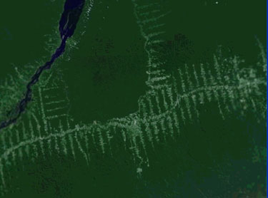
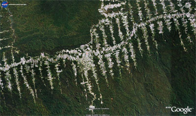 BR-230 highway near Rurópolis, Brazil in the heart of the Amazon. Image courtesy of Google Earth |
Reviewing the economic drivers of road-building in the Amazon, Stephen Perz and colleagues conclude that breaking the road-building feedback cycle will require improved governance. The authors cite the MAP Initiative in the southwestern Amazon as a model that could be used elsewhere in the Amazon to rein in and reduce the negative environmental impact of the unofficial roads, which are presently expanding at a significantly faster rate than official road networks in the region.
Government road improvements spur expansion of unofficial roads
The authors note that “distinguishing between official and unofficial roads in the Amazon reveals an important synergy: paving of official roads motivates unofficial road building.”
|
“Paving raises land values, which provides the incentive to exploit natural resources farther out from official road corridors. This in turn is made possible via construction or extension of unofficial roads, which then generate income that facilitates additional road building. This synergy poses a dilemma for environmental governance in the Amazon,” they write.
“On the one hand, official paving projects enjoy considerable political support and unofficial road building is crucial for local livelihoods. On the other hand, new infrastructure without environmental governance will probably lead to forest fragmentation and social conflicts. Such outcomes not only undermine the sustainability of current local livelihoods but also render forest more vulnerable to climate change, threatening future livelihood sustainability.”
Perz and colleagues say these issues have “prompted the discussion of new models of environmental governance” in the Amazon and cite the MAP Initiative as “an example of an innovative hybrid approach to environmental governance.”
MAP: A model for governance
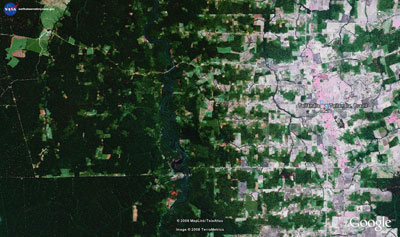
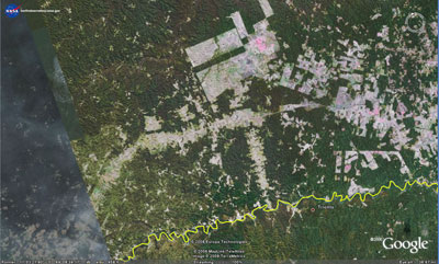
 Roads in the Brazilian Amazon. Courtesy of Digital Earth. |
‘MAP’ refers to the trinational frontier area between Bolivia, Brazil and Peru that is “incurring large-scale infrastructure investments for the Inter-Oceanic Highway”, a project that will connect Pacific Ocean ports to the heart of Amazonia with a paved highway. Projections for the region suggest the plan could have a detrimental impact on the environment: under a “business-as-usual” scenario, roughly 67 percent of MAP’s 300,000 hectares of forest cover and 40 percent of its mammalian biodiversity will be lost by 2050.
The authors say the MAP Initiative is working to avoid this fate by building capacity across national borders for tri-national environmental governance in what they call a “polycentric network”.
“The MAP Initiative has organized tri-national forums open to the public for presentations, dialogue and planning activities involving four key themes: economic development, environmental conservation, social equity and public policies,” they write. “This multifaceted array of themes allows for consideration of the many impacts of roads as well as climate change.”
“The underlying strategy of the MAP Consortium is to premise trans-boundary environmental governance on sustaining an autonomous, polycentric structure that does not rely on a single centralized authority such as a government, or on a fully decentralized, uncoordinated network such as a set of local communities,” they continue. “By retaining flexibility while ensuring coordination, the MAP Consortium constitutes a structure for collaborative environmental governance that can manage itself adaptively in order to respond quickly to rapid changes.”
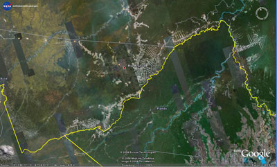
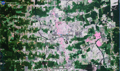
MAP tri-border area. The yellow line marks the border with Brazil above. Satellite image courtesy of Google Earth |
Stephen Perz, a sociologist at the University of Florida, says the initiative — the planning process for which links scientific data to public deliberations involving industry, NGOs, local communities including indigenous groups, and state bodies — will help ensure proper governance no matter the future circumstances in the region.
“The Inter-Oceanic Highway is bringing major changes to the southwestern Amazon, but it needs to be seen in the context of many other challenges, including other infrastructure projects, notably the Madeira Dam Complex, as well as climate change itself,” Perz told mongabay.com via email. “The southwestern Amazon faces opportunities as well as perils due to economic integration — such as growing investment from outside the Amazon in sugar cane and petroleum — or from climate variability, which in recent years has included drought and fires (2005) as well as floods (2006 and right now in February 2008). This complex circumstance has strengthened recognition of shared interests and concerns among communities and local governments on all three sides of the MAP frontier. That has resulted in annual tri-national MAP [forums], open to the public, to broaden participation in planning for more sustainable resource management via a polycentric network.”
The same polycentric network concept could be applied in other parts of the Amazon where pressure from roads is likely to rise. The net effect: a reduction in deforestation, biodivesity loss, and conflict over land.
Stephen Perz et al (2008). Road building, land use and climate change: prospects for environmental governance in the Amazon [FREE OPEN ACCESS]. Phil. Trans. R. Soc. B, DOI: 10.1098/rstb.2007.0026