Remote island provides clues on population growth, environmental degradation
Remote island provides clues on population growth, environmental degradation
University of Oregon
August 24, 2006
Halfway between South America and New Zealand, in the remote South Pacific, is Rapa. This horseshoe-shaped, 13.5 square-mile island of volcanic origin, located essentially in the middle of nowhere, is “a microcosm of the world’s situation,” says a University of Oregon archaeologist.
Until only recently, little was known about the French Polynesian Island, where the current population is less than 500. Archaeological, linguistic and genetic data suggest that the island, like much of East Polynesia, was inhabited in a final pulse of colonization by seafaring travelers who originated from Island Southeast Asia. New research, led by the University of Oregon’s Douglas Kennett, has shed fresh new light on Rapa, especially on what life may have been like for as many as 1,500 to 2,000 people who lived there before the arrival of European explorers.
 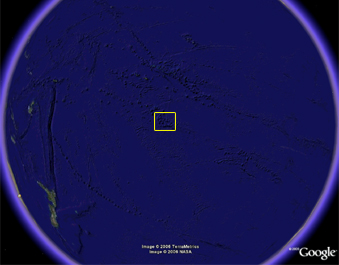 Rapa is one of the most isolated places on Earth as shown in these Google Earth maps. It is located at 27 degrees south latitude and 144 degrees West longitude.
|
Kennett’s team, which included researchers from three institutions, reported in the June issue of the journal Antiquity that Polynesians arrived on the island around A.D. 1200, much later than long assumed. The settlers spread across the island, splintering from a shoreline-based society into competing groups that built and likely defended a growing number of spectacular fortifications carved from mountaintops in the years before English explorer George Vancouver sailed by in 1791, ushering in European contact.
The conclusions of Kennett’s team are based on 48 radiocarbon dates drawn from samples taken from a variety of sites, including archaeological excavations at five of 16 known coastal rock shelters and four of 15 upland fortifications, each with a central tower surrounded by a series of large domestic terraces.
The settlement date for Rapa matches nicely with new data from Easter Island (Rapa Nui) suggesting that colonization there also occurred about A.D. 1200, a conclusion published March 17 by Terry Hunt of the University of Hawaii and Carl Lipo of California State University, Long Beach, in the journal Science.
“Our research confirms that approximate settlement date and supports the idea of a late pulse of colonization into East Polynesia,” Kennett said. “However, we believe that the archaeological record of Rapa’s later history is more compelling than Easter Island’s in terms of what it teaches us about the social and political mechanisms for population dispersal.”
Kennett argues that Polynesians moved to Rapa and several other parts of the remote Pacific after a 1,500-year lull in their major migrations. Around 3,000 years ago, he said, Polynesians had moved into West Polynesia (Fiji, Tonga and Samoa), far to the northwest of Rapa, where they lived until population densities and dwindling food resources spawned fragmentation and aggression. This idea is detailed in a chapter of “Behavioral Ecology and the Transition to Agriculture,” a book Kennett co-edited and which was published earlier this year by the University of California Press.
Archeological evidence, described in the Antiquity paper, showed that Rapa’s earliest occupants lived in coastal rock shelters. One such cave, Tangarutu, is being mined for sand to construct roads. However, Kennett’s team delineated some 400 years of occupation in the cave. Among items found were fragments of sleeping mats, cordage and fish hooks made from shell.
Radiocarbon dating indicated that people relocated their residences to fortified interior locations 300 years after the island was colonized. “These were all related people who arrived in Rapa,” Kennett said. “They generally get along and collaborate when they arrive, but with time and growing populations there was division, then competition between different family lineages, resulting in significant amounts of aggression. This division led to the establishment of fortifications in not very desirable locations, such as mountaintop ridges, where it’s cold, windy, inhospitable for crops, and far away from water.”
In the course of expansion, the islanders developed pond agriculture, similar to rice paddies, for growing taro, a root-crop much like potatoes. The expansion of pond-field agriculture on the island parallels evidence from sediment cores for deforestation and erosion. Taro remains the island’s food staple. Extending into the sea from the various drainage systems flowing from the upland fortifications are linear walls that likely served as tidal fish traps.
“The archaeological landscape is phenomenal,” Kennett said. “There are domestic and agricultural terraces all around the island. Many of the ridge tops are flattened and there are staircases carved into the mountainsides. Arable land and access to fishing grounds were limited, and the farming areas and fish traps would have been well defended.”
The findings and satellite maps taken by Kennett’s team are being shared with the people of Rapa, with whom the team is continuing to work as part of Kennett’s Rapa Heritage Project.
“Rapa is a compelling story,” Kennett said. “To me, this is an example of what’s happening on the planet today in terms of expanding populations, environmental degradation and increasing warfare. Rapa is a little microcosm of our planet. There are lessons about the consequences of population growth to be learned there.”
Co-authors with Kennett on the Antiquity paper were Atholl Anderson and Matthew Prebble, both of the Australian National University, Eric Conte of the University of French Polynesia and John Southon of the University of California, Irvine.
Sarah McClure, an archaeologist in the University of Oregon department of anthropology and assistant director of public programs at the Museum of Natural and Cultural History, served on the Rapa field team. Three other field-team members were: Yann Doignon, who in 2003 received his master’s in arts administration from University of Oregon; Nathan Wilson, who received his bachelor’s degree in 2004 in anthropology from the University of Oregon and who is now pursuing a doctorate at Arizona State University; and Rosine Oitokaia, a native resident of Rapa.
The National Geographic Society, Australian National University and the University of Oregon funded the research.
This is a modified news release (“Remote island provides clues on population growth, environmental degradation”) from the University of Oregon.