Map of earthquake-affected region in Kashmir; city news
mongabay.com
October 10, 2005
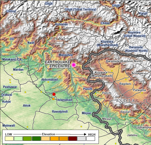 Relief map of earthquake-affected regions in Pakistan, India, and Afghanistan. Image Credit: World Food Programme of the United Nations. |
The death toll in the Kashmir earthquake is now projected between 20,000 and 30,000.
Two days ago a magnitude-7.6 quake struck the border region of Pakistan and India. Afghanistan was also affected. Much of the affected area is extremely remote and virtually impossible to reach by road due to landslides. Pakistan President General Pervez Musharraf has appealed to the international community for help, especially for cargo helicopters to reach remote areas cut off by quake damage.
Eight U.S. helicopters — five Chinook transport choppers and three Black Hawks for heavy lifting — were diverted from the war in neighboring Afghanistan. Washington has also pledged up to $50 million in aid.
Pakistan has accepted aid from its nemesis, India, which has promised tents, food and medicine but has fought a longtime war over the disputed Kashmir region.
More news for individual cities in the affected area can be found below.
Abbottabad, Afghanistan, Ahal, Akhnoor, Arja, Attock, Baffa, Bagh, Bagot, Banda, Baramula, Bhakkar, Chakwal, Chaman, Charsadda, Chichawatni, Dadu, Danna, Daska, Dehra, Dera Ghazi Khan, Faisalabad, Gojra, Gujar, Gujranwala, Gujrat, Gulmarg, Gund, Haripur, Herat, Himalaya, Himalayan, Himalayas, Hub, Hyderabad, India, Islamabad, Jacobabad, Jalalabad, Jammu-Kashmir, Jammu, Jhelum, Kabul, Kahuta, Kandahar, Kandi, Karachi, Kashmir, Kel, Keran, Khanpur, Kharian, Lahore, Leh Ladakh, Leiah, Liam, Lora, Lyallpur, Mandi Bahauddin, Mangla, Mansehra, Mardan, Mazar-I-Sharif, Mingaora, Mirpur, Mirpur Mathelo, Moro, Multan, Murat, Murree, Nankana Sahib, Neelum, Nowshera, Okara, Pakistan, Patan, Peshawar, Punjab, Quetta, Rawala Kot, Rawalakot, Rawalpindi, Riasi, Sahiwal, Sambrial, Sargodha, Saria, Seri, Shang, Srinagar, Taxila, Toba Tek Singh, and Udhampur.
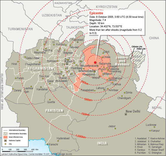 Relief map/diagram of earthquake-affected regions in Pakistan, India, and Afghanistan. Shows epicenter. Image Credit: United Nations Office for the Coordination of Humanitarian Affairs – ReliefWeb. |
This report used information from USGS, The Economist, the Southern California Earthquake Center, Proceedings of the National Academy of Sciences, and Wikipedia.