
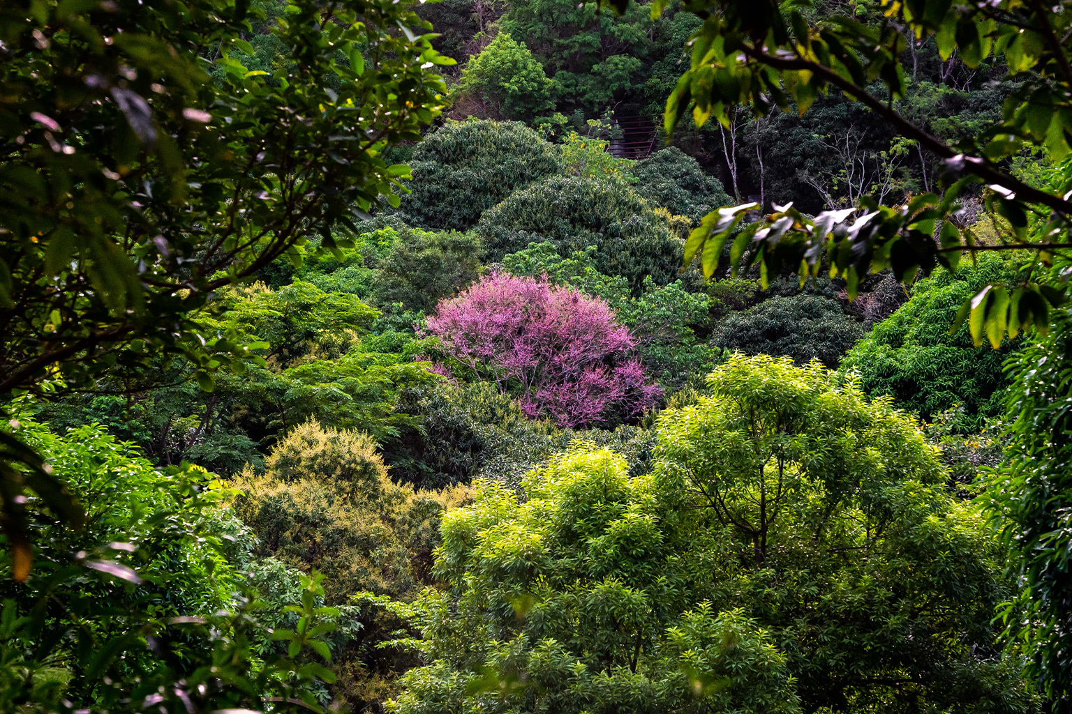
- The Masungi Georeserve is an important geological region about 30 miles from Manila, within a watershed and conservation area that is home to more than 400 species of flora and fauna, several of which are rare and threatened.
- Ann Dumaliang is a co-founder of the foundation that manages conservation and geotourism in the reserve, which is threatened by illegal quarrying, logging and development.
- Masungi’s rangers have faced violent attacks in recent months, but Dumaliang, her family and colleagues are working with numerous organizations and individuals to reforest and preserve the area.
“A lot of people talk about conservation in terms of theory, in terms of simply what is shown in books; but it’s another thing to experience a place and to be able to see how all the elements of life interact in that area. It really creates a different level of empathy,” said Ann Dumaliang, co-founder and managing trustee of the Masungi Georeserve Foundation, Inc. (MGFI), a nonprofit organization that runs a conservation project in Masungi Georeserve in the Philippines.
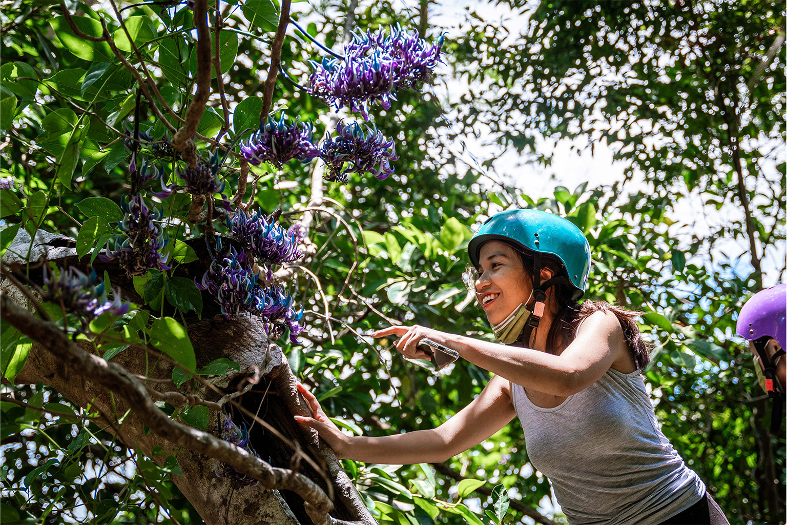
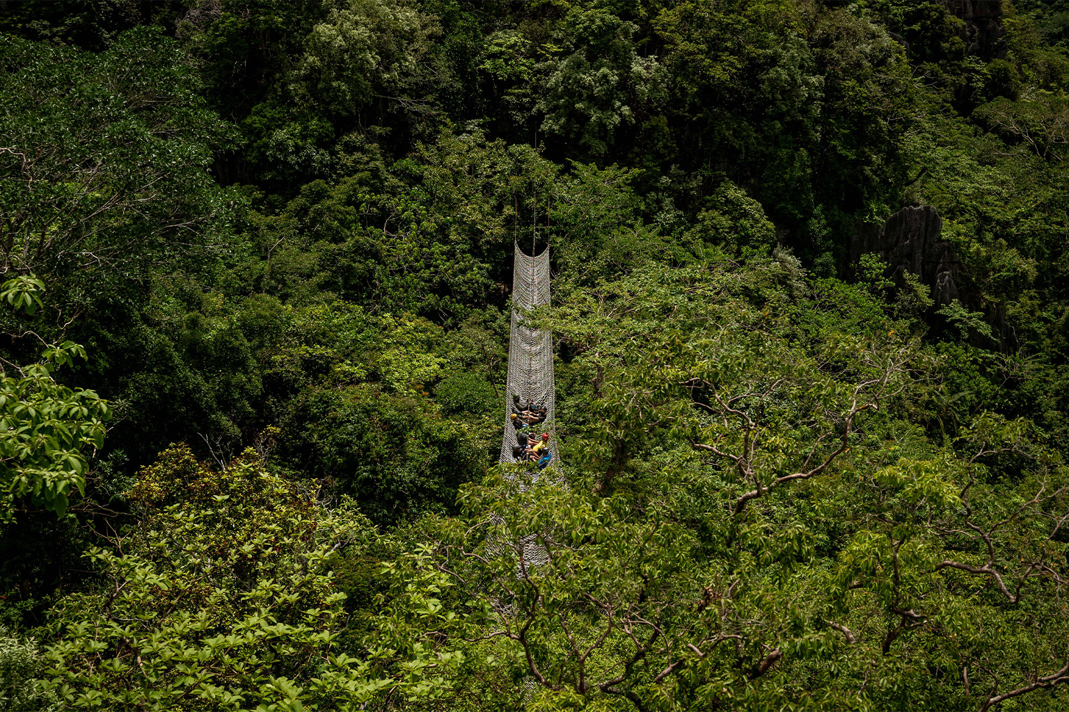
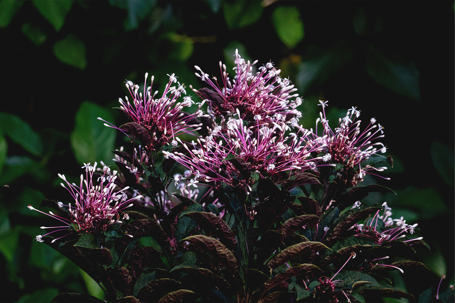
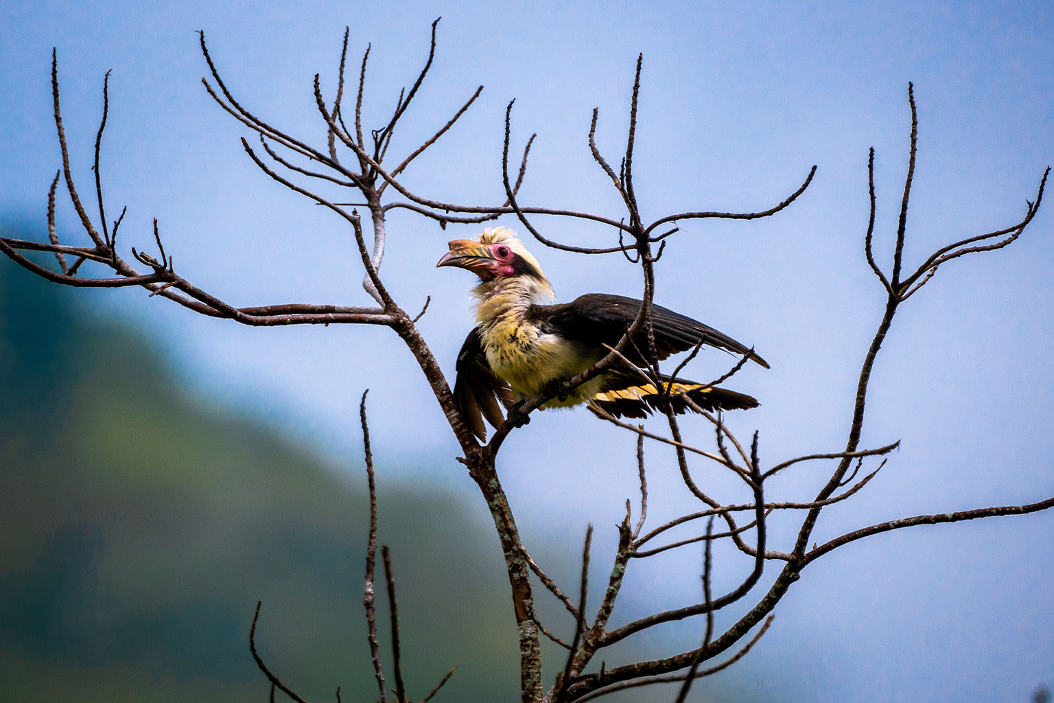
The reserve is an award-winning geotourism site dedicated to the conservation and restoration of the threatened landscape. It is known for its karst terrain, an area of land made up of limestone, formed mostly during the Paleocene epoch 60 million years ago — it is the largest exposed spine of limestone in the Philippines. The winding trails allow people to participate in restoring the forest and to appreciate nature even more. It also serves as a home to more than 400 species of flora and fauna — around 70 of which are endemic to the Philippines — such as the Luzon tarictic hornbill (Penelopides manillae), which is nationally listed as vulnerable; the critically endangered Bagawak-Morado (Clerodendrum quadriloculare) flowering tree; JC’s Vine (Strongylodon juangonzalezii); and the tiny Masungi snail (Hypselostoma latispira masungiensis), which researchers first spotted in 2017.

Masungi Georeserve is located in the rainforests of Baras, in Rizal province, and is approximately 51 kilometers (32 miles) away from Manila’s Ninoy Aquino International Airport. It is found within the 26,000-hectare (64,500-acre) Upper Marikina River Basin Protected Landscape (UMRBPL), a protected area under Proclamation No. 296 (s. 2011), which benefits five municipalities in Rizal — Antipolo, Baras, Rodriguez, San Mateo and Tanay — and regulates water flow toward the National Capital Region of Manila.
However, despite being inside a protected area, the reserve faces threats and challenges such as illegal logging, land-grabbing, quarrying and violence against its forest rangers. Rizal province is abundant in natural resources and is one of the country’s most active quarrying and mining areas. So close to the capital, the landscape also attracts business interests, and the land has a long history of illegal occupation and development.
Even though the public came to know about Masungi Georeserve when the foundation was launched in 2016, reforestation efforts date back to 1996. It had two decades of conservation efforts before the organization was formally established, Dumaliang said. In 2017, the organization entered into an agreement with the government to restore more than 2,000 hectares (4,940 acres) of land.
Since then, Masungi Georeserve has been gaining recognition both locally and internationally for the work the foundation is doing to protect and rehabilitate forest land that for many years was degraded and commercially logged. The foundation’s honors include the Water ChangeMaker Award in 2021 and a special commendation in the Pathfinder Award during the UN Convention on Biological Diversity in 2018. In 2022, Masungi Georeserve also won a UN SDG Action Award under the “inspire” category, besting 3,000 applications from 150 countries.

From visiting the then-barren Masungi during her early years to leading its conservation efforts now, together with her sister, Billie Dumaliang, the intimate relationship that Ann Dumaliang has with the place and the many benefits it brings to her fellow Filipinos inspire her to continue fighting for Masungi despite the challenges.
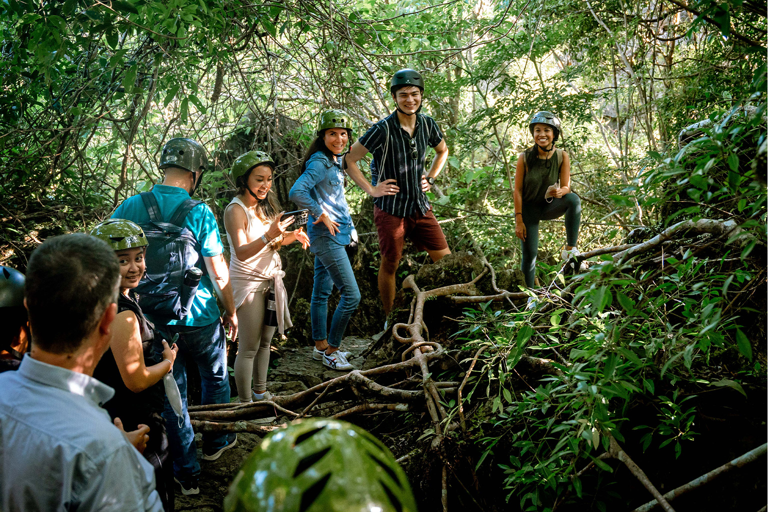
Masungi Georeserve offers various experiences to its guests. Guided by a park ranger, the Discovery Trail offers a 3-4-hour trek that allows guests to go through the conservation area and come up close with the karst terrain. The Legacy Trail allows guests to participate firsthand in tree planting and tree nurturing activities with the help of park rangers. A meal prepared by the local community members is also served. The Garden Picnic includes a 20-minute stroll and 40 minutes of guided activities that allow guests to enjoy nature at their own pace.

Mongabay had a conversation with Ann Dumaliang about Masungi Georeserve and the challenges that MGFI is facing. The following Q&A has been lightly edited for clarity.
Mongabay: What prompted your interest in nature and defending the environment?
Ann Dumaliang: What really triggered my interest is my dad’s interest. We grew up loving the outdoors and spending time taking care of plants because of him. On weekends, we would go out to visit Masungi, which was, at that time, still completely barren and was just filled with grass. The land was already so lost. There [are a lot of] barbed wires because of so many businessmen trying to illegally occupy the area. The sun was very strong because there’s hardly any trees around.

Growing up with Masungi, from my early years until today, really created an affinity for it, for making sure that it survives and exists past my lifetime. If I don’t do what I can to make sure it lasts, that would really be the regret of [my] lifetime.
We have also touched base with a lot of conservationists. It really shows us how relevant the work is, how far we can take the Philippines in terms of natural heritage conservation and really how inspiring the community is. It’s filled with people who are incredibly passionate and who are always out there to seek knowledge, to seek for the truth.
Mongabay: Could you please introduce Masungi Georeserve to us — how it started, the people behind it and the work that you have been doing?
Ann Dumaliang: Masungi started back in 1996. It started as a conservation development initiative that had this huge ambition to protect the land and have a bit of a development component to restore life in the area. At [that] time, it was led by my dad.
In 2016, we launched the Masungi Georeserve brand and the foundation, which is really specifically [aimed at] conservation, education and sustainable development through low-impact geotourism activities. That is now what we [have been] running. We launched it because we are very near Metro Manila. You can expect that urbanization will flood in. We were already seeing interests from quarries and land-grabbing earlier and that’s only bound to grow. We needed to make sure that there are more people who genuinely care for the area and who understand why it’s worth fighting for past our very small group of caretakers in the place.
In 2017, when [former Department of Environment and Natural Resources (DENR)] Secretary Gina Lopez was still in position, she challenged us to work closely with her to make sure that the success is replicated and that the land adjacent to us, which is incredibly important because it’s a watershed that has been experiencing continuous decline, is saved. So, we entered into that agreement with her, at no cost to [the] government, unlike the other greening programs. It is financed solely by the savings that we have from Masungi Georeserve and a little bit from our personal funds.
Mongabay: Was Masungi originally forested? Was it always quarried?
Ann Dumaliang: While I am not very familiar with the history outside my early years, I know that it was heavily deforested prior to us having a project in the area by virtue of our engineering firm. Elder locals I get to speak with recall a place that was lush but was destroyed by commercial logging prior to the land being trafficked [illegally occupied and developed]. We are happy to show that restoration is possible in less than a lifetime. If a group with humble roots like ourselves can do it, others surely can too.
Mongabay: What are the biggest challenges that Masungi Georeserve is facing and how do you deal with these?
Ann Dumaliang: The biggest challenge right now is interests from illegal quarries. We found out in 2020 that 1,500 hectares [3,700 acres] of the 2,700 hectares [6,670 acres] of reforestation site overlaps with illegal quarry agreements. Since then, we, alongside the Upper Marikina Watershed Coalition, a broad base of [60+] organizations that we initiated, have been pushing for the cancellation of these quarries. This has been difficult because even if they’re not operating yet, they’re certainly creating interferences on the ground that make reforestation work difficult for us to pursue. Just because DENR says that the quarries aren’t currently extracting rocks does not mean they are not harming conservationists on the ground, right?
Then there’s also land-grabbing, [which] is challenging because sometimes it involves active police generals. In our area, it involves an active police general and retired DENR officials. Political interference definitely takes it all to a different level.
So all of those three things that I’ve mentioned: quarries, land-grabbing, political interferences, they’ve also been somewhat working together so there are calls instead to cancel our reforestation site instead of these groups being cancelled. It’s crazy because that push has been moving faster than our push to get the illegal groups removed. Some of the show cause [orders issued] by DENR [have] been issued since five years ago and up until now, those groups are still on site.
Our model is an innovation that allows for protected areas to grow and prosper; whereas quarries are clearly prohibited in protected areas. [These aren’t] apples to apples [comparisons] and they shouldn’t be treated similarly by [the] government. It should not be one interest versus another interest. It should be conservation interests taking precedence over everything else.
[DENR] Secretary Maria Antonia Yulo Loyzaga has announced the cancellation of the quarry agreements on the project site, which will only take 90 days from November [2022] to put into effect. We are waiting for that, and we can’t wait to see the cancellation order to be issued. That’s a good thing. We hope this new administration really shows that it’s committed towards climate action and responding to the needs of the environment and the people who rely on it.
[Since this article originally published, the quarry cancellation was put into effect, and Ann Dumaliang asked for continued vigilance regarding any backlash or harassment in the field because of the decision and statements made by DENR. If there are questions or concerns, she asked the oversight committee to smoothly sort out the issues.]
The people depending on our environment are our most vulnerable sectors who haven’t been given enough of a voice to protect the natural resources which they love. I’m talking [about] Indigenous people, people who grew up in these landscapes and who genuinely care for [them]. Instead, the stories [are] getting lost in misinformation and putting environment and development as polar opposites, when on the ground, we all know that’s not the case. This whole nostalgia about loving the area and seeing it get destroyed through time is very painful.
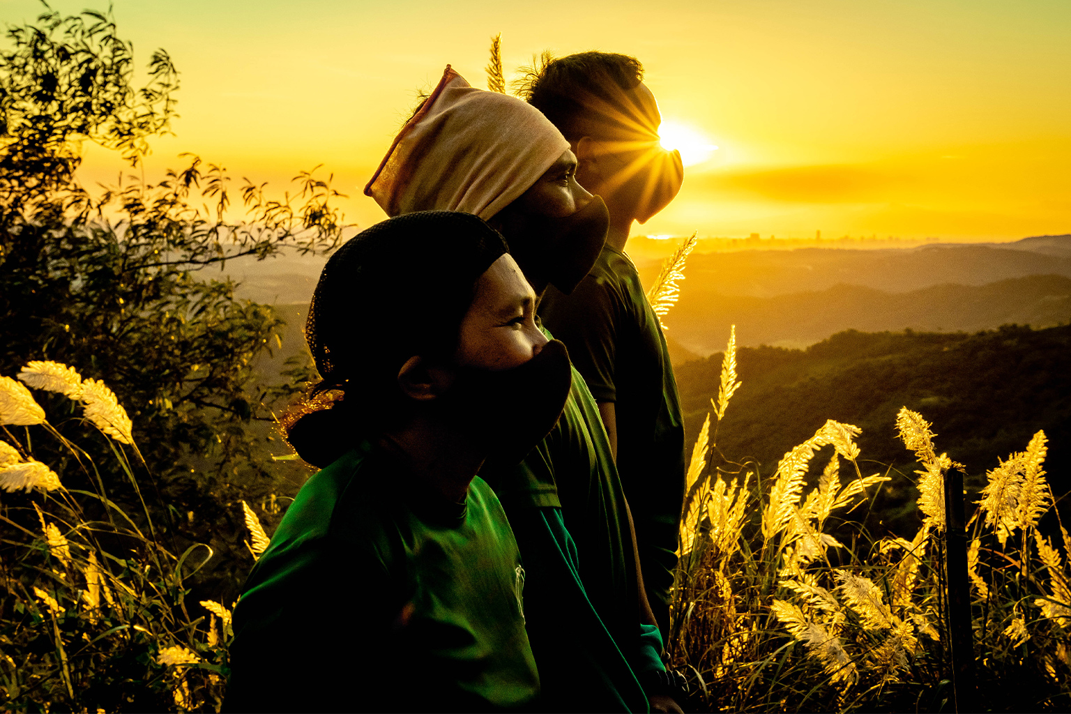
Our rangers have been the target of very hostile and violent attacks. A year and a half ago, two of them almost died because a land-grabber hired someone to shoot them in the middle of the night. The same land-grabber was back with 20 people trying to survey the area right after New Year[‘s Day]. And the police say they do not have enough manpower to respond even if they have already put up a detachment near us, supposedly to answer to our concerns and to help with the conservation work. So we hope that follow-through still happens. Because we trust and hope that our allies within the [Department of Interior and Local Government] and the police see it through.
Mongabay: Masungi is facing a lot of issues related to land-grabbing and quarrying. Can you say more about what people are quarrying and why is there so much land-grabbing?
Ann Dumaliang: The quarry interests in the area are for cement and aggregates. Masungi is only an hour and a half away from Metro Manila. If you look at the city from Masungi, it’s easy to see that a lot of [the rock formations] have already been leveled or moved, and that one of the next rock formations is our rock spine.
Our proximity to major roads and the city also make land-grabbing more active. Normally, personalities and groups who participate in this take advantage of the lawlessness in these areas and the lack of government presence.
For Masungi, we are lucky to have financing to do our work and a management team to be boots on the ground to complement the government.
However, enforcement and overcoming bureaucracy in innovative approaches is one thing that is uniquely for the government to provide. When there is resistance and even sabotage in implementing the laws and enforcement from some government counterparts, including techniques to stall action and deflect the issue, these activities stay prolific even if they are very clearly prohibited in protected areas. What is clearly observed from the Masungi issue is there seems to be greater interest in a witch hunt against Masungi from certain groups instead of working together toward the removal of identified offenders. This still progresses and diverts resources from urgent reforestation work.
And in the macro-perspective, it becomes more difficult and discouraging for civil society and the private sector to support the government in climate action.
Mongabay: Is Masungi getting outside funding? Are there donors? Do most funds come from trail fees?
Ann Dumaliang: [The] majority of our funds for maintenance operations today come from conservation fees that guests contribute as they visit the trail. We have support from our partners — monetary or in-kind for our educational and community activities. We are lucky to have some 200 partners in the different kinds of work and expertise needed.
Mongabay: The Masungi Foundation uses a geotourism and geopark model as a bottoms-up guide in its conservation work. Does that make Masungi Geopark unique?
Ann Dumaliang: For you to become a UNESCO Geopark, you need a landscape of international [geological] significance. … In the Philippines, we do not have an internationally recognized one yet.
Our model is guided by that, but again, it takes years of application [and] efforts to become one; it takes good governance in the area you belong to. We did pursue that back in 2013 but the political space where we are wasn’t ready for such a move. That’s still something that needs to be worked out through time. As far as Masungi’s execution of the model is concerned … two other aspects make the model that we do what it is.
In the Philippines, we have protected areas, but usually it’s a “paper park” execution. Legally, on paper, it has protection; but on ground, it has no capacity to protect itself. No on-the-ground body to protect it. In fact, you have one ranger for every 4,000 hectares [9,900 acres] for our protected areas. And so, management suffers. On-the-ground protection suffers. Enforcement suffers. That’s why we, as an organization, need to do so much around countering illegal quarrying interests [and] land-grabbing.

Because my dad has an expertise in engineering, creative engineering is also a huge part of what we do. If you look at the highlights on our Discovery Trail, you’ll notice that the executions are always greatly inspired by the natural environment. From how the trails are structured and made to our viewing points. It’s a good example of how development and engineering can be used to complement and enable conservation in nature. It can be discreet; it can be exercising enough sensitivities and biomimicry to showcase the natural character of a destination or a location.
Because we have the engineering expertise, it also helps us respond quicker to challenges in the conservation site. Because we know how to make prefabricated ranger stations, we now have 17 ranger stations in the area and we can rival the speed of security forces and land-grabbers when it comes to erecting structures. So it also really allows us to be nimble with responding to the reforestation and protected work that’s needed.
Mongabay: How did Masungi Georeserve adapt to the pandemic?
Ann Dumalaing: The pandemic was really difficult. We couldn’t lay low. We had to be more active in the conservation and protection work. We moved into the area just so, even if there are checkpoints established on the road, response to the site does not get compromised or affected. For our rangers, the same thing happened. Some of them had to stay in. There were no tourism activities but instead, everyone’s work got redirected to conservation, to really responding to the challenges in the reforestation site. So I would say, the last three years have been the most challenging three years since we launched in 2016, by far. Even if there were less guests.

Mongabay: You are facing many challenges, and they are very complicated issues. So, despite all of that, what motivates you to continue fighting for and protecting the environment, especially the Masungi Georeserve?
Ann Dumaliang: For me, just how beautiful the Philippines is and how [many] opportunities we have because of our natural heritage that we are still failing to harness properly and sustainably for the equitable benefit of our people. It motivates me because I know that it can be done differently and that we have a lot of opportunities going for us if only we understand what we have and we take care of it and we harness it correctly. The Philippines went through hundreds of years of colonization and up until today, the way we treat our resources is as if we’re colonizers in our own land. We have to change that mindset. We have to go back to our roots. Understand that there is beauty and value in that knowledge, in that kind of coexistence with nature, which is what everyone’s going for today, right? Just change that mindset and view things differently moving forward.
[Second], what motivates me is despite all of these issues, we are making progress in Masungi. Of the 2,700 hectares monitored, we, alongside other civil society groups, other government agencies, have found creative ways around the problems. As much as we talk about challenges a lot and it does not seem to end, it is moving forward. And we are learning; we are growing. The way things are done are being changed along the way, not just for us but also for the entire country.
And the progress isn’t just with us. I’m very proud of the amount of collaboration and the progress already been made and pursued by the conservation space. I love how the new generation of conservationists have taken lead in each of their own spaces and are actively working together to push things forward despite the lack of resources and despite systematic push for it just yet. So that’s a huge complementing force that really shows the force for good will always be so much bigger. That’s what keeps me motivated.
Of course, the passion of our rangers; the sacrifices that have already been made. On the ground, it’s really something else. It’s really a movement of people working together. Our rangers doing the bit that they can, mayors lending their voice, civil society organizations doing their bit, law firms, media agencies, etc., contributing their skill sets and expertise. It’s really motivating to see that level of collaboration for a greater cause.
Mongabay: Why is it important to create awareness and educate people about what is happening in Masungi Georeserve?
Ann Dumaliang: The work that we’re doing is important because it spans portions of the Upper Marikina Watershed. Restoring the forest in this watershed does not just do good for the communities upland and the water quality, but ultimately has a very direct impact on disaster risk mitigation in the capital of Metro Manila. Numerous scientific studies have already shown that protecting this watershed can reduce peak flow, if we’re talking about disaster risk resilience, by 3-5 hours. It could reduce the [amount] of water from upstream brought down to the city by 27% to 47%.
The problem is, instead of being forested because it’s a protected area, it’s only 11% forested at this point. … So, it really needs a push so that this area is saved and so we can revive the ecosystem services that could supply the 20 million Filipinos who rely on it. That’s why we keep on pushing even if it is incredibly challenging and even if there are threats to our lives because it benefits so many people.
If we can increase awareness and show people how protecting this watershed can save Metro Manila, it’s a huge wake-up call to the Filipino consciousness that we need to really save our forests because our lives are interconnected with it. So, that’s what we want to do by educating people around the Masungi ecosystem, educating them about the importance of the larger Upper Marikina Watershed, and how that ultimately connects down to Metro Manila and people who rely on it downstream.
For some reason, we have this notion that by being in cities or by being in our barrios, we live separately from nature — but we are ultimately in nature and whatever happens to nature ultimately affects us back. We need to make sure that we strike that balance before it’s too late because nature has its own pace. It’s not something you can rush with technology and, ultimately, at the end of it all, these are the base life systems that we rely on, that we are currently interfering with.
Mongabay: How can people join the movement and help support Masungi Georeserve?
Ann Dumaliang: Come in touch with us if you have a specific skill set or expertise that you’d like to lend to conservation. Follow our online pages. Make noise; it matters because it calls the attention of our leaders on these issues typically on the last of their agenda. All of that would help greatly. We have a petition online. Ordinary people could join in that petition and of course, when possible, come and visit the site so you could learn more.
Mongabay: What message would you like everyone across the globe to hear?
Ann Dumaliang: I think a lot of us tend to feel depressed about the state of affairs of the world, especially in the conservation space. Because you have so much empathy for the life around you, it could hurt so much. But it’s important to push on because it matters; it’s what is right. Make sure that your love does not turn into apathy, but turns into action — no matter how small, because all of that counts and could make a difference. At the end of the day, this movement is not broken or defeated as long as you keep on moving, as long as you keep on fighting. There are stumbling blocks along the way. Naturally. There’s resistance to change. It’s just the natural force of things. But so long as you do not give up, we’re still winning.
Banner image: Ann Dumaliang is a managing trustee of the Masungi Georeserve Foundation, Inc. (MGFI), a conservation project powered by geotourism, education and sustainable development located in Baras, Rizal province, Philippines. Image courtesy of Masungi Georeserve.
Update: This article was amended Feb. 14 to reflect the cancellation of the quarries in Masungi, which has now been verified.