
- The Connected Conservation Foundation and the Airbus Foundation are currently accepting proposals for an award to support the use of satellite imagery for biodiversity conservation.
- The competition winners will receive access to Airbus’s Pléiades and Pléiades Neo satellite constellations and $5,000 in financing.
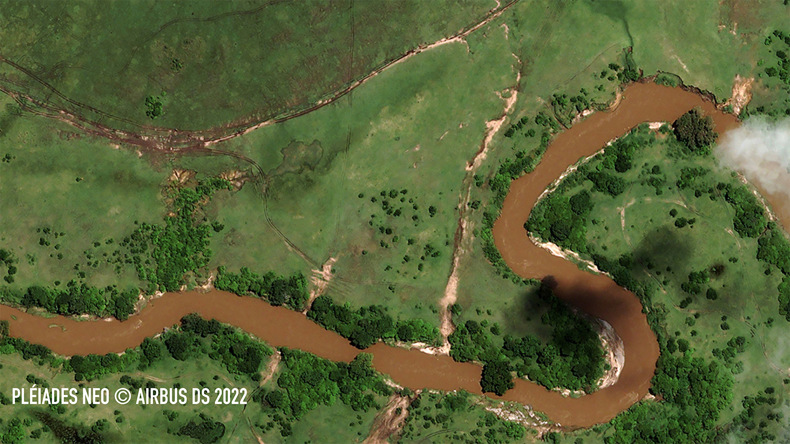
- The satellites deliver images with resolutions down to 30 centimeters (12 inches) and could be used in applications such as anti-poaching, forest monitoring, and species population assessments.
The Airbus Foundation and the Connected Conservation Foundation (CCF) recently announced a new award for research that would use satellites to aid in biodiversity conservation.
The application period, open to individual researchers and nonprofit organizations, began Dec. 5 and ends Feb. 3, 2023. A team of four judges will assess the potential of proposals designed to address the global loss of species, which many scientists call Earth’s sixth mass extinction. Along with $5,000 in funding, the award comes with access to Airbus’s Pléiades and Pléiades Neo satellites. Pléiades Neo images come from a quartet of satellites offering spatial resolution down to 30 centimeters (12 inches).
“The open call sets out to look at the species in situations where high, 30-centimeter resolution imagery can really have a benefit,” Sophie Maxwell, executive director of CCF and one of the judges of the competition, told Mongabay.

CCF is an organization that aims to encourage the use of technology in conservation and nature protection applications, such as anti-poaching and population monitoring. In 2021, the group partnered with the Airbus Foundation, the philanthropic arm of the European aerospace company.
The goal, Maxwell said, is to find the bounds of the role that remote sensing can play in biodiversity conservation, including what it does and doesn’t do well.
“We have looked at use cases such as road detection [and] charcoal kiln detection, with variable levels of success,” Maxwell said. High-resolution imagery can help biologists better tabulate the sizes of wildlife populations. But there are limitations. Picking out the shapes of wildebeest against the varied background of an East African savanna, for instance, can be difficult, so projects aimed at monitoring on a more uniform background may work better, she added.
“One of the best examples perhaps would be counting penguins or other birds in the Arctic or Antarctic on their breeding grounds,” said Anna Schweiger, a postdoctoral researcher in remote sensing at Switzerland’s University of Zurich, who is not affiliated with CCF or the Airbus Foundation.
Schweiger noted that Pléiades Neo has a deep blue band for probing bodies of water. She said scientists have used WorldView, another set of satellites, to spot whales in clear water as deep as 30 meters (approximately 100 feet).

Schweiger said deep learning, a kind of machine learning and artificial intelligence, could be employed in tandem with Pléiades’ high-resolution imagery to gain new insights.
“The explosion of AI on satellite imagery is also making it much more … valuable and easier to get insights … because you’ve got analysis running on these huge images,” Maxwell said.
Schweiger said that scientists must be careful with the results of remote sensing, and noted that this type of imagery could have uses beyond conservation. (Airbus, for example, markets access to the Pléiades satellite constellation for military and intelligence uses.)
It’s also possible that imagery detailing, say, “the migratory routes of large swarms of fish,” could fall into the wrong hands, Schweiger said. “I can see that being a detriment to the survival of certain species.”
Still, Maxwell said addressing the biodiversity crisis requires innovative solutions, which she hopes the competition for this award will help to drive.
“This is a great chance to explore where this technology can help conservation efforts,” she added.

Banner image: Satellite image of the Himalayas. Image by European Space Agency via Flickr (CC BY-SA 2.0).
Correction: A previous version of this article mistated the organization involved in this award in the headline. It is the Airbus Foundation, not Airbus.
FEEDBACK: Use this form to send a message to the author of this post. If you want to post a public comment, you can do that at the bottom of the page.