
- The Ñembi Guasu Area of Conservation and Ecological Importance is the second-largest protected area in southern Bolivia’s Gran Chaco ecoregion, and an important area for Indigenous communities.
- Despite gaining official recognition as a protected area in 2019, dozens of rural settlements have appeared in Ñembi Guasu over the past three years.
- Research indicates these settlements contributed to severe forest fires in 2019 and 2021; satellite data and imagery show roads and clearings proliferating within Ñembi Guasu over the past several years.
- Meanwhile, officials are planning for another road that would transect Ñembi Guasu aimed at connecting agricultural producers in Bolivia and Paraguay.
This report is part of a journalistic collaboration between Mongabay Latam, La Región and Red Ambiental de Información.
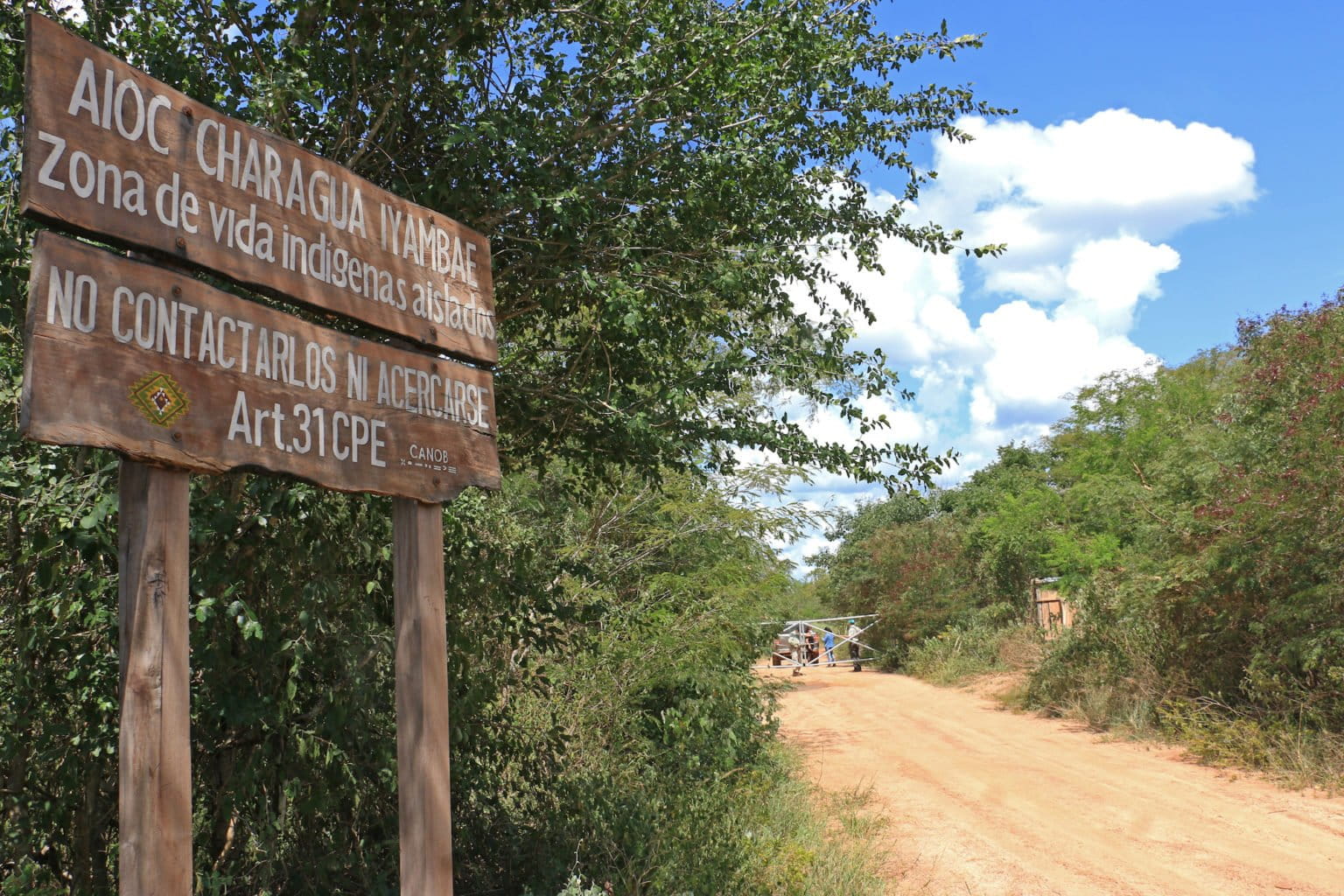
ROBORÉ, Bolivia—The Ñembi Guasu region is referred to as the “great refuge” by the Guaraní people of the Bolivian Chaco. To recognize its ecological and social importance, the Charagua Iyambae Rural Indigenous Autonomous Government (GAIOC) incorporated it as a protected area in 2014 as the Guaraní Nation Ñembi Guasu Area of Conservation and Ecological Importance. In 2019, the Bolivian government officially recognized Ñembi Guasu. At 1,207,850 hectares (2,984,662 acres), it is the second-largest protected area in the Gran Chaco, which is a semiarid ecoregion that stretches across large portions of Bolivia, Paraguay and Argentina.
“[The fact] that — in their autonomy statute — the Guaraní have included a conservation area is an element that differentiates Ñembi Guasu from other protected areas. It is a historical and cultural demand, not just environmental, that is — in general — the motive for creating a protected area,” says Leonardo Tamburini, the director of Oré, an organization that provides legal assistance to Indigenous communities in Bolivia.

However, granting official protection to Ñembi Guasu doesn’t mean it is free from habitat loss. The National Institute of Agrarian Reform (INRA) authorized 81 rural settlements over the past three years, according to Charagua Iyambae GAIOC data.
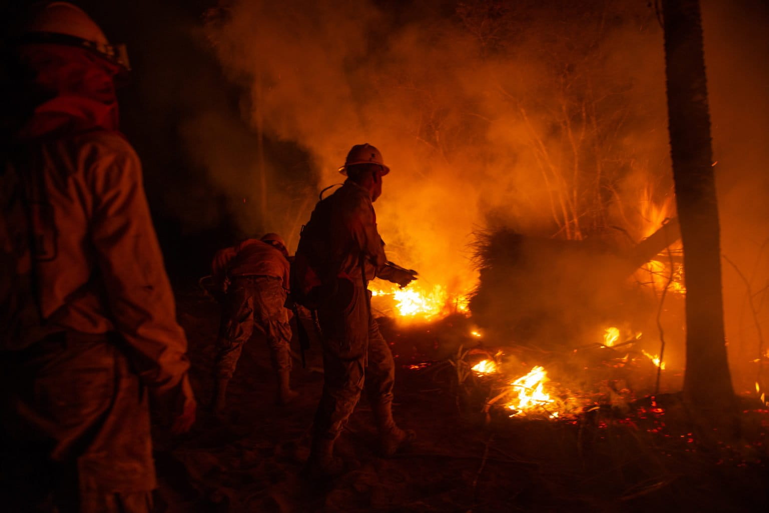
Research conducted by the Friends of Nature Foundation (FAN) found that these settlements, exacerbated by climate change, contributed to severe forest fires that damaged 442,186 hectares (1,092,665 acres) in 2019 alone. In 2021, about 200,000 more hectares (494,210 acres) were burned.

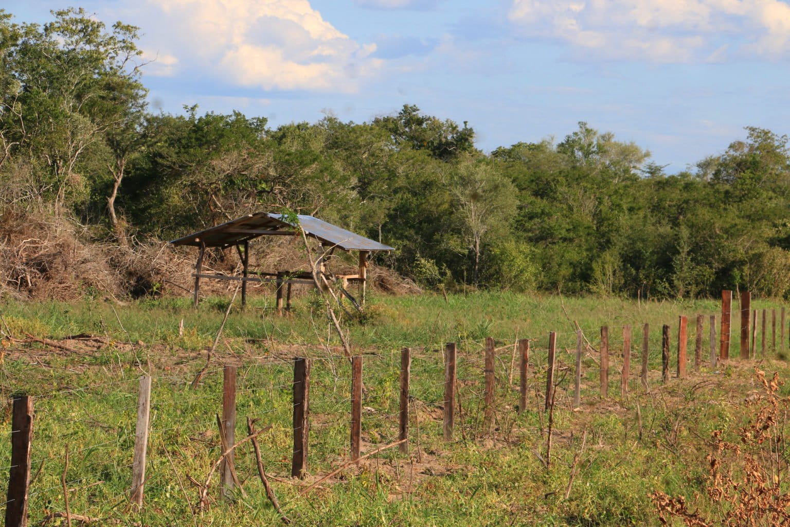
Juan de Dios Garay, a biologist from the organization Nature, Land and Life (Nativa), has been involved in the management of Ñembi Guasu since 2018. Garay says that when he entered the area for the first time, he found cattle ranches and “a ton of [road] signs for rural communities without inhabitants.” A team of reporters made similar observations during an April 2022 trip to Ñembi Guasu; satellite data and imagery visualized on Global Forest Watch show roads and clearings proliferating within Ñembi Guasu over the past several years.
Ravaged by fire


Ñembi Guasu is a dry area, with rainfall amounting to between 400 and 600 millimeters (13.5 and 20.3 fluid ounces) per year (in comparison, the Amazon rainforest receives 1,500 to 3,000 mm [50.7 to 101 fl oz] of rain annually). The San Miguel River and the Aguas Calientes River run through the protected area and act as oases that attract a diverse array of wildlife, including jaguars (Panthera onca). Because of this, Ñembi Guasu serves as an ecological corridor between Kaa-Iya del Gran Chaco National Park and Otuquis National Park.
In 2019, unprecedented forest fires raged across some 6.4 million hectares (about 15.8 million acres, roughly the size of West Virginia) of Bolivia. “Ñembi Guasu was the epicenter of the fastest and most intense fires in the world,” says Huáscar Azurduy, director of the conservation and restoration unit of the Foundation for the Conservation of the Chiquitano Forest (FCBC).
“The gusts of wind fueled the fires and provoked a flamethrower effect,” says Daniel Villarroel, assistant manager of ecosystem research and monitoring at FAN. He adds that research conducted by FAN and the Wildlife Conservation Society reveals a tree mortality rate of 70-90%.
NASA satellite data visualized on Global Forest Watch show the area comprising Ñembi Guasu was hit hard again by fire in August 2021.
“If there was any trace of tree species that were saved in 2019, with this fire [in 2021], they would have been totally destroyed,” says Mario Cereze, a fire monitoring technician with the Roboré municipal government. However, early rains coupled with human intervention extinguished the Ñembi Guasu fires in less than two weeks, mitigating the destructive potential of a longer burn.
The areas most affected by the fires in 2019 and 2021 are in the “process of regressive succession,” according to Villarroel. But he cautions that the forest, as it was, may not come back. “The fires would be producing a modification in all the physicochemical characteristics of the soil, which does not guarantee that [the vegetation] that will emerge later will be the same as it was before,” Villarroel says.
The region is experiencing drought in 2022, which has led Cerezo and others to fear another destructive fire season. However, as the 2022 dry season winds down, NASA data show no large burns have affected Ñembi Guasu as of Oct. 17.
Protection in limbo
The fires in Ñembi Guasu caused the Charagua Iyambae GAIOC to file a “preventative environmental action” against the INRA and the Forest and Land Inspection and Social Control Authority (ABT) in 2021 for authorizing clearings and burning in the area. The action was accepted by an agro-environmental court, which arranged for an “ecological pause” in Ñembi Guasu that prioritized habitat regeneration and prohibited further development. The action also allows the National Police to monitor activity in the protected area and enforce regulations.
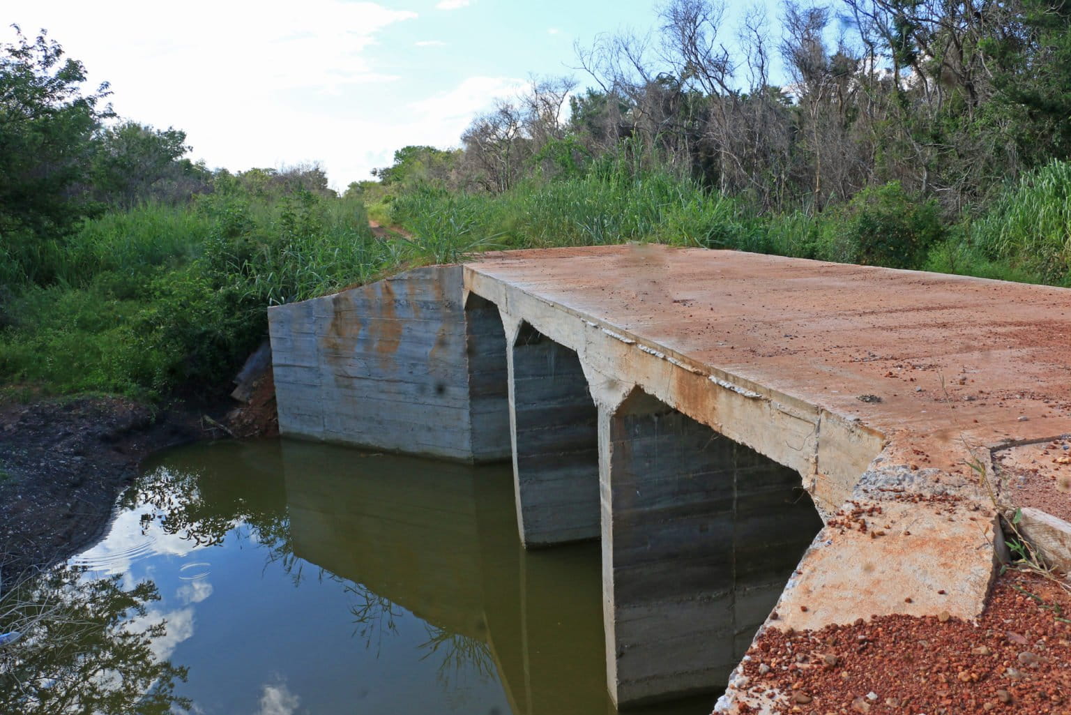
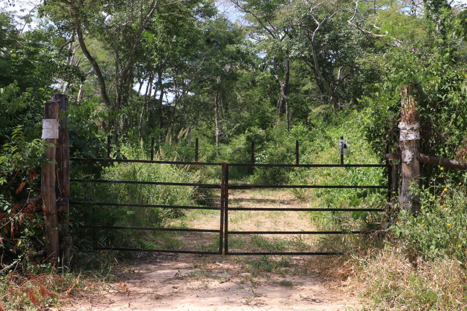
However, sources familiar with Ñembi Guasu say roads are still expanding, and that bridges were built after the preventative environmental action was enacted.
Mongabay reporters visited Ñembi Guasu and observed more than 100 wooden structures along one of the roads inside the protected area. Sources, including Garay who frequently helps patrol the conservation area on behalf of the GAIOC, say they likely belong to rural communities that claim to have land titles.
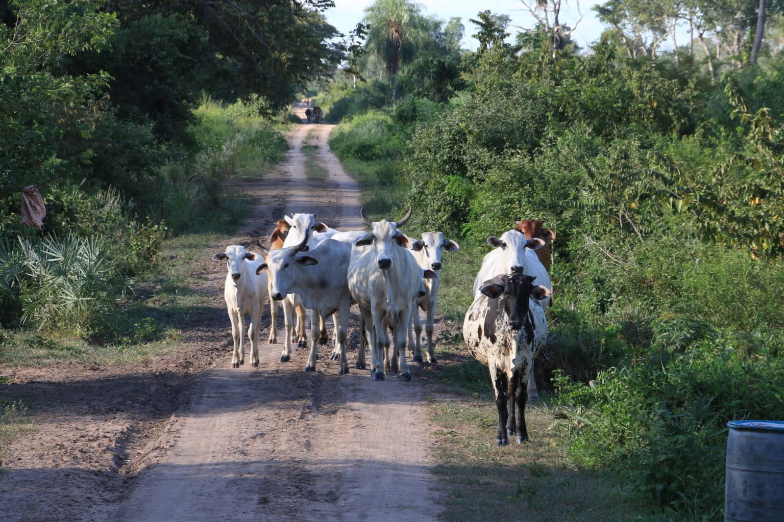
A resident of one of these communities in Ñembi Guasu, identified only as “Estanislao,” says his employer has owned the land on which the community was built for 10 years, and that the community grows sesame, peanuts, watermelon and other crops.
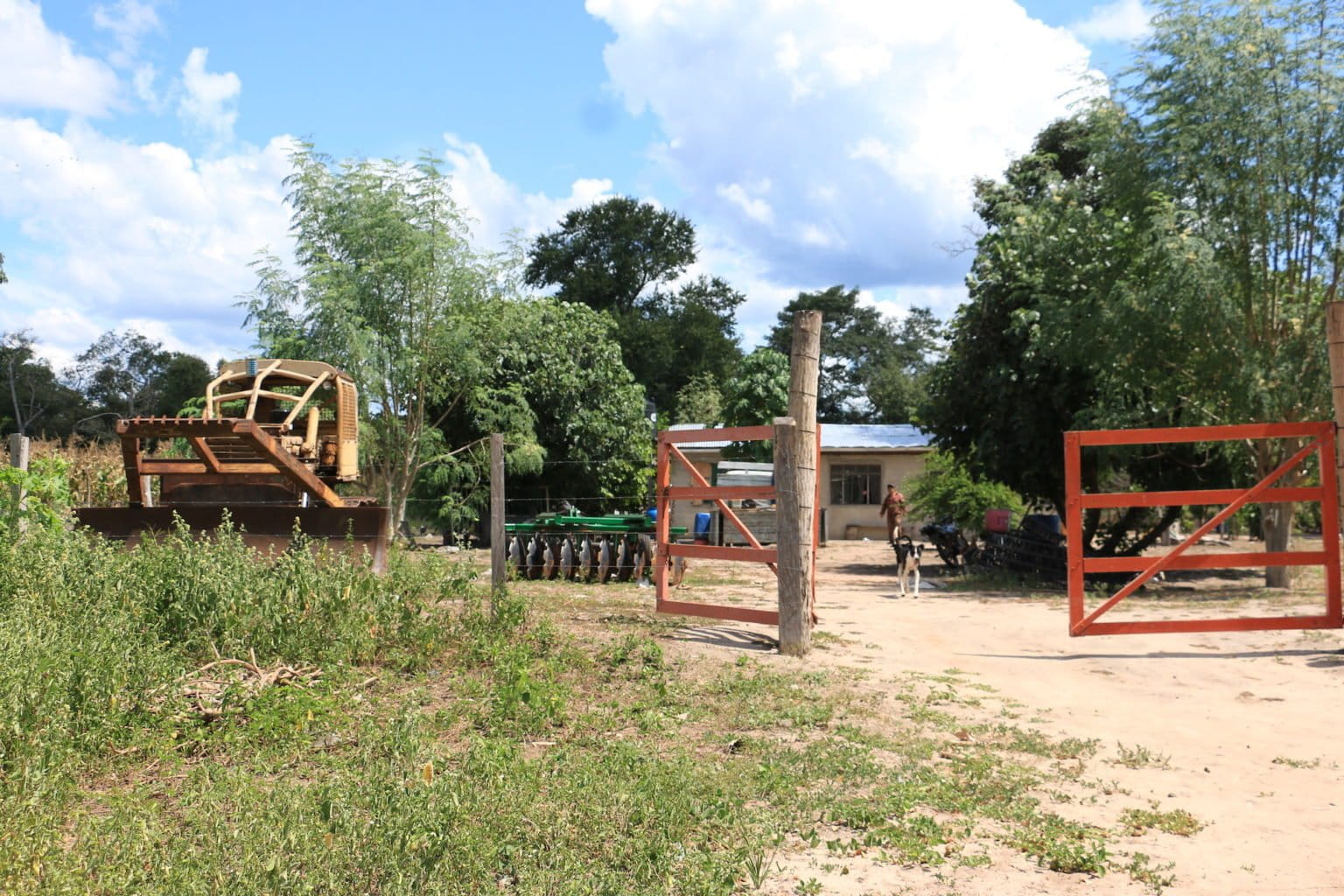
According to Estanislao, seven communities in the northeastern portion of Ñembi Guasu work with a company called Agroexport headquartered in the Bolivian city of Santa Cruz. “[Agroexport] buys the sesame and is now interested in joco [Bolivian squash] seed to extract its oil,” Estanislao says.
José Luis Ojopi, a warehouse manager at Agroexport, denies doing business in Ñembi Guasu.
“We do not monitor planting, except those [producers] who have a direct relationship with the company, and we do not have any in the area you are mentioning,” Ojopi says.
Estanislao and other residents of the Ñembi Guasu community visited by Mongabay reporters say they do not permanently occupy the area due to heat, aridity and mosquitos. “Here it doesn’t rain; you have to pay for water,” Estanislao says.
The Charagua Iyambae GAIOC is planning to enact a law to further preserve autonomous protected areas, which will apply to the five areas inhabited by Guaraní communities: Kaa-Iya, Otuquis, Ñembi Guasu, Serranía de Irenda and Guajukaka.
“For this reason, we believe it is very important to have a law [regarding autonomous protected areas], since the area being conserved exceeds 5 million hectares [about 12,355,269 acres],” says José Ávila, the director of the protected areas of the Charagua Iyambae GAIOC. “It will be a Guaraní system that allows for the management of each area. With the law, we will make the regulations, have control, surveillance and tourism.”
The Charagua Iyambae was expecting to enact the law in June 2021. However, this had not yet happened by the time of this article’s publication in Spanish, and authorities from the GAIOC estimate that it will not come to pass this year. “We are in the development process,” Ávila says.
A new road looms
In June 2021, the Paraguayan news outlet ABC reported that producers from the Agua Dulce region of Paraguay, across the border from Ñembi Guasu, are exploring how to unite their region with Bolivia via a road that would be built across the protected area. According to the report, the cross-border talks with Bolivian ranchers are at a “very advanced” stage.
“It is an association of around 70 members from the Paraguayan side, on the border, who have made an alliance with ranchers from the Bolivian side,” says Leonardo Tamburini, the director of the Bolivian legal assistance organization Oré. “On the [Paraguayan] side, there are gigantic clearings.”
In a phone interview, Celso Muxfeldt Echauri, the president of the Agua Dulce Agricultural Association (APAD) of Paraguay, says the road would increase access to Ñembi Guasu and prevent future fires. According to a Paraguayan government document, the project is “of priority and of strategic interest to national interests.”
Muxfeldt says the plan has been in progress since 2015 and has the support of the current mayor of the Bolivian city of Roboré, José Eduardo Díaz.
“With [Díaz], we want to assemble the international meeting in October so that both central governments [view the road project] as a binational agenda,” Muxfeldt says. “We [in Paraguay] already made our route with help from the Ministry of Public Works. We have already finished graveling our section up to the border with Bolivia.”
Mayor Díaz says that what is being sought is “to coordinate and join forces” to prevent and reduce fires, but also “to strengthen [agricultural] production and tourism sectors,” of Roboré.
Ávila says Charagua Iyambae GAIOC has not yet received any official communication regarding the road project but is concerned about impacts to the region if it comes to pass.
“We have offices in Roboré and we believe that the first thing would be to let us know [if the project is] viable because we know that it could generate problems in the future,” Ávila says.
This is a translated and adapted version of a story that was first reported by Mongabay’s Latam team and published here on our Latam site on July 8, 2022.
Citation:
Impactos Ecológicos de los Incendios sobre la Amazonía, Bosque Seco Chiquitano y el Pantanal boliviano. (2021). Retrieved from Fundación Amigos de la Naturaleza website: https://www.fan-bo.org/wp-content/uploads/2021/07/Informe-Tecnico_Restauracion_FAN2021.pdf
Banner image: A view of the road that pierces Ñembi Guasu. Image by Fernando Portugal.
Feedback: Use this form to send a message to the editor of this post. If you want to post a public comment, you can do that at the bottom of the page.