- A new tool co-developed by Google Earth Engine and the World Resources Institute is being billed as the planet’s most up-to-date and high-resolution global land cover mapping data set, giving unprecedented levels of detail about how land is being used around the world.
- The launch of the tool this week marks a big step forward in enabling organizations and governments to make better science-based, data-informed decisions about urgent planetary challenges, the developers say.
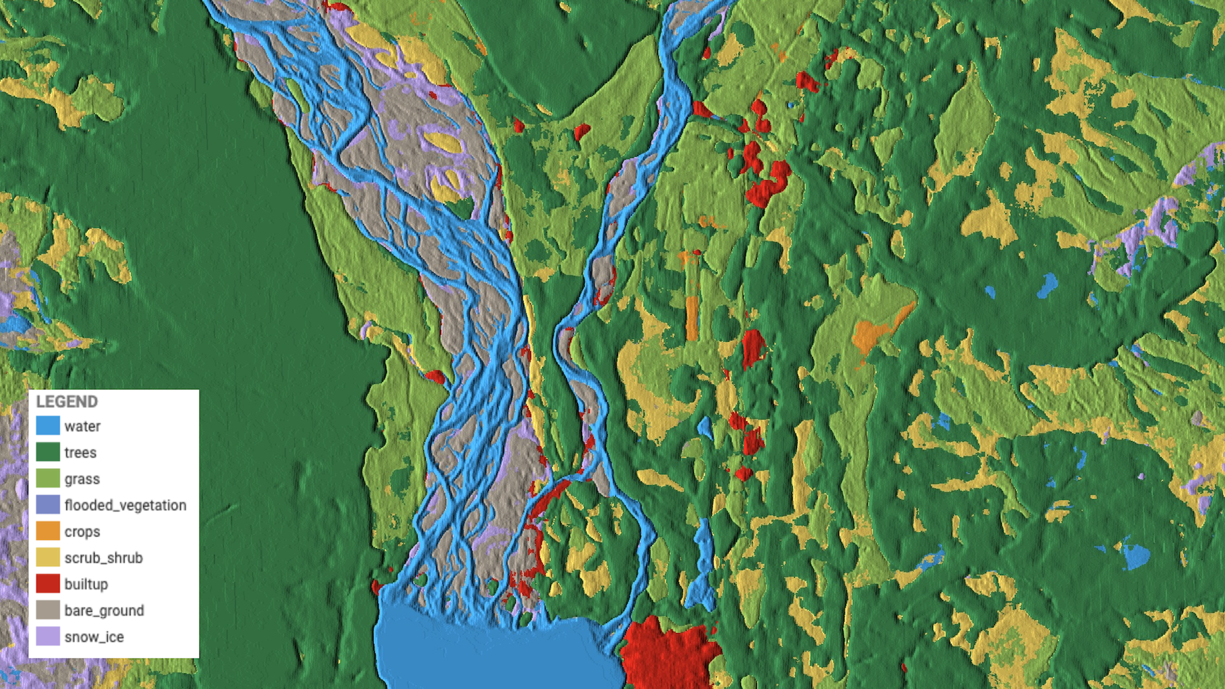
- Named Dynamic World, it merges cloud-based artificial intelligence with satellite imagery to give near-real-time global visualizations of nine types of land use and land cover.
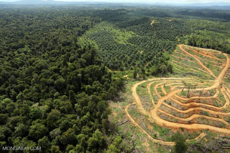
- The tool is likely to be important for a variety of purposes, the developers say, such as monitoring the progress of ecosystem restoration goals, assessing the effectiveness of protected areas, creating sustainable food systems, and alerting land managers to unforeseen land changes like deforestation and fires.
Google and the World Resources Institute (WRI) this week announced the launch of a new mapping tool touted as providing an unprecedented level of detail about how land is being used around the world. Called Dynamic World, it’s said to be the first global land cover data set available in near-real-time at high resolution.
“It’s a new frontier in global, high-resolution, near-real-time environmental monitoring,” Rebecca Moore, director of Google Earth, said at an online press launch on June 6.
Powered by Google Earth Engine’s cloud-based artificial intelligence, Dynamic World uses satellite imagery with a resolution of 10 by 10 meters (33 by 33 feet) from the European Space Agency’s Sentinel-2 satellites to reveal up-to-date coverage of a suite of different land and water types, including urban development, wetlands, forests, crops and trees.
While satellite images are typically processed as soon as they become available, up until now, global land cover maps often take months to produce, and are updated only on a monthly or annual basis. As a result, decision-makers at times lack timely data that could lead to rapid actions to address environmental disturbances, such as unprecedented changes to seasonal ecosystem cycles, the impacts of storms, floods and fires, or human disturbances like illegal logging.
“We’ve heard from a number of governments and researchers that they’re committed to taking action … but they’re lacking critical environmental monitoring information that they need [in order] to understand what’s happening on the ground,” Moore said. She added that the level of detail available through Dynamic World will now enable scientists and policymakers to rapidly detect and quantify the extent of environmental change anywhere on Earth.
A new study about the tool, published June 9 in Scientific Data, says Dynamic World’s features will “enable unprecedented flexibility for a diverse community of users across a variety of disciplines.”

The Dynamic World tool leverages the systematic orbit of the ESA’s Sentinel-2 satellites, which collect imagery of the entire globe every five days at the equator and every two to three days at mid-latitudes, amounting to more than 5,000 images per day. These are streamed into the Google Earth Engine’s AI platform for analysis.
As new satellite images become available, the AI system classifies land cover types in near-real-time by detecting combinations of nine different land cover types — water, flooded vegetation, built-up areas, trees, crops, bare ground, grass, shrub/scrub, and snow/ice — in the images and calculating which types are most representative within each 10-by-10-meter pixel.
The continual updates mean the data set is extremely up-to-date, and users can also compare land-use maps for specific areas across chosen time periods between 2015 and two days ago. The data set is open-access and freely available on monitoring platforms Google Earth Engine and Resource Watch.

Speaking at the launch event, Craig Hanson, vice president of food, forests, water and the ocean at the World Resources Institute, said the new tool will enable public, private and nonprofit groups to make wiser decisions to protect, manage and restore our forests, nature and ecosystems, as well as create sustainable food systems and alert people to unforeseen changes to land.
“This is particularly important because we live in a world facing great land squeeze,” Hanson said. “The world is experiencing growing demand for food, for timber, for bioenergy, for urban expansion. All the while, we need to be conserving land for nature, biodiversity and climate.”
Unlike most land cover platforms, which typically display a static view of locations, Dynamic World displays “the pulsation of life” throughout the year, Hanson said, making it useful for understanding longer-term trends of seasonal ecosystem change. For example, as landscapes are seasonally flooded, the land cover can switch from grassland or trees to wetland and water. In agricultural landscapes, Dynamic World is able to detect the presence and proliferation of agroforestry systems, which would have once been classified simply as cropland.
“Given the importance of restoration for the global agenda, such monitoring abilities are increasingly important and valuable, and will empower government, NGO and village efforts to advance restoration of their landscapes,” Hanson said.
The African Forest Landscape Restoration Initiative (AFR100), which aims to restore 100 million hectares (247 million acres) of land in Africa by 2030, is applying Dynamic World to keep track of progress toward its restoration goals, according to Mamadou Diakhité, leader of the initiative. Speaking at the online launch event, he said AFR100 is aiming to establish a credible monitoring platform that leverages satellite land cover data sets “to bring in more investment from the private sector, from non-state actors, from the government to really embrace land restoration.”
For Wanjira Mathai, vice president and regional director for Africa at WRI, the new tool essentially brings landscapes to life. “To understand the vulnerability of this precious planet is to understand how dynamic and how fragile it truly, truly is,” Mathai said at the online launch. By showing the complex details of how land on Earth is used in a continually updating manner, she said, Dynamic World “activates an emotional connection” that has the potential to “trigger a level of action that we have never seen before.”
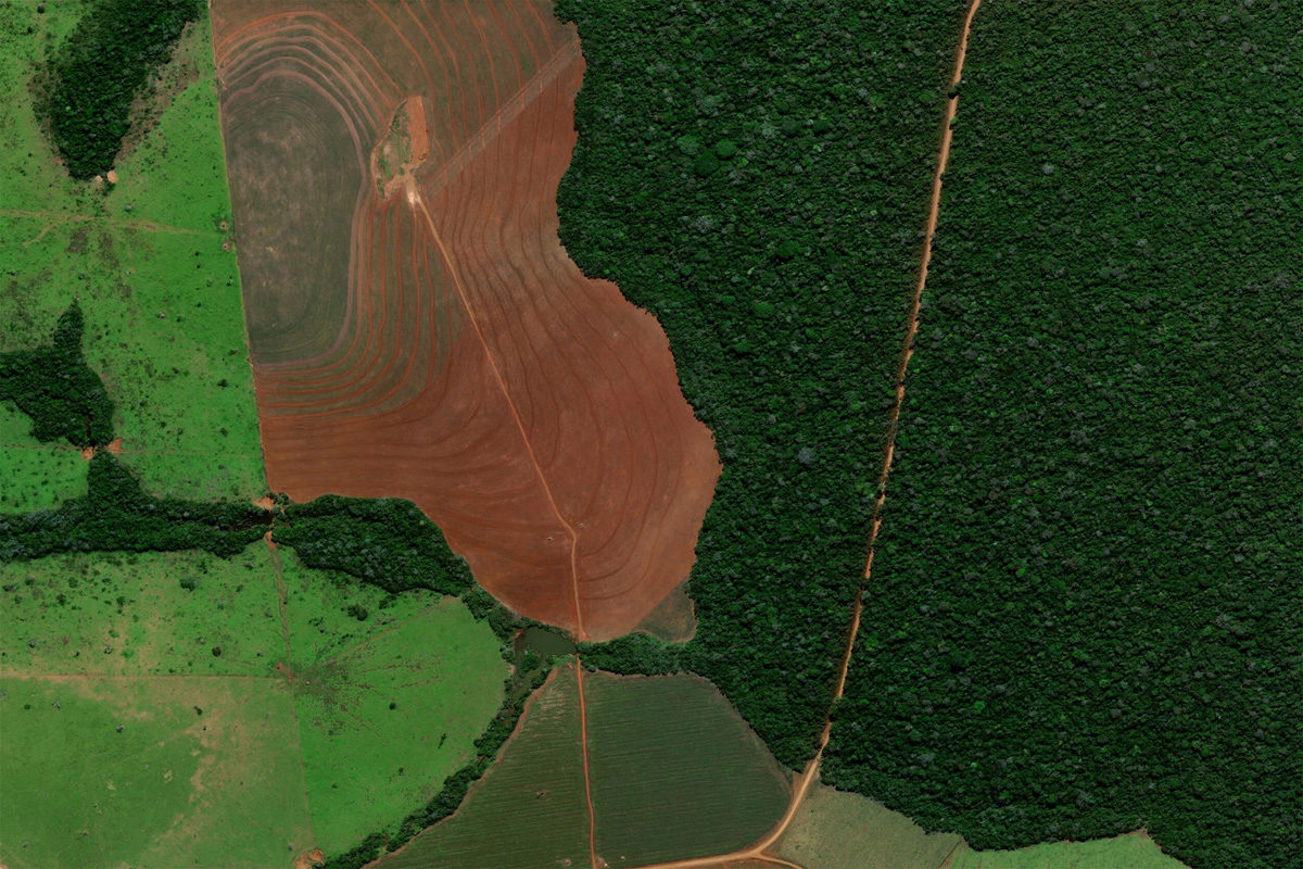
Banner image: Forest clearing for soy in Parecis in the state of Rondonia, Brazil. Image by Microsoft Zoom Earth
Citation:
Brown, C. F., Brumby, S. P., Guzder-Williams, B., Birch, T., Brooks Hyde, S., Mazzariello, J., … Tait, A. M. (2022). Dynamic World, Near real-time global 10 m land use land cover mapping. Scientific Data, 9(1), 251. doi: 10.1038/s41597-022-01307-4
Carolyn Cowan is a staff writer for Mongabay. Follow her on Twitter @CarolynCowan11
FEEDBACK: Use this form to send a message to the author of this post. If you want to post a public comment, you can do that at the bottom of the page.