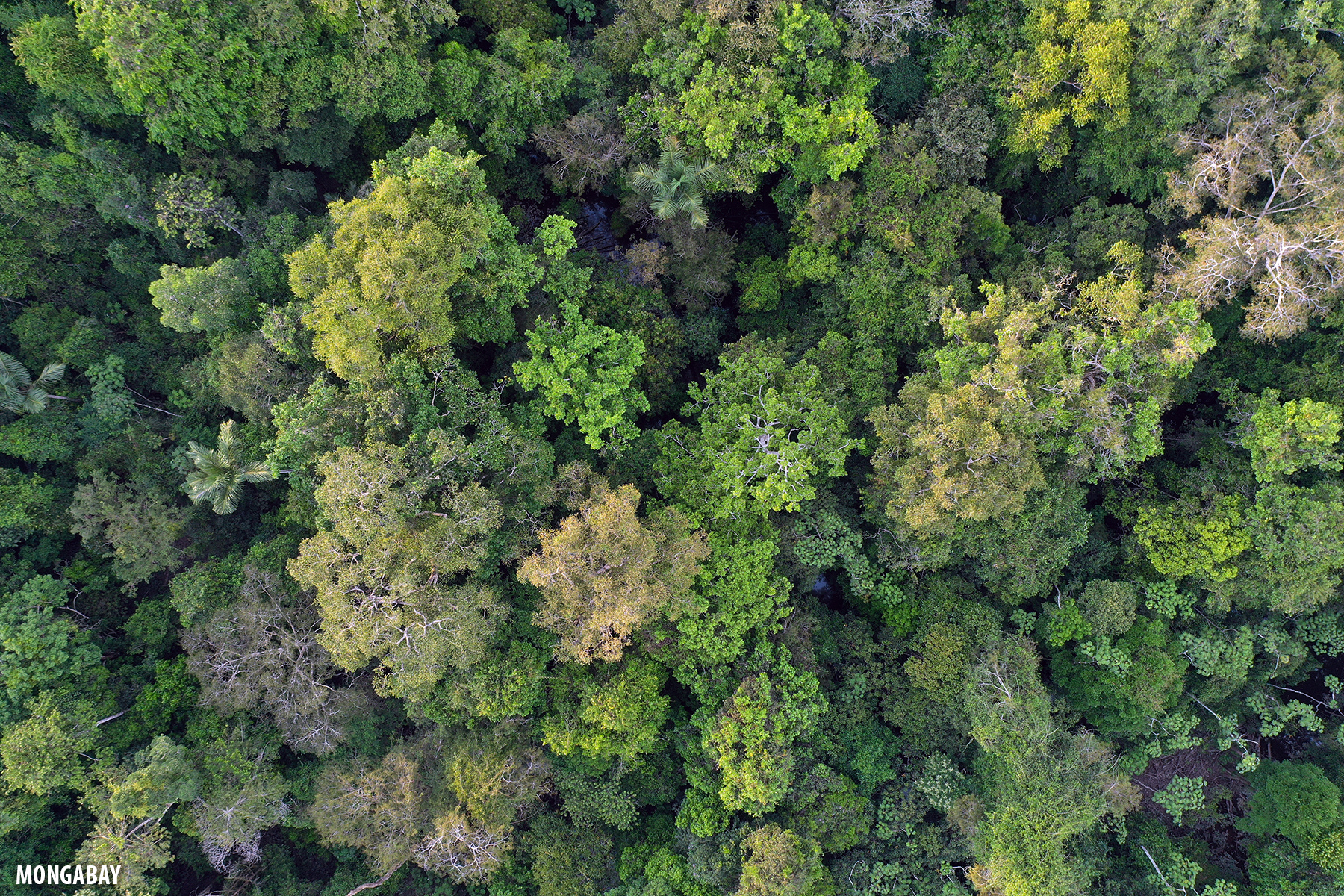
- Large portions of the Amazon rainforest are degraded by human activities, such as patchy smallholder farming, timber extraction, and burning.
- Airborne laser scans paired with an ecological model show that these areas store less carbon, carry less water, and are much more fire-prone.
- During periods of extreme drought, intact forests also run out of water and become as hot as degraded forests, stressing the entire ecosystem
Every year, growing swaths of the Amazon rainforest are degraded by logging, fragmentation, and human-sparked fires. New research using airplane-based laser scanning of trees shows that degraded forests are hotter, drier, and more flammable than nearby “healthy” intact forests. But in periods of drought, intact forests also run out of water and start behaving like degraded ones, researchers reported recently in JGR Biogeosciences.
Tropical forests benefit the planet by absorbing carbon dioxide from the atmosphere and generating water vapor to help spur cloud formation. This cycling of water from the Amazon rainforest back into the sky is sometimes called a “flying river,” as the water vapor travels to other parts of South America and eventually falls as rain.
Researchers studied the shapes of different forest canopies to investigate how these functions shift in degraded areas. They used lidar, an airborne laser scanning system, to measure the structures of intact and degraded forests in the northern and central Brazilian regions of Belterra, Paragominas, Feliz Natal, and Tanguro, as well as in Paracou, French Guiana.
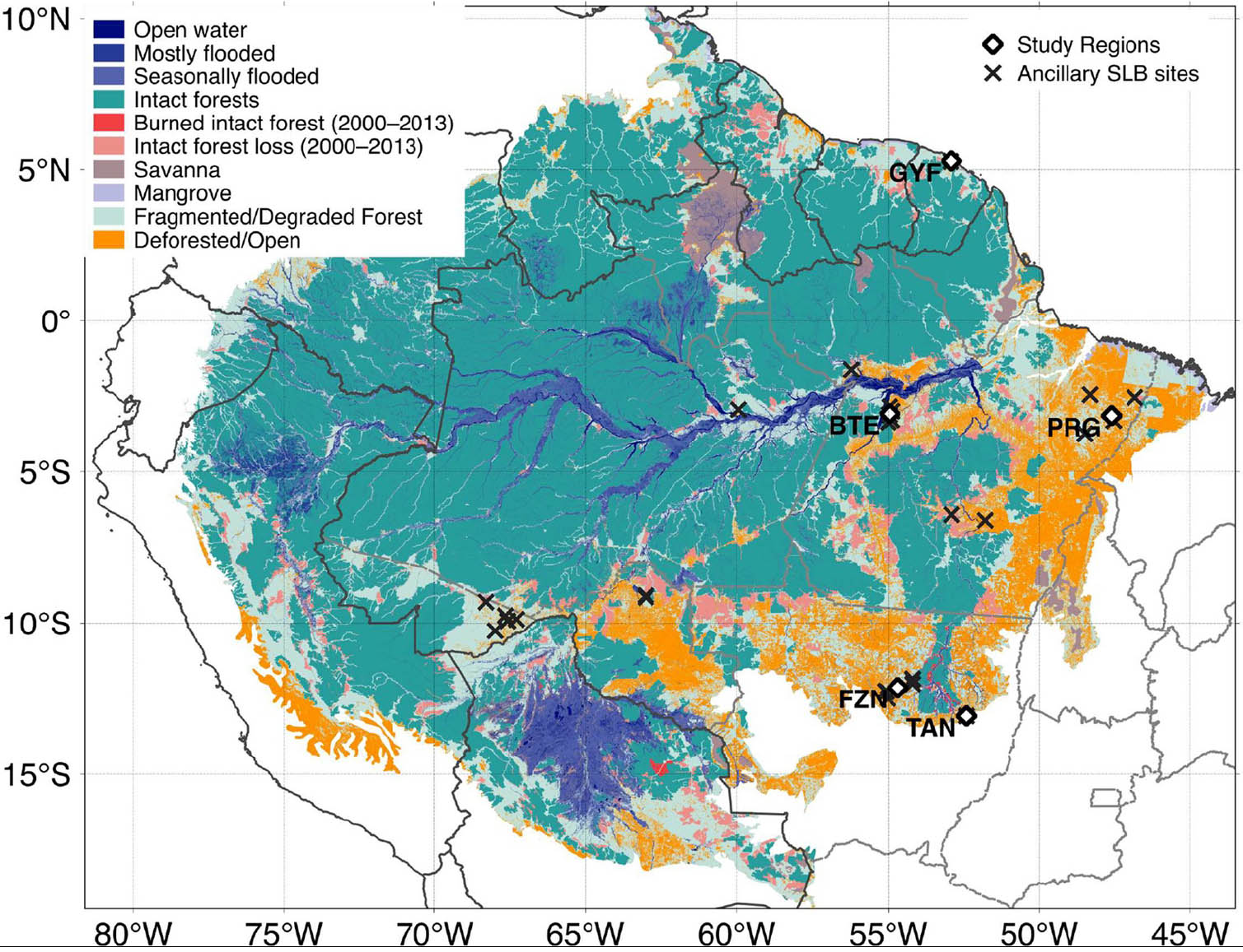
To scan trees with lidar, researchers beam millions of light pulses from an airplane-based device into the forest. They measure the time it takes for the light to leave the sensor, hit trees and other vegetation, and reflect back to determine the distance to each tree, with an accuracy of about 15 centimeters (6 inches). Combining millions of these measurements maps the trees in meticulous three-dimensional detail—revealing stark differences between verdant intact forests and patchier degraded areas.
“You get the 3D variation of the forest,” said Marcos Longo, a carbon cycle and ecosystems researcher at NASA’s Jet Propulsion Laboratory in Pasadena, California, and lead author of the study. Because degradation tends to change the shapes of trees, lidar allows scientists to quantify this process in action, he told Mongabay.
Longo and his collaborators used this tool to survey plots covering 13,500 hectares of forest, roughly the size of 16,500 Olympic football fields. They also surveyed these plots on the ground to identify the tree species. The scientists plugged their data into a computer program called the Ecosystem Demography Model, which calculates water and carbon exchanged between the forest and the atmosphere as meteorological conditions change over time.
The degraded segments were 6.5°C (11.7°F) hotter on average than the intact areas. They also were more flammable—a serious concern, said Longo. “Most degraded forests are near settlements, pastures, and croplands,” he explained. This proximity increases their chances of igniting from wayward agricultural fires or other human-sparked blazes, he said.

The team found that degraded forests absorbed and stored 34 percent less carbon from the atmosphere than their intact counterparts. They also cycled about 35 percent less water between plants and atmosphere.
Researchers were surprised to see that the conditions of degraded and intact forests converged during major droughts. They initially thought that after several months of drought, the differences in water and carbon cycling would be more pronounced, Longo said. But the opposite happened.
“Essentially, at some point, the [whole] system runs out of water, and the climate stress is more relevant than the forest structure,” Longo said of the extremely dry periods.
“Another way to look at this is that degraded forests are functioning almost as intact forests hit by extreme drought in typical years,” said Elsa Ordway, an Earth systems scientist at Harvard University, who was not involved in the study. “And that’s really concerning, because there’s been a huge amount of forest degradation across the tropics. The fact that there’s such an impact on these areas on a yearly basis is really important.”
In the future, the researchers hope to test other forest variables not included in the model, like soil texture, depth, and nutrients.
“All of those things can have a huge influence on a forest’s ability to recover,” said Ordway.
Longo also plans to apply this analysis to new, bigger lidar datasets, including measurements from a sensor onboard the International Space Station. While the current study focused on five specific areas in the Eastern Amazon, Longo says data from the ISS sensor covers the whole rainforest biome. “We’re excited to bring this to much larger scales.”
Citation:
Longo, M., Saatchi, S., Keller, M., Bowman, K., Ferraz, A., Moorcroft, P. R., et al. (2020). Impacts of degradation on water, energy, and carbon cycling of the Amazon tropical forests. Journal of Geophysical Research: Biogeosciences 125(8). (https://doi.org/10.1029/2020JG005677)
Tess Joosse (@tessjoosse) is a graduate student in the Science Communication program at the University of California, Santa Cruz. Other Mongabay stories produced by UCSC students can be found here.