
- The PAWS AI system, developed out of Harvard University, uses data about past poaching and game theory to predict where rangers are most likely to find poaching activity next.
- PAWS has been field tested in Cambodia and Uganda, and will soon roll out worldwide, available with the next update of a global data tool called SMART.
- Subsequent versions of the system will also feature a tool that recommends the best route for rangers to travel in their patrols.
On a humid morning in 2019, Lily Xu watched as a patrolling ranger driving a motorbike down a remote forest road in Cambodia signaled his group to stop and pull over. He stooped, fishing for something the Harvard University Ph.D. student couldn’t see, and pulled from the brush a length of long, thin wire: a snare, set to trap a leopard, a valuable local species that had been hunted nearly to extinction.
The ranger’s keen eyes were essential to spotting the snare. But how did he know where to look in the first place? His source wasn’t a local informer, or a poacher-turncoat: it was the work of artificial intelligence (AI).
The AI is called PAWS, short for Protection Assistant for Wildlife Security. Using data logged on previous ranging patrols, compiled on the open-source Spatial Monitoring and Reporting Tool (SMART), PAWS is able to predict where poachers might go next.

After several years of field-testing in Uganda and Cambodia, the PAWS system will soon make its world debut. PAWS has been incorporated into the latest update to SMART, which is already used widely by rangers and other park employees to gather data and track observations of illegal activity in parks around the world.
PAWS arose out of a chance experience in the early 2010s, when Harvard University professor Milind Tambe was invited to sit on a panel at a World Bank conservation event. As the university’s Gordon McKay Professor of Computer Science and director of Harvard’s Center for Research in Computation and Society, Tambe was there to contribute ideas of how artificial intelligence might assist in conservation. But many of Tambe’s co-panelists cited statistics on wildlife extinction that shocked him into action.
“It opened my eyes,” Tambe tells Mongabay. “There was a lot of news about the possible extinction of landmark species, and so I was in general aware of poaching being a threat … but I did not know the specifics of what was really going on.”
After the event, Tambe connected with experts in wildlife conservation who could help him figure out how AI might be able to address the problem. He traveled to Uganda, where he visited Murchison Falls National Park, walking the banks of the rushing Nile and watching families of threatened elephants stride across the savanna. From Murchison, he gained his first set of data on instances of poaching. Just a few years later, PAWS was born.
The PAWS system runs off the concept of game theory. Prevalent in economics and computer science, game theory focuses on the actions and decisions of individual agents, each of them acting specifically to maximize their share in an interest.
“That could be money, it could be animals, it could be anything,” says Xu, who is leading the development of the latest version of PAWS in Tambe’s lab. All agents in game theory, Xu says, are “in some sort of competition to do what’s best for themselves, potentially at the expense of others.”

Developed by researchers from a consortium of conservation nonprofits, SMART proved to be a perfect partnership for the new system. SMART has already been widely implemented, allowing rangers in more than 800 protected areas around the world to organize and track data collected on patrols. This provided a standardized framework for PAWS to work with.
Through the SMART system, PAWS has access to data about poachers’ past actions — where they set snares, or left evidence of a campfire, or cut down trees — that can feed into the game theory design. It combines that data with information about the natural layout of a park, such as the slope of the land, the areas closest to park borders, or the regions with the most animals, to make a map that shows where poaching risk is likely the highest.
Tambe compares the system to the movie recommendations you might get from Netflix: it’s making guesses about the future based on actions in the past.
For Xu, working on PAWS has been a way to use her skills in computer science to actually make a difference in what she sees as the “most pressing challenge” of our generation: preventing environmental catastrophe. When she was applying for graduate work, she was disappointed to find many computer science researchers were only working on theoretical applications.
“Really we’re trying to change that pipeline and make this the standard for within the AI community, in that we’re actually trying to build technology for the betterment of society rather than the betterment of Silicon Valley,” she said.
As a predictive system, PAWS isn’t always perfect, of course. One aspect of Xu’s doctoral research has been focused on how PAWS can make predictions from data that have inherent uncertainties. For example, if rangers record finding a snare, they may not be able to tell if a poacher set the snare the day before, or months ago. Poaching can also vary widely by season, making data from the rainy season, for instance, less valuable in the dry season. In addition, the data collected in SMART can’t “prove a negative,” as it’s often called: just because a ranger didn’t find a trap in a location doesn’t mean there wasn’t one there, hidden out of view.

In a preprint paper posted online in June, Xu and her co-authors show that PAWS itself can help to compensate, in part, for the imperfect data it’s working with. By targeting rangers’ work in hotspot areas, the system can help create a deterrent effect, keeping poachers from pursuing the wildlife there in the first place. However, they also found that this effect can push poachers into surrounding areas instead.
“We can plan our patrols in light of this model and figure out, if we know certain areas have greater animal densities, the areas we think are more important to protect,” Xu says. “We want to make sure poachers are not attacking these precious areas, and if we have to compromise a little in adjacent areas, that might be worth it.”
The other aspect of Xu’s work has been creating a system that can provide a plan for optimal patrols, much like Google Maps might provide the quickest route between points.
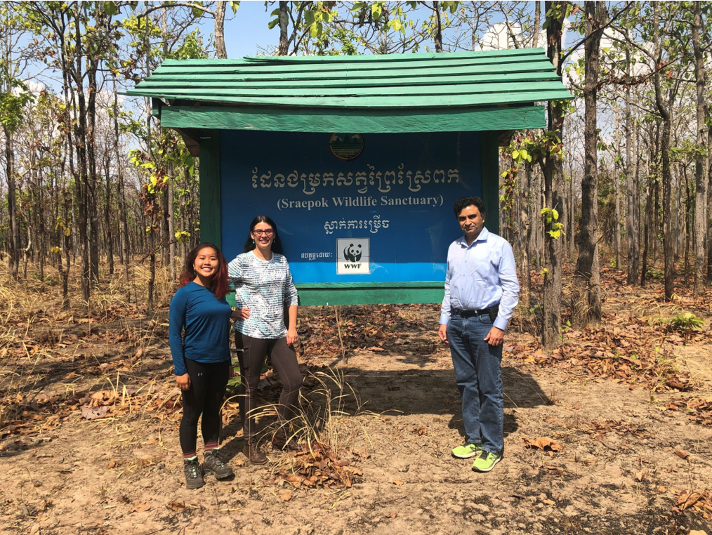
This work received a boost last year when Xu and Tambe traveled to Cambodia to see how rangers were using PAWS in the field. The researchers rode along with rangers from Srepok Wildlife Sanctuary, gripping the back of the park’s motorbikes as they sped down remote dirt forest roads. Xu says they quickly learned several things that they incorporated back into the system: for example, that rangers rarely stayed on a single path during their travels, instead using clues like trampled grass to guide their patrol, so it was unrealistic for PAWS to prescribe an exact path that the rangers should travel. They also learned that the Srepok teams often went on multi-day patrols, camping overnight. Xu and Tambe realized it was useful for PAWS to incorporate good campsite locations, with access to running water, into its recommendations.
The poaching risk prediction maps will be available to any park that downloads the next version of SMART, but this prescriptive feature isn’t quite ready for release. Xu and Tambe are currently working with parks that use PAWS, holding weekly Skype calls to identify bugs in the system and learn how the recommendations could be useful to different types of patrols. According to Tambe, the prescriptive feature should be available in the subsequent SMART launch.
As the PAWS system becomes more widely available, though, some experts are raising a common concern with technological fixes: that parks will become over-reliant on PAWS to stop poaching, while diverting already limited resources from programs that address why people poach in the first place.
“PAWS is one tool that can help, but it has a very targeted and limited focus that doesn’t really address the root causes of poaching,” says Laure Joanny, a Ph.D. researcher at the University of Sheffield, who is studying how law enforcement technologies can be applied in a conservation setting. She notes that people not only poach for high-value, profitable wildlife, but also for subsistence, and even as a way of protesting or airing grievances about local regulations. Community outreach and social justice efforts, she says, are needed in combination with deterrents if organizations want to truly end poaching.
She says she’s also worried the system could create mistrust between local rangers and the larger organizations pushing for PAWS’ implementation, as it could be seen as showing a lack of confidence in the rangers’ ability.
“Because this AI is positioned as maybe more efficient or objective than rangers, my concern is it will cause an over-attention of funding, attention and training diverted towards it — to the detriment of other aspects that are important,” Joanny tells Mongabay.
So far, Tambe says the feedback about PAWs has been mostly positive; in one example, he says rangers in Cambodia reported finding between 5 and 20 times more snares with PAWS than they had without it. And a 2019 study in Indonesia showed that many rangers reported a high level of willingness to use PAWS after an educational workshop.
However, the study also found that rangers who were resistant to the technology from the start were less engaged in the workshop. This highlights the importance of working with rangers directly, to figure out any sources of resistance.
Tambe says he’s realistic about the need for PAWS to adapt, including the potential that it may have to change tactics if poachers adapt to increased patrols. Regardless, he says he sees boundless opportunities for the AI to expand. In the future, he says, the software might be connected to remote monitoring tools like satellites, which would reduce the need for humans to enter some basic data. He’s already having conversations about expanding the system to predict other kinds of environmental crime, such as illegal logging or fishing.
Lastly, Tambe says, the program is also “fundamentally contributing to AI” as a field, and to the goal he shares with Xu: making AI work as a force for social change.
“This is bringing up newer kinds of challenges that may not arise in other domains where AI is active,” he says. “What lessons we’ve learned would be valuable for many applications — they wouldn’t be confined to wildlife crime. There are all sorts of challenges in applying AI for society and social good, and the benefits would spread across to other areas.”
Banner image: A Wildlife Alliance Ministry of Environment ranger on patrol in the Cardamom Mountains. Image by Andy Ball via Wikimedia Commons (CC-BY-SA-4.0).
Citations:
Xu, L., Perrault, A., Plumptre, A., Driciru, M., Wanyama, F., Rwetsiba, A., & Tambe, M. (2020). Game theory on the ground: The effect of increased patrols on deterring poachers. arXiv preprint arXiv:2006.12411.
Sintov, N., Seyranian, V., & Lyet, A. (2018). Fostering adoption of conservation technologies: A case study with wildlife law enforcement rangers. Oryx, 53(3), 479-483. doi:10.1017/s0030605317001533
Claudia Geib is the 2020 Sue Palminteri WildTech Reporting Fellow, which honors the memory of Mongabay Wildtech editor Sue Palminteri by providing opportunities for students to gain experience in conservation technology and writing. You can support this program here.