- The digital mapping platforms developed by Esri, including ArcGIS, have revolutionized conservation and environmental planning, management and policymaking.
- Esri co-founder Jack Dangermond calls geographic information systems (GIS) “a sort of intelligent nervous system for our planet at a time when humanity desperately needs one to address the environmental and humanitarian crises at hand.”
- He credits Esri’s success to a sustainable trajectory of heavy investment in R&D, not being beholden to outside investors, and providing discounted and free use of its software to environmental nonprofits.
- In this interview with Mongabay founder and CEO Rhett A. Butler, Dangermond says that technology, amid the current fractured political climate, should be employed to encourage understanding rather than dwell on divisions.
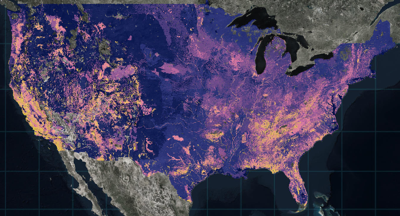
Today, maps are a critical part of nearly all place-based conservation efforts. Maps enable scientists and conservation practitioners to identify where they operate, allocate resources, organize and present data, and communicate the results of their work. It’s hard to imagine modern-day conservation without maps.
Before the age of computers, map-making was typically the domain of specialists. But as computers became more mainstream in the 1980s and 1990s, map-making became more accessible, driving a sharp increase in the creation and use of maps as platforms for presenting an ever-growing array of data.

A great enabling factor in the acceleration of map-making was the development of geographic information systems (GIS), frameworks for capturing, storing, managing, and analyzing spatial data. And no company has been a bigger player in the GIS space than Redlands, California-based Esri.
Founded in 1969 as the Environmental Systems Research Institute, Esri products like ArcGIS have been the basis for countless applications across numerous industries. In the conservation realm, ArcGIS has been used to manage and present data for an enormous array of applications, from mapping wildlife habitat to understanding the impact of climate change to demarcating protected areas on land and in oceans.
Esri was founded by Jack and Laura Dangermond, who committed the privately held company to “sustainable growth” from its early days. In practice, this has meant investing heavily in research and development, eschewing outside investment to allow it to focus on long-term goals rather than immediate financial returns, and providing discounted and free use of its software to nonprofits working to understand and monitor the environment.
“Esri is a successful company today because we work hard to serve our users,” Jack Dangermond told Mongabay during an October 2020 interview. “This symbiotic relationship between Esri and our users has resulted in a stable and resilient company where we can remain focused on our mission to integrate environmental and geographic thinking into the way governments, businesses, and NGOs work in a more sustainable way.”
Esri products are widely used by groups working on environmental issues: the company’s database of story maps is a who’s who of NGOs from World Resources Institute to the Natural Resources Defense Council to Greenpeace.

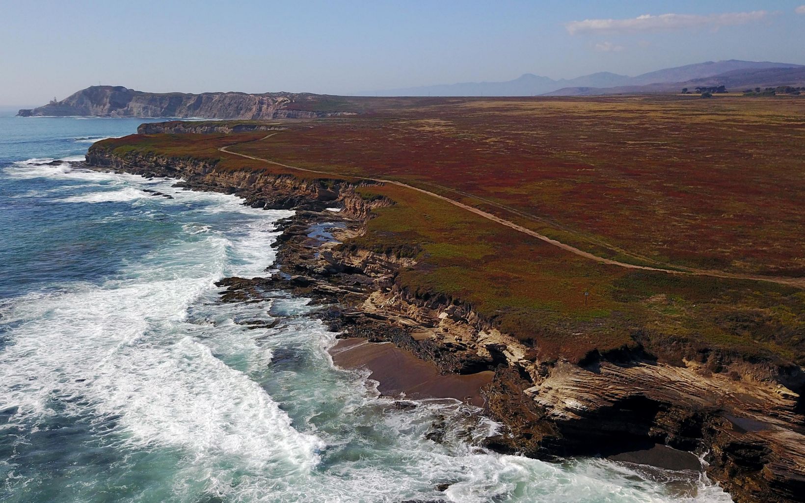
Dangermond’s philosophy on how he runs his business extends to how he views our relationship with the environment. In 2017, he and his wife donated $165 million to The Nature Conservancy to establish the Jack and Laura Dangermond Preserve in central California. The Dangermonds have also signed The Giving Pledge, committing to giving away the majority of their wealth to charitable causes.
“We rely on natural places and the biodiversity they harbor,” Dangermond told Mongabay. “So our survival, and in turn, our economic prosperity is tied to our being good stewards of the environment.”
Accordingly, Dangermond calls climate change and biodiversity loss “existential threats” that urgently need to be addressed no matter where someone sits on the political spectrum. And he believes Esri’s tools can play a role in contributing toward solutions.

“We don’t really dwell on the divisions but rather how we can encourage understanding to help mitigate challenges and encourage informed decision-making,” he said. “We are at a point where there are no simple solutions. What is needed are millions of decisions and actions at all levels of society and within organizations to understand, adapt, and improve the circumstances around us. In that sense we try to focus as a company on how we can move forward towards more sustainable outcomes informed by accurate data and based on rational thinking.”
Dangermond spoke about these issues and more during an October 2020 conversation with Mongabay founder and CEO Rhett A. Butler.
AN INTERVIEW WITH JACK DANGERMOND

Mongabay: You studied landscape architecture and environmental science as an undergrad at Cal Poly Pomona, before going on to the University of Minnesota, and then Harvard University. What prompted your interest in environmental science?
Dangermond: I became interested in the environment when I was growing up in Redlands, California. My parents started a tree nursery there, where my siblings and I worked, taking care of the plants and trees and working with customers on their landscaping projects. My brothers and I would go into the foothills of the San Bernardino mountains and collect rocks and small boulders for the nursery. This experience got me thinking about different landscapes and the connections across them.
When I went to college, I was able to explore these interests and came to learn that some of my assumptions about nature’s inter-connections were backed by actual formal principals in the field of geography. This personal interest led me through the fields of environmental science, urban planning, landscape architecture, and ultimately to the Laboratory for Computer Graphics and Spatial Analysis at Harvard where some amazing people were working to bring geography to life through emerging computer science tools.
Mongabay: And what led you to start Esri?
Dangermond: At the time I was studying foundational topics such as modeling, analytics, environmental science, and geography, which became my life’s passion. I learned in the Lab at Harvard that computational tools could not only help us make better maps, but do real analysis rooted in science. I was thrilled about the implications for society and managing our world with these technologies. Keep in mind this was the 1960s, when environmentalism was only just emerging as a movement and we were starting to better appreciate and care about the fragility of our planet.
When I left the academy, I returned home to California where I initially looked for work, both in academia and other organizations where I could apply the skills I learned, and I just could not find anything interesting at the time. So my wife Laura and I founded the Environmental Systems Research Institute, or Esri as we know it today, with the purpose of applying computational geography to problem solving. We started off building geographic information systems solutions on a case-by-case basis for natural resources and urban planning organizations, but over time the software we developed followed common patterns, and organically we became a software company as other organizations started requesting this new product. That was now over 50 years ago and we’ve developed the most advanced and complete GIS platform available.

Mongabay: How has technology changed since you started Esri? And what would you say is the most significant change over the past 50 years when it comes to our ability to understand our environment?
Dangermond: Technology has not only evolved since my days in school, but the pace of advances has increased exponentially. Each of these extraordinary advances presents opportunities for our user community and a new way of solving problems. However, it takes real engineering grounded in science to make that a reality. At Esri we reinvest over a third of our revenue into research and development so that we shorten the gap between promising emerging technology, and delivering useful tools that our users can apply.
Today, we live in world where we are surrounded by sensors, such as our cell phones, smart devices in our homes or in cities, and new remote sensing capabilities via satellites or drones, all of which are contributing new information streams about the world around us and the planet as a whole. This is an exciting opportunity, but it also presents challenges to decipher trends and patterns through modeling and analysis.

I would have to say of all of the evolutionary steps that led to the information society we live in today, it is the internet that provided a major framework. The development and growth of the internet enabled us all to participate in one geographic information system to better understand our work, and make better decisions as a result. While you can still install software on your laptop and go off into the field and work in isolation, this is an increasingly uncommon pattern compared to working in a connected, or occasionally connected environment. Now, a user can securely manage their information in the cloud, for instance, and pull in the best available data to augment their work from the rest of the GIS user community. Our users and partners have built a vast Living Atlas of the World which organizes thousands of the best available, authoritative datasets to provide context to geospatial work around the globe. In this sense, we are all benefiting from and contributing to the same information system. GIS is a sort of intelligent nervous system for our planet at a time when humanity desperately needs one to address the environmental and humanitarian crises at hand.
Mongabay: Esri is “committed to sustainable growth.” What does that mean to you?
Dangermond: Esri is a successful company today because we work hard to serve our users. We listen closely to GIS users to learn about the solutions they need, and invest heavily in research and development to build tools to meet those needs. We made a decision early on to build our organization carefully and without taking out loans or venture capital to accelerate our growth. In many ways we were lucky in that regard as this has allowed us to focus solely on our users as our primary shareholders. Today we serve over 350,000 organizations around the world. This symbiotic relationship between Esri and our users has resulted in a stable and resilient company where we can remain focused on our mission to integrate environmental and geographic thinking into the way governments, businesses, and NGOs work in a more sustainable way.
Mongabay: What would you say have been Esri’s biggest contributions to environmental science over its history?
Dangermond: GIS enables a vast amount of information about our world to be better organized and utilized. Prior to GIS becoming mainstream as a way to deliver location intelligence today, it was very tedious and costly to acquire enough information to conduct meaningful analysis on environmental topics. But, as GIS has evolved, so has the nature of the challenges the technology has scaled to address. We have gone from being a relevant technology for creating efficient projects; to supporting organizational data-driven understanding; to the idea of digitally transforming society through these same forms of insights. It is becoming increasingly clear that environmental issues such as climate change and natural resource management are global issues, so we need an information system for the planet as a whole. Fortunately, the geospatial industry has been working towards this goal for some time.

Mongabay: Esri is known for providing discounted and free use of its software to nonprofits working to understand and monitor the environment, while you personally have signed the Giving Pledge and funded the establishment of the 24,000-acre Jack and Laura Dangermond Preserve managed by The Nature Conservancy in central California. What drives your philanthropic efforts? And what are your top priorities?
Dangermond: As humans, we must grow and develop, but do so in a way that balances industrial and commercial advances with conservation and preservation of the natural world—people and planet are inextricably linked. If we continue to drain natural resources and disrupt ecosystems, the result will be detrimental for our species. We rely on natural places and the biodiversity they harbor. So our survival, and in turn, our economic prosperity is tied to our being good stewards of the environment.
It has also always been important to us to put GIS technology in the hands of people who are working to make a difference. We provide our software for little or no cost to nonprofit organizations, students, and responders in times of need, and most recently to furloughed workers who are out of work due to COVID-19. What is important to us is that people use these tools in a constructive way to help make things better for the planet. These organizations are often working on complex topics and applying the technology in a remarkable way, so sometimes we partner to help them tell stories that will inspire others. However, this isn’t a requirement, nor is it a facet of typical corporate social responsibility policies. We partner with these organizations in a meaningful sense, and the fact that they working hard to make a difference is all that really matters to us.
Mongabay: COVID-19 has caused disruptions on a scale not seen in generations. What do you think we’ll learn from the pandemic and does it present opportunities to shift humanity’s relationship with the world around us?
Dangermond: COVID-19 is a global tragedy, and a challenge that rivals anything we’ve experience in our lifetimes. Unfortunately, this pandemic is also likely to be just one of a number of increasingly complex challenges that will require us to work together. In that sense, we are learning a lot about what it will take to work our way out of these crises, what we need to better understand them, and the ways technology can contribute to and inform our actions. We are also beginning to understand COVID at a societal level. One of the ways we’ve contributed as a company is supporting ministries of health around the world to quickly publish dashboards that monitor the situation. There are many mechanisms for communication, but we are seeing the role of geography in COVID communications as essential. Tracking the spread, understanding where it is most prevalent, locating vulnerable populations, and identifying where fighting the virus has been most successful are all functions of location intelligence.
Mongabay: The United States is more politically divided now than at any point in most peoples’ lifetimes. Until relatively recently, some environmental issues had bipartisan support. Do you see opportunities for the environment to unify politically divided Americans? And if so, what issues do you see as having the most potential to appeal to people across the political spectrum?
Dangermond: These are undoubtedly challenging times politically in the US. However, we don’t really dwell on the divisions but rather how we can encourage understanding to help mitigate challenges and encourage informed decision making. Climate change and biodiversity loss are existential threats facing our planet. There is undoubtedly a wide array of positions and opinions about those topics, but we are at a point where there are no simple solutions. What is needed are millions of decisions and actions at all levels of society and within organizations to understand, adapt, and improve the circumstances around us. In that sense we try to focus as a company on how we can move forward towards more sustainable outcomes informed by accurate data and based on rational thinking. Achieving a sustainable future will require a tremendous amount of effort from all of us. Our focus is on contributing GIS technology to those working towards positive outcomes for people and for our planet. It’s also important on a human level that we work to be kinder to one another despite these political differences, since the crises at hand are putting a different kind of stress on everyone. We must put effort into tolerance and empathy as we work through these issues.

Mongabay: 2020 has been a difficult year on a number of fronts. Beyond the pandemic and widespread upheaval, we’ve seen large-scale damage from disasters, horrible forest fires from California to the Amazon, and severe crop failures in some of the countries that can least cope with them. Has 2020 changed your outlook or priorities? And what most worries you looking out over the next 10-20 years?
Dangermond: 2020 has been unprecedented in the sense that while the types of crises we are facing are not entirely new to us, they are happening all at once and compounding one another. Our users have been responding to food crises, managing wildfires, and combating global health issues for many years now. If anything, the current set of problems at hand forces us to dig deeper and work harder to support our users. We are constantly improving our technology to better support organizations on the front lines responding to complex challenges. In that sense, our priorities have not changed. We continue to learn and adapt so we can support organizations positioned to move the dial on these seemingly unsurmountable challenges. At Esri, we are growing as a company to serve our users who are adapting to and trying to affect positive change in this world.
Mongabay: What would you say to young people who are distressed about the current trajectory of the planet?
Dangermond: Well the first thing I would say is, “so am I”—but the question I would then put forth is “what can we do about it?” There are so many things we can do individually and collectively to help improve the world around us. A worst-case scenario would be one whereby we somehow let our guard down and allow an apathy to take over, however what I see happening is the opposite. The stances youth have taken in the racial equity movement as well as on climate change and other crucial topics inspire me and are hallmarks of the impact these future generations will have. Obviously, so much work lies ahead, but I am confident that young people today understand their role profoundly in shaping the future. As digital natives, they are well suited for this challenge since it relates to technological solutions. We invest heavily both through our education programs that make our technology freely available to K-12 students, and through collaborations with key partners like the National Geographic Society. These investments help equip youth with geographic problem-solving techniques and GIS tools to support advocacy and program work. I remain optimistic about our future despite the headlines today. And, I have the benefit of seeing amazing progress around the world when our user community shares their work with us for our main conference every year. It is truly humbling and so very inspirational.
