
- Eyes on Earth studied data from a 28-year period to determine the extent that dams in China on the Upper Mekong River impact natural water flow.
- While these dams have disrupted the river’s natural systems for years, 2019 saw a particularly damaging situation, as downstream countries faced a severe drought while the Upper Mekong received above-average rainfall.
- China’s water management practices and lack of data-sharing with neighboring countries threaten the livelihoods of roughly 60 million people.
Last year, while parts of Thailand, Cambodia, Laos and southern Vietnam experienced a devastating drought, China held abundant water on the Upper Mekong River back from downstream communities, wiping out crops and fishing stock and bringing one of the world’s great waterways to its knees.
At one point, the river was roughly 5 meters (16 feet) lower than it should have been under natural conditions, while from April to November, China’s upstream areas received above-average levels of rainfall.
In July, the river reached its lowest point in a century in northern Thailand, while in November, Cambodia’s Tonle Sap Lake, which provides up to 500,000 tons of fish to the country in a normal year, faced a crisis as its unique annual flooding cycle was disrupted.

For thousands of years, the Mekong’s natural flooding cycle has nourished fertile fishing and farming grounds, ultimately creating the Mekong Delta, which is home to 20 million people and Vietnam’s most important agricultural region. Dams on the Lancang, as the river is known in China, and new ones being built on the Mekong and its tributaries in Laos, have completely disrupted that cycle, while the annual monsoon has become erratic due to climate change.
These are the findings of a report released by Eyes on Earth, a research company based in Asheville, North Carolina. Alan Basist and Claude Williams, the authors, analyzed satellite imagery of the Lancang and daily data from a gauge on the Mekong River in northern Thailand from 1992 to 2019 to measure the impact that upstream dams in China have had on water flow.
The Chinese government has categorically rejected the report’s conclusions while saying the Lancang was going through a drought of its own.

The researchers write that they “calculated the quantity of water that would naturally flow versus the measurement at the Chiang Saen gauge [in Thailand].” Over the 28 years in question, they found that 126.4 meters (414.8 feet) of cumulative river height was missing at Chiang Saen.
The impact of China’s system of cascade dams on the Mekong, which supports 60 million people in Laos, Thailand, Cambodia and Vietnam, has become particularly pronounced since 2012. That year, the Nuozhadu dam was completed, and six more have been built in Chinese territory since then, bringing the total to 11.
As China brought these dams online, it began a water management system in which it stores water in reservoirs during the wet season, and then releases water during the dry season to power its hydroelectric turbines.
Generally, this system has worked. While the river’s flow has not matched what it naturally would without the dams in place, the Lower Mekong Basin’s fishing grounds and agricultural land have stayed in relatively good health, maintaining the lives of farmers, fishermen and their families in the region.
Last year, however, the impact of this management system was particularly pronounced, as noted above.
That same year, people in northern Thailand were surprised to see the Mekong’s usually dark brown water turn blue, as upstream dams held back ever more sediment.
Brian Eyler, Southeast Asia program director at The Stimson Center in Washington D.C. and author of the 2019 book Last Days of the Mighty Mekong, said in an email that this was devastating for downstream communities.
“During the 2019 traditional monsoon season, which failed to produce monsoons due to an El Nino weather pattern,” Eyler said, “China’s unprecedented restriction of water undeniably impacted Thailand’s northeastern irrigation projects, the Tonle Sap Lake and the Mekong Delta and reduced the livelihoods of tens of millions of people living there.
“The Mekong’s complex system of ecological processes works best when the monsoon season causes the river to swell and the dry season drains the river level to extreme lows,” he added. “Floods are not seen as dangers, rather they are welcomed by most along the riverbanks. If China’s restrictions neuter floods during the monsoon season and increase the level of the river during the dry season, then the Mekong’s mightiness can be undone.”

In February, China announced that it would release more water from its dams, ostensibly in order to help its downstream neighbors. At the same time, China said it was suffering from a drought along the Lancang, though the satellite data mentioned above showed otherwise.
In an email, Basist and Williams said this release had a limited effect: “Findings indicate that although the restriction of flow by the dams certainly decreased during the end of 2019 and early 2020, the flow coming from the upper basin still did not replicate the natural flow during this period of time.”
Vietnamese media reported that the release was too small to even reach the Mekong Delta, which is facing a historic drought of its own, along with record salt intrusion, in part caused by a lack of sediment flowing downstream due to the dams.
Marc Goichot, WWF’s freshwater lead for Asia Pacific, said he believes the accountability aspect of this issue can be resolved easily. “In terms of who is wrong or who is right, if China is right and they’re not doing anything wrong, then share data,” he said via Skype. “If we have no data from them, then it’s open to dispute.”
The Mekong River Commission (MRC), an intergovernmental organization that works with the governments of Vietnam, Cambodia, Laos and Thailand, monitors water and sediment flows on the Mekong, but it has no monitoring stations in China. According to Goichot, China has only agreed to share partial data on water levels with the MRC, to which it is an observing member, and no data regarding sediment.
He reiterated his belief that the report’s analysis is strong: “China may disagree, but the way forward is to share information. If you had real-time data upstream and downstream from the dams and you had data sharing on the operation of the dams, as we do in many other parts of the world, we would know what is going on.”
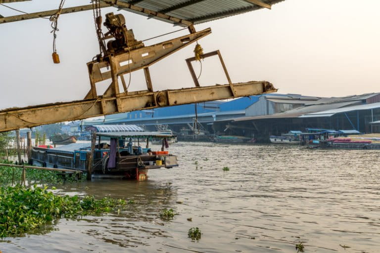
Banner image: A floating village on Tonle Sap Lake, Cambodia, where upstream dams are impacting the Mekong River, and with it, the lives of those who live downstream. Photo by Jialiang Gao/GNU Free Documentation License 1.2 on Wikimedia.