
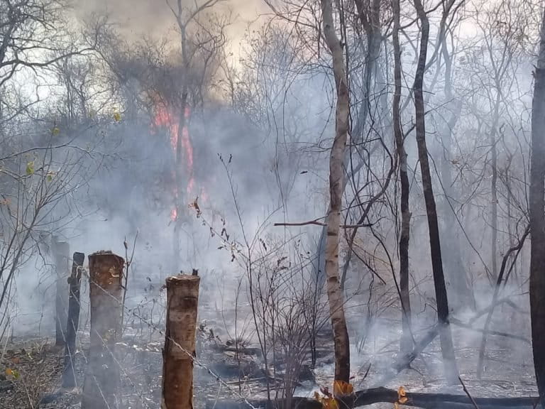
- Fires are raging in Bolivia, hitting particularly hard the Chiquitano dry forests of the country’s southern Santa Cruz region.
- Officials say the fires are largely the result of intentional burning to convert forest to farmland. Sources say this practice has recently intensified after Bolivian president Evo Morales signed a decree in July expanding land demarcated for livestock production and the agribusiness sector to include Permanent Forest Production Lands in the regions of Beni and Santa Cruz.
- Satellite data indicate 2019 may be a banner year for forest loss, with tree cover loss alerts spiking in late August to levels more than double the average of previous years. Most of these alerts are occurring in areas with high fire activity, with data from NASA showing August fire activity in Santa Cruz was around three times higher than in years past.
- Human communities are suffering due to the fires, with reports of smoke-caused illnesses and drinking water shortages. Meanwhile, biologists are worried about the plants and animals of the Chiquitano dry forests, many of which are unique, isolated and found nowhere else in the world.
This story is a journalistic collaboration between Mongabay’s Latin America (Latam) team and the Bolivian newspaper Página Siete
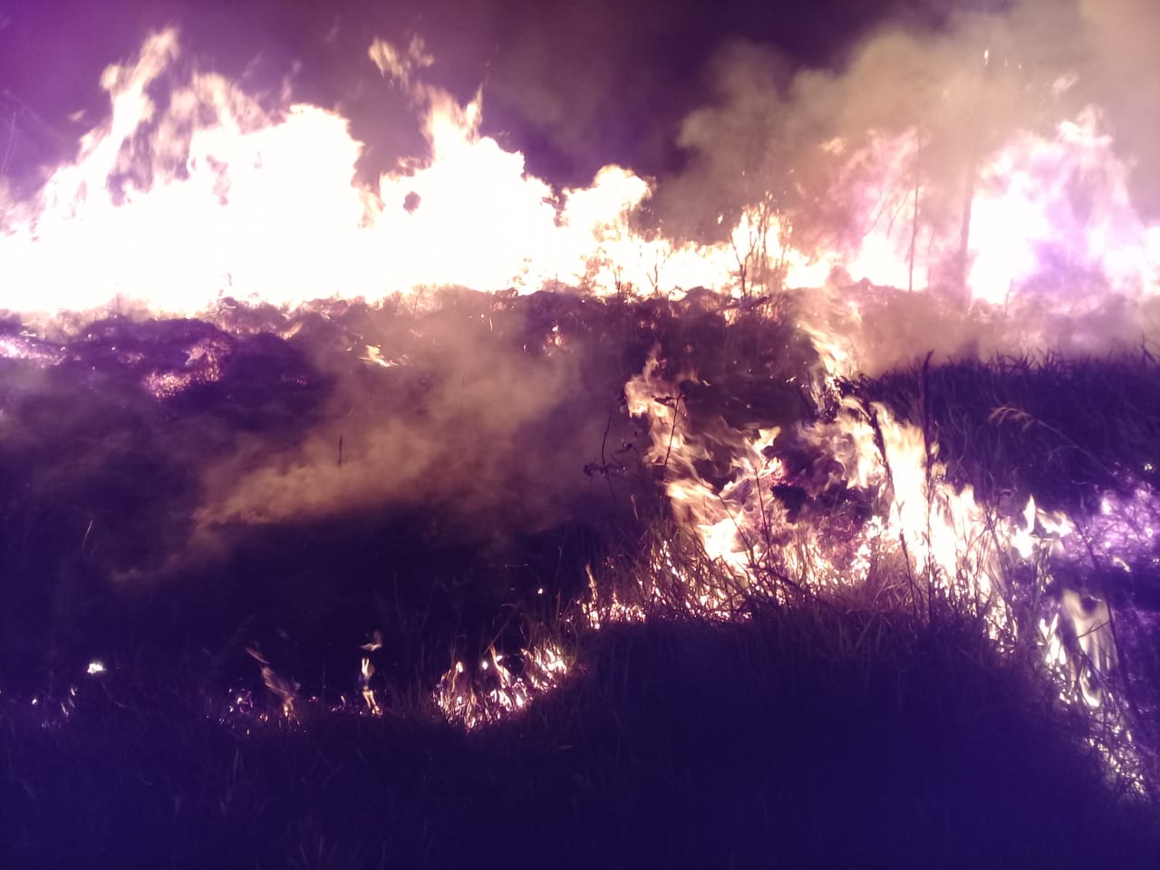
“Fire is a monster and is threatening us. Everything is ashes and fear,” says Iván Quezada, the mayor of Roboré, a town in eastern Bolivia. Last week, fires consumed more than 450,000 hectares (1.11 million acres) of forest; if added to the amount of forest destroyed since the fires in Bolivia began this year, that figure would border on a million hectares (2.5 million acres), according to official sources.
Every year at this time, the chaqueos, burning events to prepare the land for planting crops or raising cattle, are carried out in the Chiquitania region of eastern Bolivia, often generating fires that burn out of control. However, this year is worse. Boosted by a controversial governmental decree that promotes the expansion of the agricultural frontier and allows “controlled burning” in forests, the chaqueos have triggered a crisis for the area’s unique dry forests and savannas.

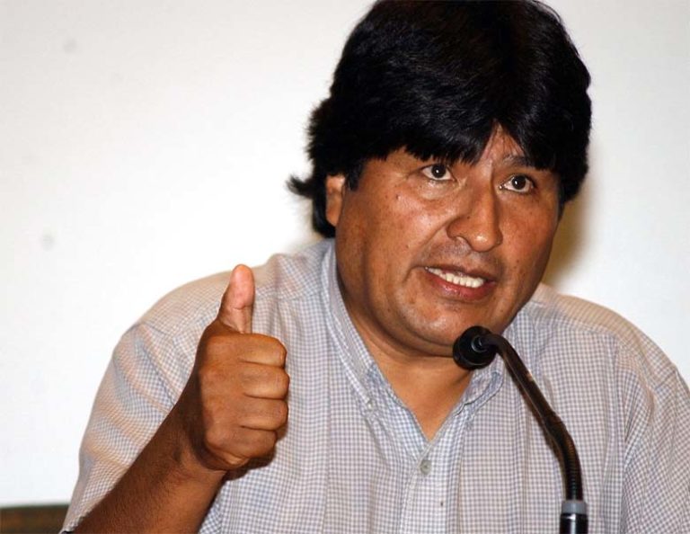
On July 9, President Evo Morales approved the amendment of Supreme Decree 26075 to expand land demarcated for livestock production and the agribusiness sector to include Permanent Forest Production Lands in the regions of Beni and Santa Cruz. The decree authorizes the clearing of forest for agricultural activities in private- and community-held areas under a system of sustainable management. According to current regulations, this system allows controlled burning.
“We have the duty and mission to boost Bolivia’s economic growth, not only based on non-renewable natural resources but also based on agriculture,” Morales said. He added via Twitter that the government is planning on expanding agricultural production and infrastructure to boost beef exports to China.
A crisis in Santa Cruz
Bolivia’s Santa Cruz region is rich in forest cover. But the lack of rain in the last three months has turned the dry forest into combustible fuel, with eight nearby communities directly affected by fires so far.
One of these is the town of Roboré, where the air is thick with smoke. The situation is more somber in surrounding communities, however. Families depend on water transported from the mountains via hoses. But these hoses these have been burned, cutting off community access to drinking water. Moreover, residents report that any water that reaches them is full of ashes, which causes digestive and respiratory problems, infections and conjunctivitis. Community activities, including school, have been suspended. Local authorities have requested the declaration of a state of emergency, but the government says it is not necessary.

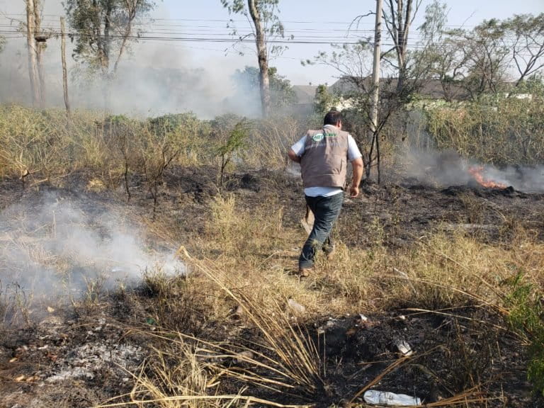
Firefighters sent by the Santa Cruz police department to battle the blazes face difficulties on the ground. For one, there are no trails to access the fire areas. Also, because water delivery systems can’t cross roads in the region, firefighters are forced to carry water in backpacks. Ultimately, this means firefighting is slower than the rate at which the fires are spreading; as fires are being put out on one side of the road, more are ignited on the other.

Along with the regulation changes and seasonal burning practices, windy conditions are contributing to the inferno, helping spread the fires over an ever-greater area. With strong winds forecast in the near future, many are worried things are just going to get worse.
Skyrocketing deforestation
Bolivia is no stranger to fire and deforestation. According to numbers from the University of Maryland (UMD), which has been collating satellite data on the world’s forests since the beginning of the century, the country lost 7.5 percent of its tree cover between 2001 and 2018. The record-holding year during this period was 2016, when around 471,000 hectares (1.16 million acres) of tree cover were lost.
But preliminary data for 2019 indicate this year could dramatically unseat 2016. According to the Forest and Land Audit and Social Control Authority (ABT), fires have consumed more than 953,000 hectares (2.35 million acres) of Bolivian forest so far. If these data hold true, this means that deforestation in 2019 will be more than double that of 2016 — and more than three times the 300,000 hectares (741,000 acres) lost in 2018.
The lion’s share of Bolivia’s deforestation is happening in the Santa Cruz region, which comprises vast tracts of both the rainforest of the Amazon and the dry forests of the Gran Chaco. Satellite data show that Santa Cruz lost a full 10 percent of its tree cover in less than two decades. Here, too, preliminary numbers from UMD indicate 2019 may be a banner year for forest loss, with tree cover loss alerts spiking in late August to levels more than double the average of previous years. Most of these alerts are occurring in areas with high fire activity, according to data from NASA that show Santa Cruz fire activity in August was around three times higher than in years past.
“If we take 2012 as the base year, when 128,043 hectares [316,401 acres] were deforested [in Santa Cruz], this year’s deforestation would be more than seven times greater; and if we take only the deforestation of Chiquitania, it would be three times greater,” said Pablo Solón, former Bolivian ambassador to the U.N.

Santa Cruz’s forests are being carved away to free up more land for soy plantations, cattle ranches, illicit coca-growing operations, and biofuel crops, as well as for the expansion of towns and smallholder farms. According to officials, the region most affected by the recent fires is a major soybean and livestock production area.
“What is happening is not an accident. Five years ago, the vice president challenged agribusinesses to expand the agricultural frontier by one million hectares per year,” Solon said. “Now it has reached that figure, not of productive agricultural land but of land devastated by the flames.”
Political motivation
Activists say this year’s mass deforestation by fires is not only driven by economic motives, but also by political interests. In its early years, the Movement for Socialism–Political Instrument for the Sovereignty of the Peoples (MAS in Spanish) opposed biofuels. However, the group, led by Morales, later changed its platform in favor of ethanol and biodiesel, arguing that resources could be saved if Bolivia reduced its fossil fuel imports. In alliance with the country’s agroindustrial sectors, it promoted biofuel feedstock such as sugarcane as “green” energy sources.
“There are direct culprits for this environmental disaster and the first one to blame is the government which has consistently passed in recent years laws of ‘forgiveness’ and promotion of the expansion of the agricultural frontier. They have also made an agricultural summit where the government, the agricultural sector of the east and communities allied to the MAS have joined,” said environmentalist Cecilia Requena. “In that summit they have decided to approve the harvest of genetically modified organisms, agrofuels, the expansion of the agricultural frontier, the export of beef to China and finally the approval of the July 9 decree that allows deforestation for agricultural purposes.”
Alcides Vadillo is the regional director of the Tierra Foundation, an NGO dedicated to research into the access, use and governance of Bolivia’s land and natural resources. He says the government has been handing out areas previously classified as “permanent forest” to colonizers. “There is a lot of money at stake,” Vadillo told Mongabay.
According to Requena, the government has pro-development goals that don’t mesh with 21st-century values.
“This damage is irreversible and immeasurable,” Requena said. “We have no idea of the dimension of the consequences, but we can say that we hope this will serve, like other disasters, to stop this suicidal drift. We need a development vision that values standing forests, not only for being vital for water but because it opens the window to an economy towards post-extractivism.”
The aftermath
The Chiquitano dry forest is home to hundreds of animal and plant species, many found nowhere else in the world. In Tucavaca Valley Municipal Reserve alone, biologists have recorded 554 different animal species, of which 35 are endemic; 55 endemic plants have also been found there.
Habitat loss is a big concern for many, as well as the outright deaths of animals and plants unable to escape the fires.
“We don’t understand very well what we have lost, but we know it’s huge,” Requena said, lamenting the fires’ impacts on the region’s “enormous” biodiversity.


One species affected by the fires is the plant Frailea chiquitana, a cactus endemic to Santa Cruz.
“The environmental damage has been elevated to a maximum power,” said biologist Kathrin Barboza. “Of the species affected, some reproduce slowly and if they die in large quantities it can take many years to recover.” She said habitat loss that happens in isolated, unique habitats like the Chiquitano dry forest could drive species to extinction.

Barboza said an environmental damage assessment will be needed once the fires cease.
“We have to see how many hectares of forest have been damaged and see if there are species that can be rescued,” she said, adding that the forest should be monitored and studied to determine how long it may take to recover.
The region’s biodiversity isn’t the only thing affected by the fires.
“Among the consequences to consider [are] impacts to soil, air (increase of greenhouse gases) and water (pollution), in addition to the loss of the landscape,” said Cecilia Tapia, an environmental engineer.
The fires may be over in the near future, but their consequences will be felt for much longer. Ever Durán, the president of the College of Forest Engineers of Santa Cruz (CIF-SC), estimates that it will take around 200 years for the Chiquitano to recover.
Durán added that it is imperative that the government activate the national disaster declaration protocol for fires and call for international aid, not only to extinguish the fires burning now but also to assist with mitigation of future fires and restoration of previously burned forests.
Hugo Salmón, the president of the Regional Assembly of Santa Cruz, requested that the National Institute of Agrarian Reform (INRA) abolish the provision of land and the granting of settlement permits in protected areas and areas that are not already used for agricultural purposes.
In response to the fires, representatives of several Santa Cruz professional associations recently issued a statement imploring the Bolivian government to stop the expansion of the agricultural frontier, and repeal laws legalizing burning in the Santa Cruz, Beni and Pando regions.
“We demand and urge the government to consider that natural resources are not economic resources for a few, but [resources that support the] quality of life for all Bolivians and this will only be achieved if a sustainable framework of these resources [is maintained],” the statement reads.

This story is a translated and adapted version of a story first published by Mongabay Latam on Aug. 22, 2019.
Banner image: Fire rages outside the community of Taperas. Image courtesy of Germain Caballer.
Editor’s note: This story was powered by Places to Watch, a Global Forest Watch (GFW) initiative designed to quickly identify concerning forest loss around the world and catalyze further investigation of these areas. Places to Watch draws on a combination of near-real-time satellite data, automated algorithms and field intelligence to identify new areas on a monthly basis. In partnership with Mongabay, GFW is supporting data-driven journalism by providing data and maps generated by Places to Watch. Mongabay maintains complete editorial independence over the stories reported using this data.
Feedback: Use this form to send a message to the editor of this post. If you want to post a public comment, you can do that at the bottom of the page.