- Mongabay founder Rhett A. Butler writes about his visit to the dry forests of western Madagascar last month.
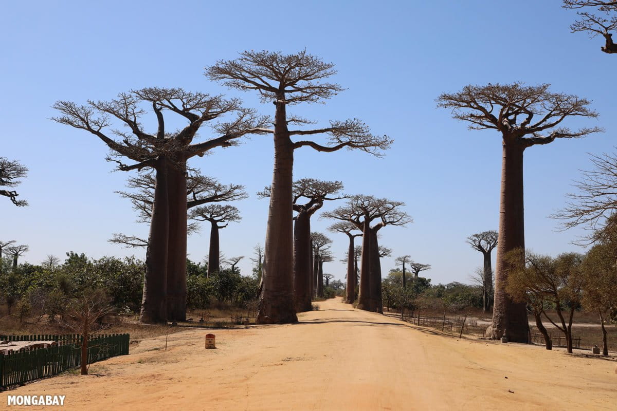
- The dry forest of western Madagascar is famous for its wildlife and baobab trees, including the tourist destinations of Baobab Alley, Tsingy de Bemaraha, and Kirindy Forest.
- Rhett traveled to Madagascar for the annual Association for Tropical Biology and Conservation (ATBC) meeting. Ahead of the conference, he used the opportunity to visit the Menabe region of western Madagascar to investigate some GPS points identified via Global Forest Watch’s GLAD alert system as potential recent deforestation.
- This post is insider content, which is available to paying subscribers.
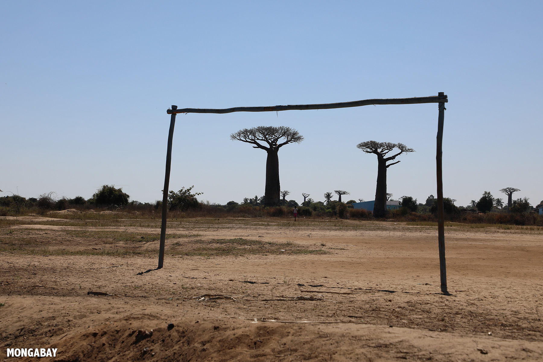
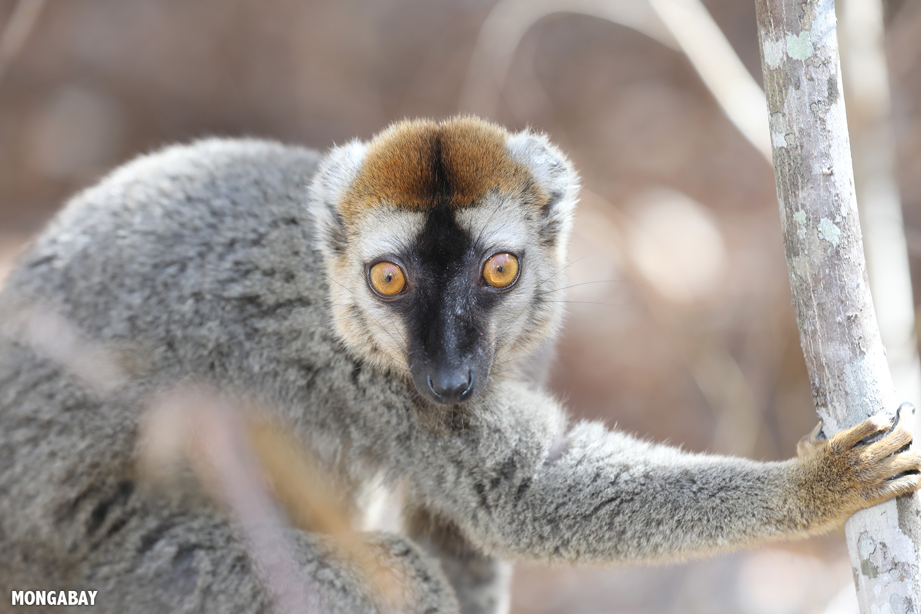
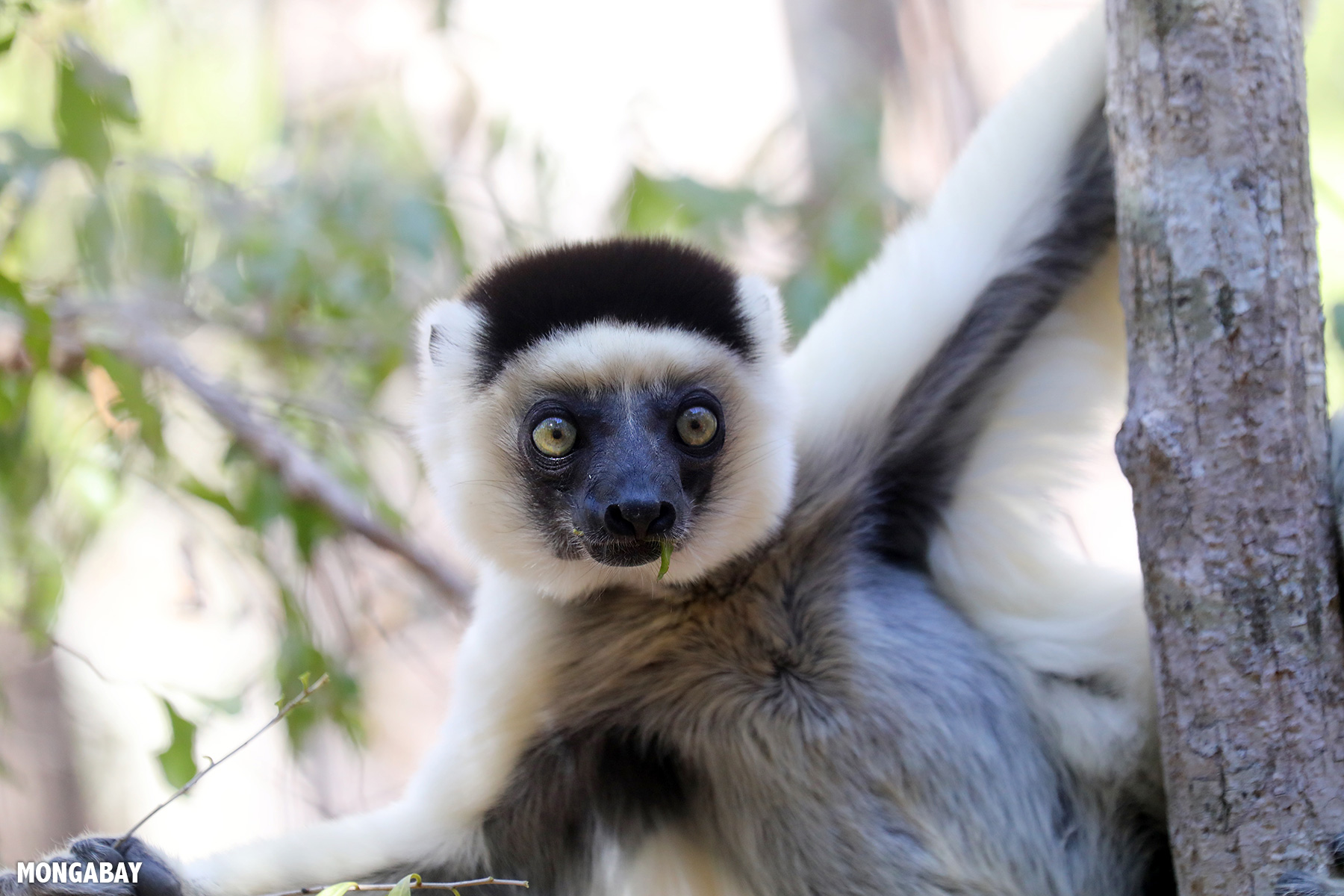
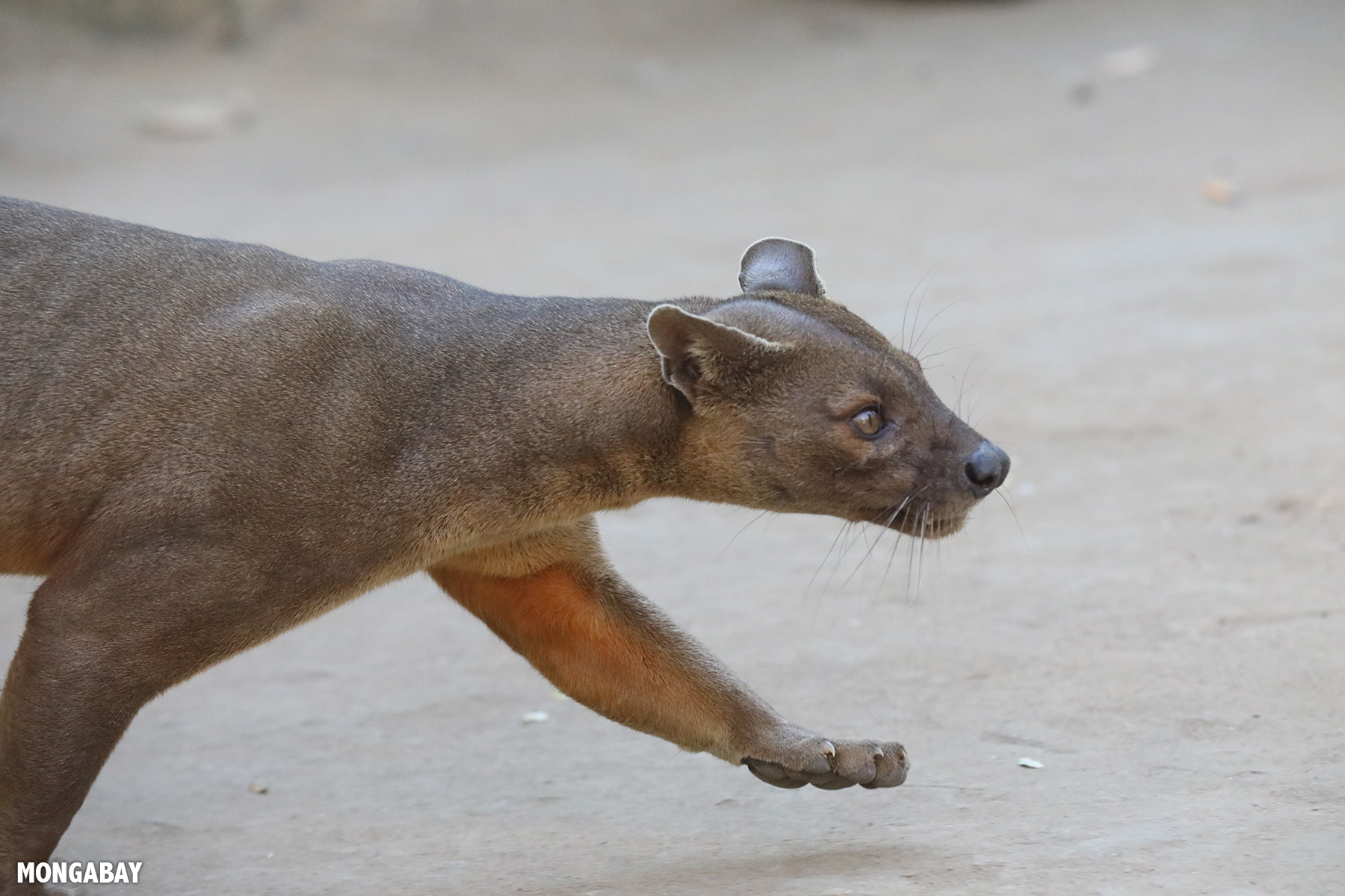
The dry forest of western Madagascar is famous for its wildlife and baobab trees, including the tourist destinations of Baobab Alley, Tsingy de Bemaraha, and Kirindy Forest. Among the species that call these forests home are the rabbit-sized giant jumping rat (Hypogeomys antimena); the puma-like fossa (Cryptoprocta ferox), Madagascar’s largest predator, which feasts on lemurs; and Verreaux’s sifaka (Propithecus verreauxi), the so-called “dancing lemur.”
In July 2019 I traveled to Madagascar for the annual Association for Tropical Biology and Conservation (ATBC) meeting, which was held in the capital city, Antananarivo. Ahead of the conference, I used the opportunity to visit the Menabe region of western Madagascar to investigate some GPS points identified via Global Forest Watch’s GLAD alert system as potential recent deforestation. I already knew what I was likely to find, thanks to reporting by Mongabay contributor Emilie Filou, who filed a story in February 2019 on illegal corn farming in the region, as well as recent high-resolution satellite data from Planet.

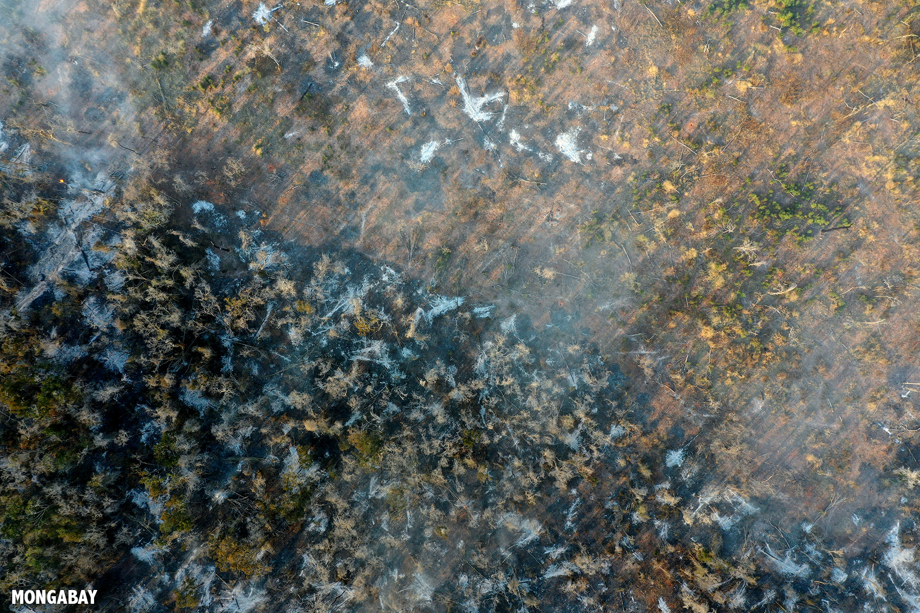
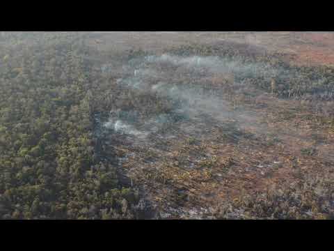
Sure enough, I encountered burned-out dry forests and areas of active burning. While the Global Forest Watch-identified GPS points were useful for general orientation and finding where the damage had been done in the previous month, the large plumes of smoke rising from the horizon made it pretty easy to pinpoint where the action was currently occurring. I used satellite imagery to find roads that could get me within drone range (around 4 kilometers, or 2.5 miles) of the GPS points. Typically we’d find a narrow road running off the main national route that would give us access to paths leading to recently deforested areas or at least a good launch point for the drone.
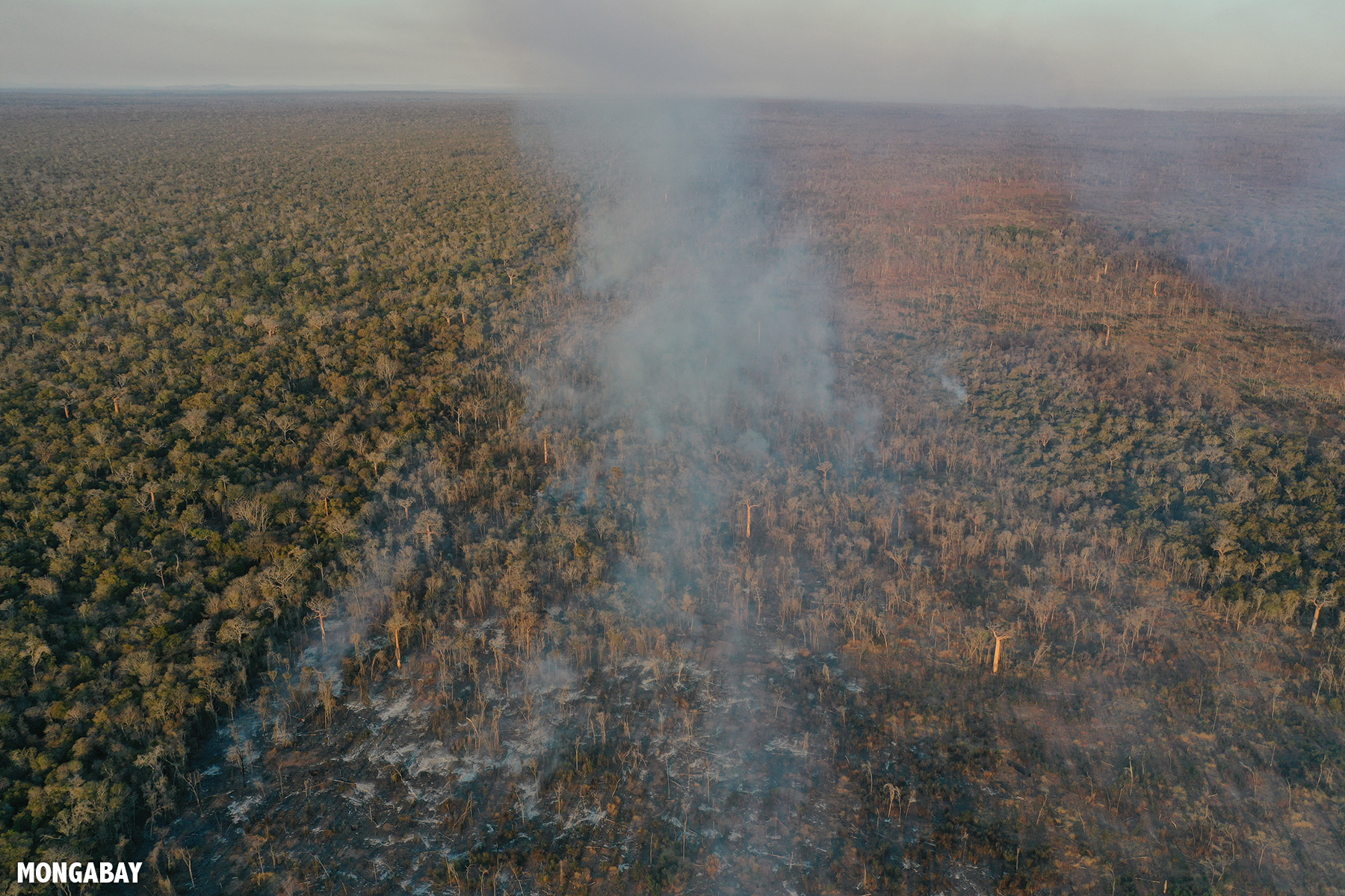

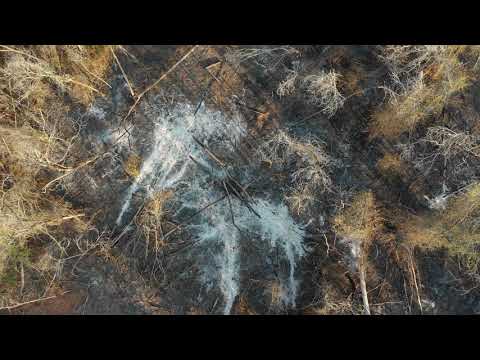
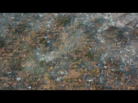
Flying over the deforested areas in some cases provided a clear view of what had replaced the forest. In some cases, the deforested land was now planted with corn or cassava (manioc). In others, the soil was just scorched or barren. In places where fires had just burned, skeletal remains of trees and charred stumps were all that remained. The drone also provided a view of active burning. Through the smoke I could see trees teetering and falling over.

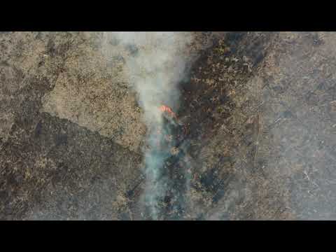
I was able to walk through a few areas of active fire, the smoke rising around me as burning trees and grass snapped and crackled. I also heard the ringing distress calls of couas and other animals.
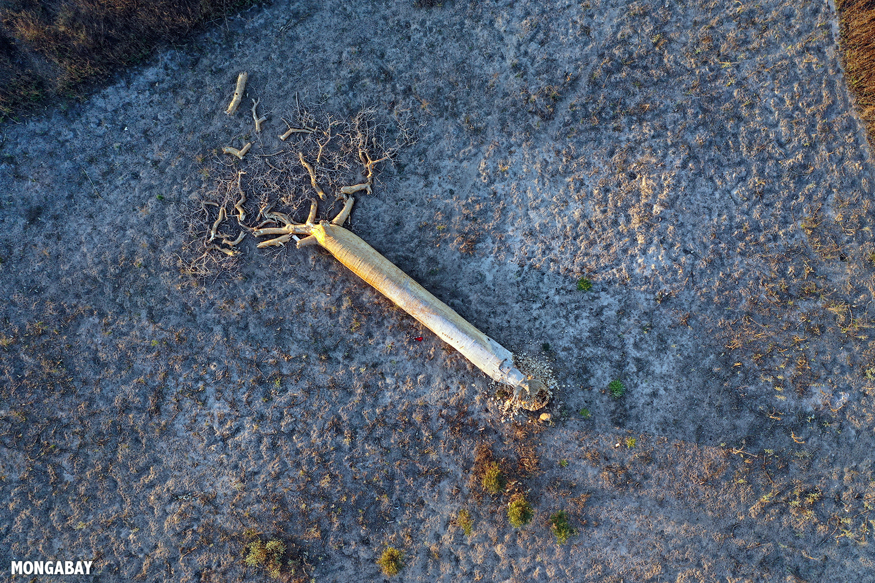
In areas that had been deforested earlier and showed up on Global Forest Watch as GLAD alerts, I found corn cobs, corn and cassava plants, and disturbed soil. A lot of the land was just charred, with no sign of any productive use. Other areas consisted of dead trees, their trunks bleached white by the fire.


Conversations with local people shed further light on the situation. A surge in peanut prices has apparently driven commercial conversion of forests for peanut planting in the area. Peanuts are alternated with other crops, providing a lucrative source of income relative to other common activities in the area like charcoal production. Locals said much of deforestation is being carried out by migrants from the south who have poured into the region in recent years. According to the Durrell Wildlife Conservation Trust, the population of Menabe has increased by more than a quarter in less than 30 months.
The drone also revealed the sheer scale of the burning. While July is still a couple of months away from the typical burning season, I could see dozens of fires. And many of these were burning inside protected areas, including Kirindy Forest. What made this particularly distressing is there didn’t seem to be anything keeping these fires from spreading. Indeed, when winds picked up in the afternoon, the speed and extent of the fires would grow.


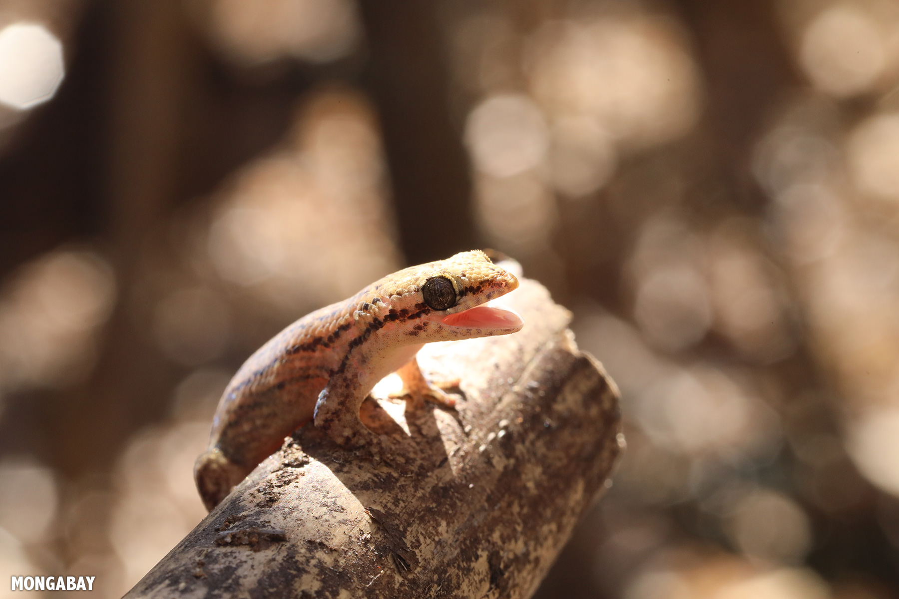
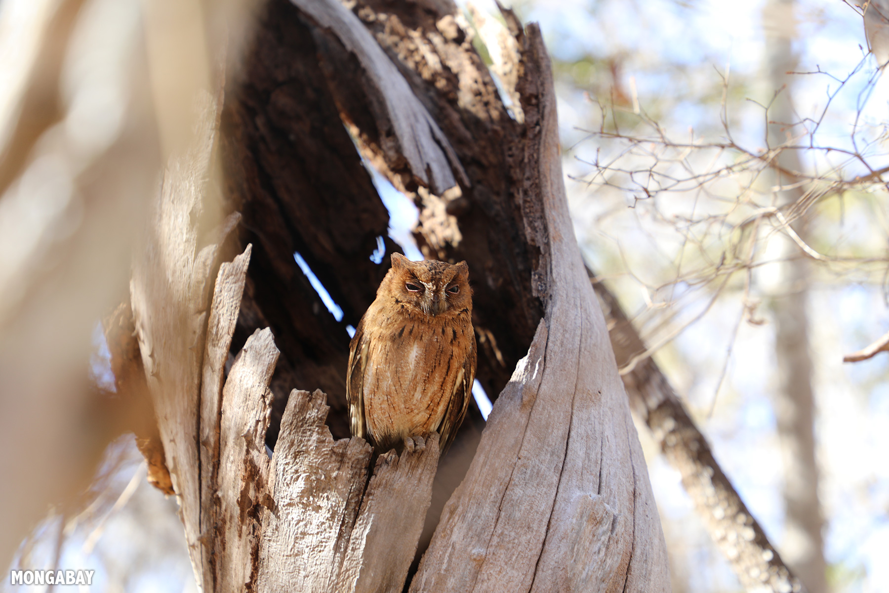
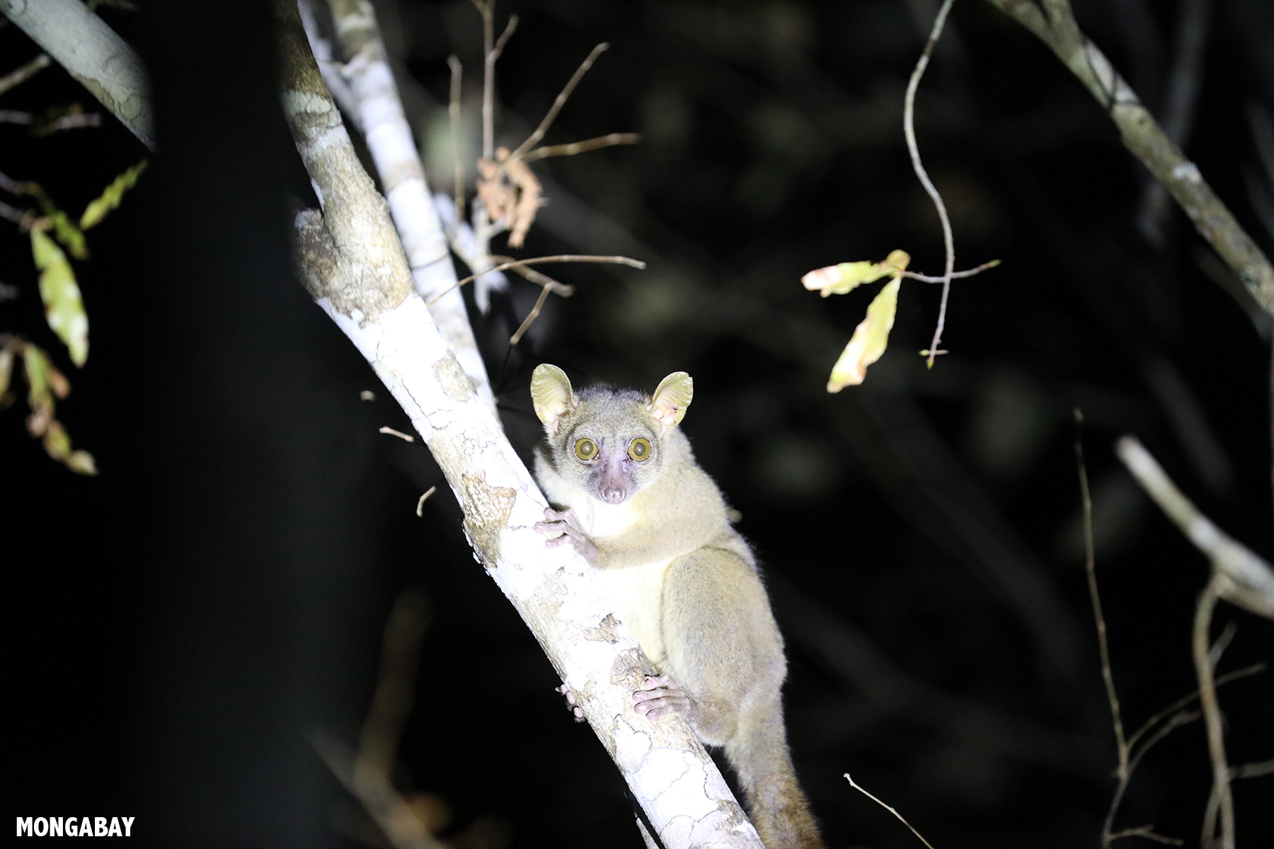
Some of the burning was occurring just a few miles from where I’d earlier seen lemurs and other wildlife. These areas had no doubt been home to the same species just days — or possibly even hours — before. Some of those animals are pictured below.
But before we get to the animal pictures, I’d like to thank Rainbow Tours for organizing logistics of this trip, including setting me up with an excellent guide and driver.


Why I attended ATBC in Madagascar
Always cognizant of my carbon footprint, I try to make sure my travel is as productive as possible. Attending the Association for Tropical Biology and Conservation’s meeting in Madagascar offered several opportunities:
- Team meeting: Mongabay recently hired two staff in Africa: Malavika, our Madagascar staff writer, and Terna, our Africa contributing editor. ATBC was a chance to meet them in person and introduce them to Willie, Mongabay’s global program director, and Becky, the editor who has been commissioning most of Mongabay’s Madagascar stories the past three years.
- Connecting with Malagasy journalists: At ATBC, Mongabay organized a workshop with local Malagasy journalists to learn more about the challenges facing environmental reporting in the country, what issues resonate with editors and the public, and what gaps and opportunities there are for covering conservation. We also provided background information on key conservation topics and introduced the journalists to some scientists.
- Symposia on conservation issues in Madagascar and environmental monitoring: We held two symposia jointly with World Resources Institute. The first looked at a range of environmental monitoring tools. Willie presented on how Mongabay is using Global Forest Watch data for our Forest Trackers series, while I presented on how bioacoustics could be used to strengthen corporate conservation commitments and improve biodiversity monitoring. Becky and our correspondent Rowan Moore Gerety, who has done a number of Madagascar stories for us, spoke on “Covering conservation in Madagascar” and “How should conservationists deal with corruption and security threats?” respectively.
- Coordinating with ATBC around future events: I met with ATBC leadership regarding potential collaboration around next year’s meeting in Cartagena, Colombia, and other possible projects, including our Transforming Conservation initiative.

Rhett Butler standing at the base of a baobab while flying a drone. Photo by Rhett A. Butler / Mongabay. Baobab Alley outside Morondava. Photo by Rhett A. Butler / Mongabay.
