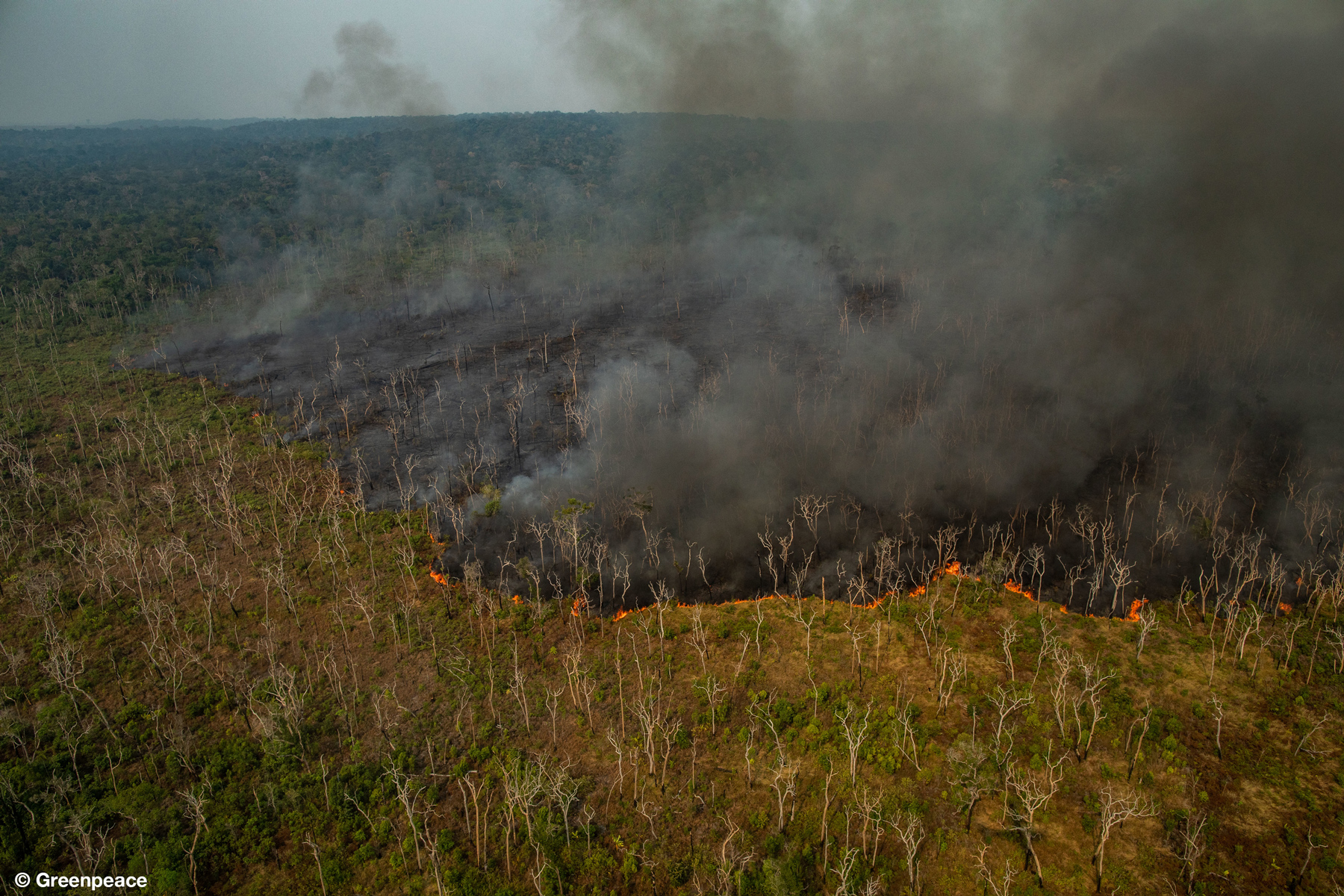
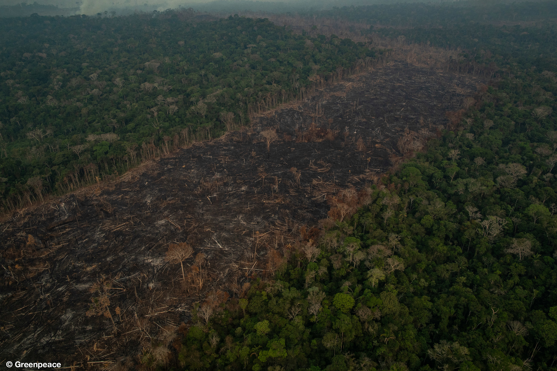
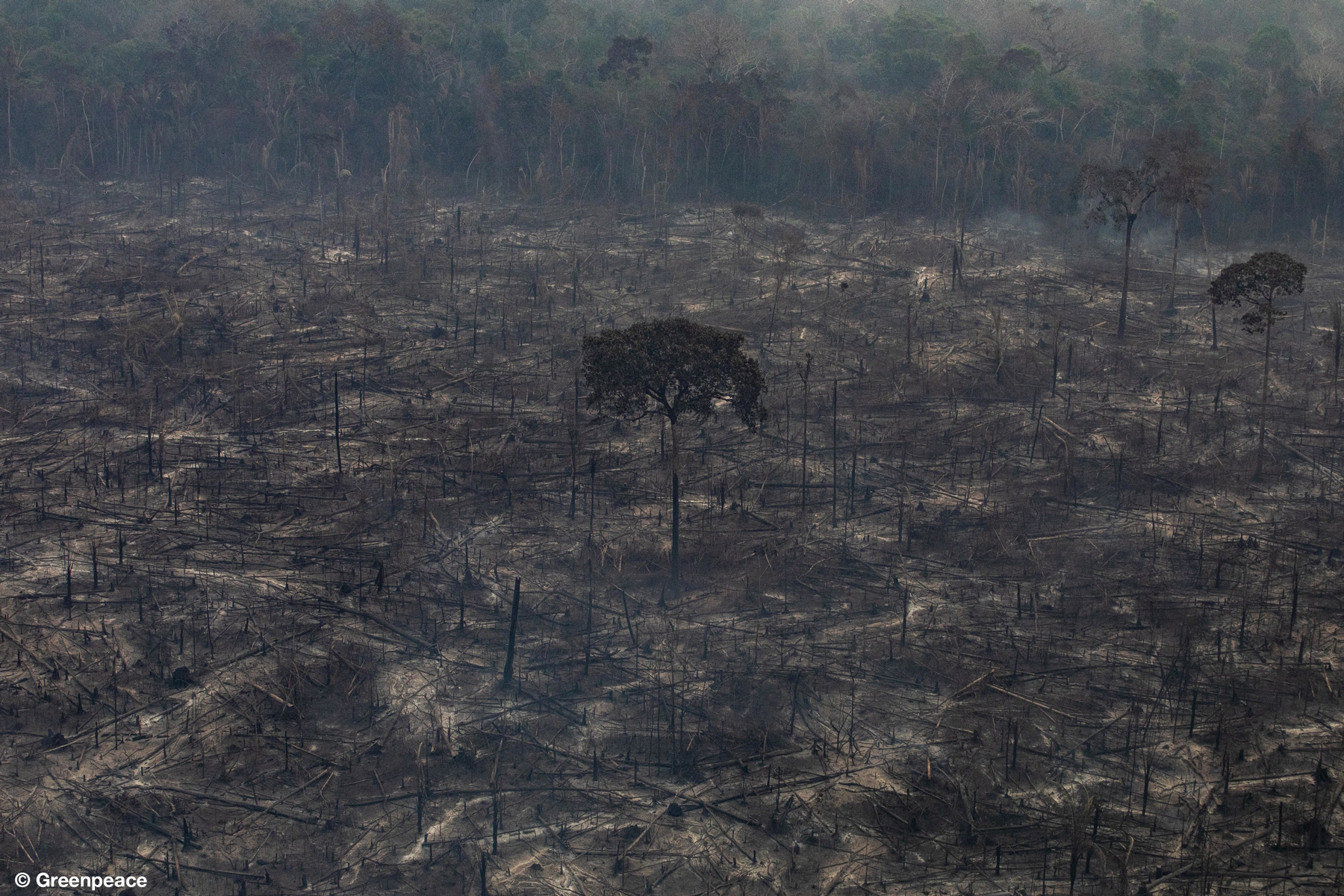
- Today Greenpeace Brazil released dramatic photos of fires currently burning through rainforests and agricultural land in the Brazilian Amazon.
- Some of the fires appear to be burning forests with well-developed canopy structure, suggesting that carbon-dense and biodiverse forests are being directly impacted by the fires.
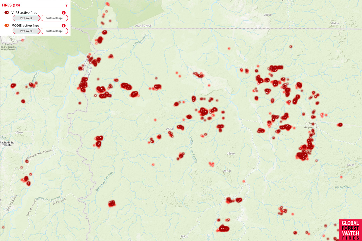
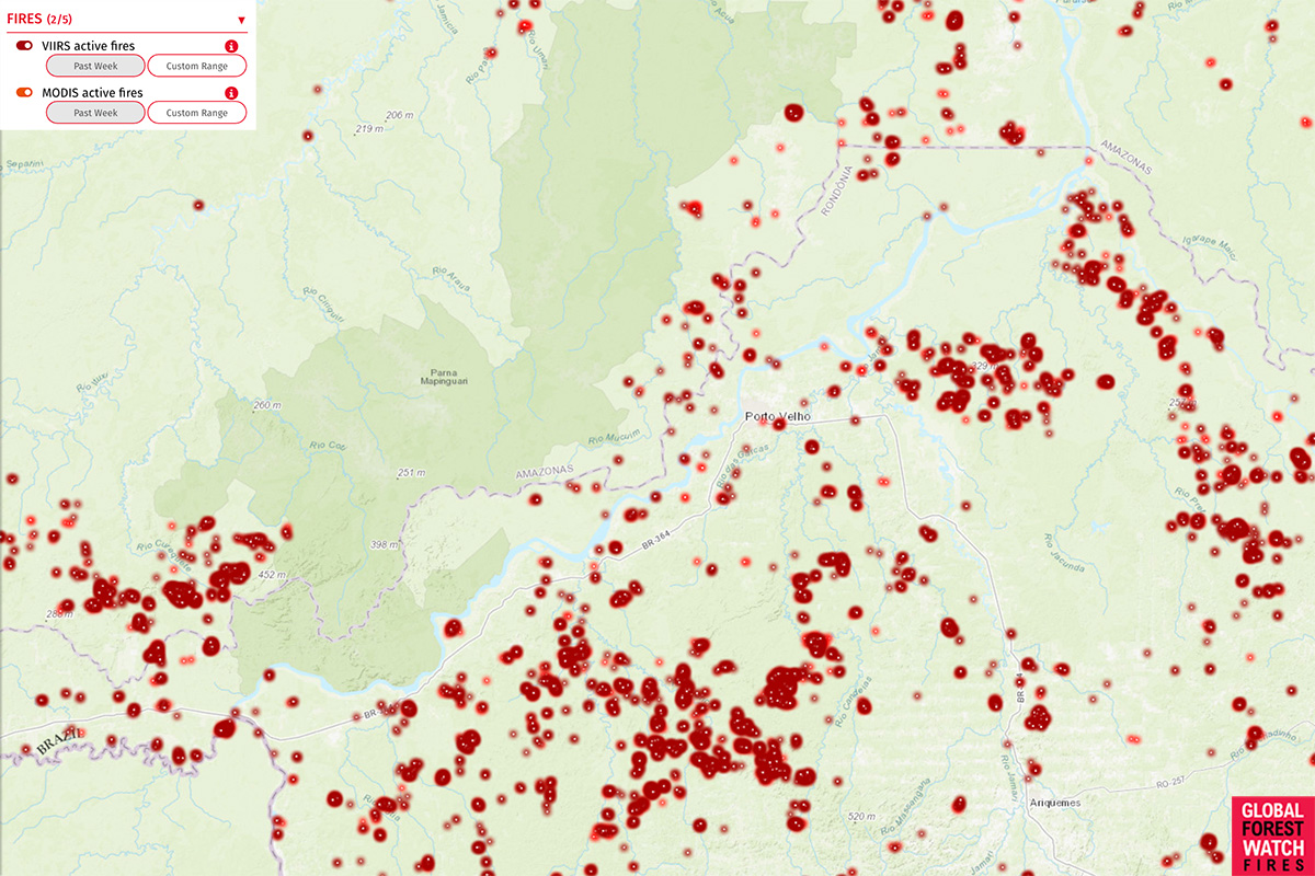
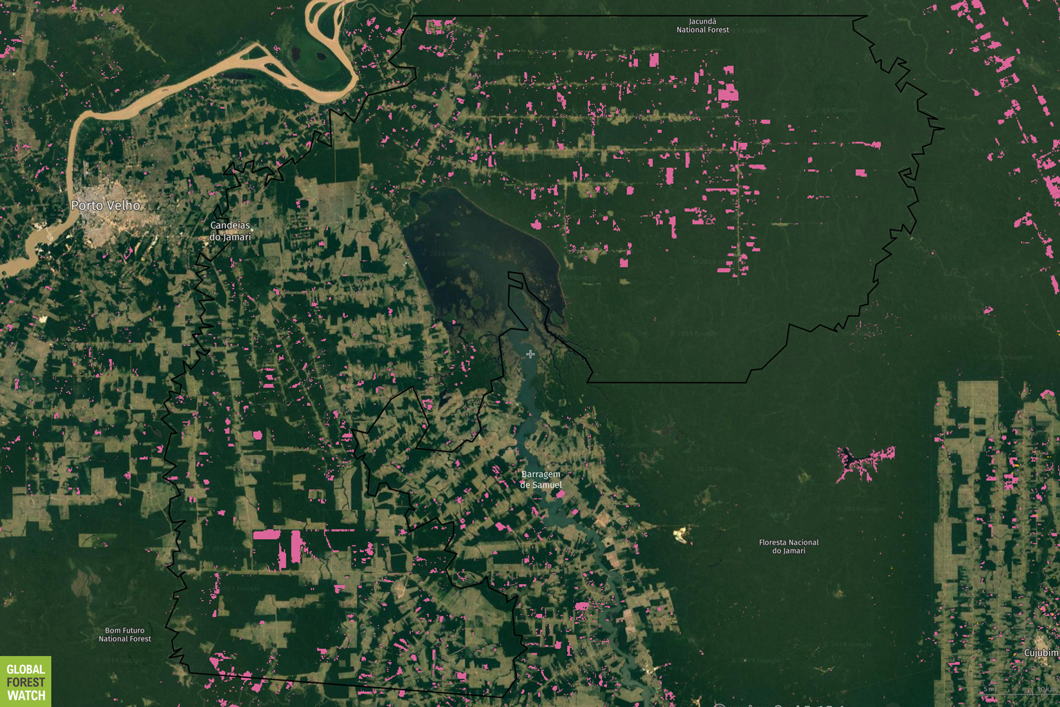
- Greenpeace says its own spatial analysis indicates that 15,749 of the 23,006 hotspots it recorded in the Amazon in the first 20 days of the month were in areas that were forest in 2017.
- Those conclusions provide further evidence that the fires were set intentionally for forest-clearing purposes.
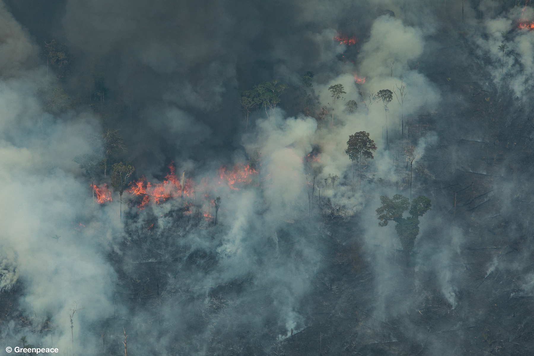
Today Greenpeace Brazil released dramatic photos of rainforest fires currently burning in the Brazilian Amazon.
The images show agricultural lands, pasture and forests in the states of Rondônia, Mato Grosso, and Pará going up in flames. Some of the fires appear to be burning forests with well-developed canopy structure, suggesting that carbon-dense and biodiverse forests are being directly impacted by the fires.
Greenpeace says its own spatial analysis indicates that 15,749 of the 23,006 hotspots it recorded in the Amazon in the first 20 days of the month were in areas that were forest in 2017. A quarter of the hotspots registered last week occurred in conservation areas or officially recognized indigenous territories, according to the group.


Those conclusions provide further evidence that the fires were set intentionally for forest-clearing purposes. Last week, research published by IPAM Amazônia, a Brazilian research group, revealed that the 10 Amazonian municipalities that had the most fire outbreaks this year were also the ones that had the highest deforestation rates.
“These municipalities are responsible for 37 percent of the hotbeds in 2019 and 43 percent of recorded deforestation through July,” the IPAM report said. “This concentration of forest fires in newly deforested areas with mild drought represent a strong indication of the intentional character of the fires.”

The group put the blame squarely on the policies of President Jair Bolsonaro, who has been an outspoken critic of conservation efforts in the Amazon while also encouraging ranchers, farmers, loggers and miners to clear forests.
“It’s urgent and necessary to put an end to this vicious cycle while we still have time,” Danicley Aguiar, Amazon campaigner at Greenpeace Brazil, said in a statement. “During a flyover last Friday (23 August) we could see the consequences of Bolsonaro’s government anti-environmental agenda: extensive deforested areas, surrounded by smoke, showing the advance of industrial agriculture into the forest. Unlike what the Bolsonaro’s government claims, the wave of fire sweeping the Amazon is linked to an increase in deforestation in the region.”
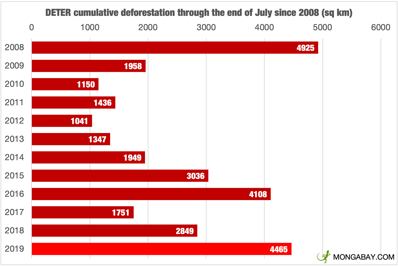
Brazilian government data show that deforestation in the Amazon is up 57 percent through the end of July from last year. Forest clearing surged in July, when more than 2,092 square kilometers (808 square miles) — an area more than 35 times the size of Manhattan — was chopped down. That was the highest single month of deforestation in more than 12 years.
After that information was released, Bolsonaro sacked the head of Brazil’s space agency INPE and demanded the right to “review” deforestation data before it becomes public, raising fears that his administration would manipulate the data. INPE has not published any deforestation data since then.

Soaring deforestation coupled with smoke from the fires have sparked a global outcry, including street protests, calls for boycotts of Brazilian companies and products, and condemnation from world leaders. The EU has threatened to cancel a major trade deal over the issue.
Pressure appears to building on Bolsonaro. Late last week he retracted some of his wildest and most inflammatory claims — that NGOs were setting the fires to make him look bad — and mobilized thousands of soldiers to combat the fires. But he still has not announced any policy measures that would be needed to address the issue in the long term. That led Greenpeace to blast the president.
“The fires that are devastating the Amazon are also destroying Brazil’s image internationally,” Márcio Astrini, public policy coordinator at Greenpeace Brazil, said in a statement. “Even the agribusiness sectors are already admitting that the government’s anti-environmental policies can bring economic damage. In the meantime, Bolsonaro is not announcing any concrete measures to fight deforestation. He seems more concerned with saving himself than saving the forest.
“The forest has its limit, and we are dangerously getting close to it,” Astrini added. “Moreover, deforestation only damages Brazil’s economy, the planet’s climate and endangers wildlife and the lives of thousands of people. Taking action to end deforestation must be everyone’s goal and an obligation of those who lead the country.”
Related stories:
- How many fires are burning in the Amazon? [Aug. 25,2019]
- Amazon fires trigger protests worldwide [Aug. 24, 2019]
- Satellite images from Planet reveal devastating Amazon fires in near real-time [Aug. 22, 2019]
- Amazon rainforest fires leave São Paulo in the dark [Aug. 21, 2019]
Photos of the Amazon forest fires
Nova Bandeirantes, Mato Grosso


Porto Velho, Rondônia


Candeiras Do Jamari, Rondônia


Colniza, Mato Grosso