
- Researchers tracked 17 juvenile whale sharks tagged at three sites in the Philippines to understand how their movements related to food sources and fishing grounds in Southeast Asia.
- They found that juvenile sharks moved quickly and widely through the Bohol and Sulu seas but remained near their feeding sites within Philippine waters.
- In combination with other studies, these findings suggest that locally focused whale shark conservation efforts are critical and must consider the movements juvenile whale sharks make within zones of several hundred square kilometers.
Where do the biggest fish in the sea go to find enough food? Turns out, not too far, if they live in a region with lots of food.
Whale sharks (Rhincodon typus) swim about 25 kilometers (15 miles) per day and can make some tremendous long-distance oceanic movements. Scientists recently tracked a female whale shark from the eastern Pacific to the western Indo-Pacific for 20,142 kilometers (more than 12,000 miles) over 841 days, the longest whale shark migration route ever recorded.
Juvenile sharks in a series of four studies, one in the Philippines and three in the western Indian Ocean, apparently prefer to swim laps around their favorite feeding grounds.
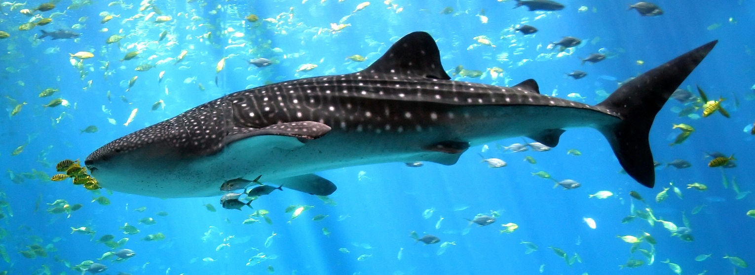
Whale sharks are the world’s largest fish, growing up to 12 meters (40 feet) long and weighing up to 25 tons; even juveniles are 7 to 9 meters (23 to 30 feet) long. Scientists are keen to understand where these huge fish spend their time to better conserve them.
Fishing activity threatens whale sharks through direct killing, capture as bycatch, and boat strikes. Half of the world’s whale shark population has been killed since the 1980s, primarily by fisheries in China, India, the Philippines and Taiwan, and Chinese fisheries still target whale sharks for their fins and meat. The rapid decline in whale sharks’ global population prompted the International Union for the Conservation of Nature (IUCN) to reclassify the species as endangered in 2016.
The Philippines supports the world’s third-largest known population of whale sharks, and tracking and photo-identification data have detected sharks moving between the Philippines and elsewhere in Southeast Asia.
Given the country’s proximity to both other whale shark populations and major fisheries, researchers tracked the movements of sharks with near-real-time satellite tags to better understand their movements around the Philippines archipelago.
 |
 |
| Tracks of whale sharks tagged in Tubbataha Reefs National Park (TRNP), left, and northern Mindanao Island, right. Sharks from Mindanao and a third coastal tagging site off Panaon Island/southern Leyte generally remained nearby throughout the study. Those tagged at TRNP spread out across the Sulu Sea, traveling faster and farther on average than sharks tagged at the other two locations. All three tagging sites are in the Sulu and Bohol seas, Philippines. Maps are Figures 1 and 3 of Araujo et al (2018). Satellite tracking of juvenile whale sharks in the Sulu and Bohol Seas, Philippines. PeerJ, 6, e5231. | |
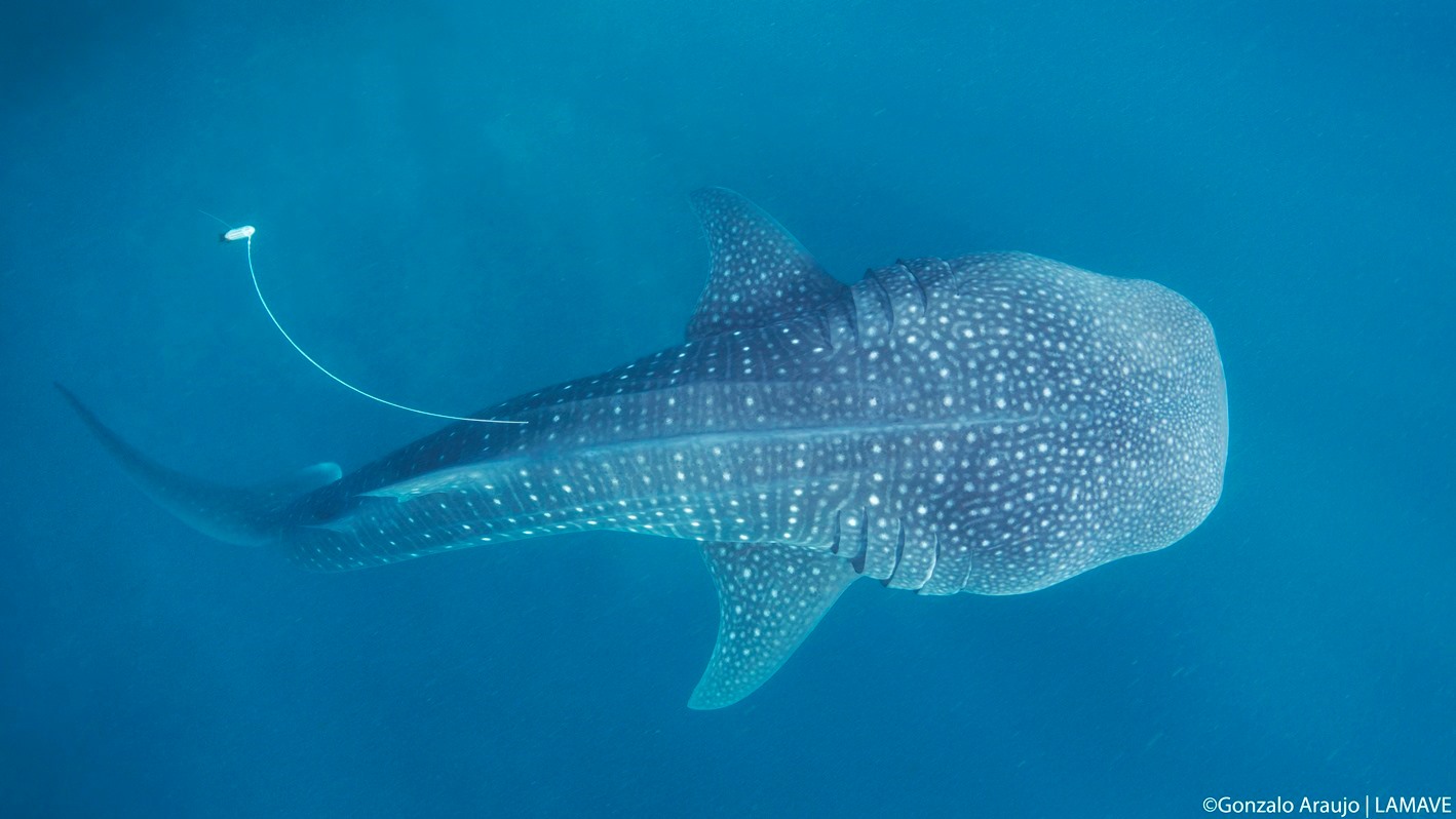
The researchers tagged 17 juvenile whale sharks with “smart position and temperature” (SPOT) tags, tethered to the dorsal fin of each individual, from three areas in the Sulu and Bohol seas.
This video describes the 2015-2016 tracking project, including the tagging process, which involves a researcher simply swimming next to a shark and darting it. The shark seems to react very calmly, as if it just felt a bee sting, a finding echoed by other researchers.

The buoyant tags trail about 1.8 meters (6 feet) above a shark like a floating sausage to provide maximum opportunity for a given tag’s antenna to break the water’s surface and trigger a wet/dry sensor. Each time the antenna breaks the surface, it sends a message to the Advanced Research and Global Observation Satellite (ARGOS) system. ARGOS estimates the tag’s location using the Doppler effect (movement of the passing satellite compared to the tag) via its stations on the ground and sends the data to the researchers.
The system works even where no radio communication exists, so it is commonly used for tracking wide-ranging marine animals.
One limitation of the SPOT tags is that they send information only when the antenna breaks the surface. Whale sharks dive deep, down to nearly 1,800 meters (5,900 feet). Days can go by with no signal if a tagged shark swims too deep for the tag to break the surface of the water.
The researchers used a software filter that evaluated the most probable tracks and removed data points with less certain or unrealistic locations. Just under one-third of the bulk raw transmissions (31 percent) were considered by the system to have high location precision, said lead author Gonzalo Araujo of the NGO Large Marine Vertebrates Research Institute Philippines (LAMAVE), making the filter more important.
The individual sharks traveled an average of 16 kilometers (10 miles) per day, covering between 86 and 2,580 kilometers (53 and 1,603 miles) during the study. They all remained in Philippine waters for the duration of their tracking, which lasted between six and 126 days. The difference in tracking periods among the tagged sharks may relate to how different sharks move underwater and those movements affect the frequency of data transfer.
“It could be that individual whale sharks have different depth use overall,” Araujo said in an email to Mongabay-Wildtech, “and therefore tags end up spending less time at the surface. It could also be that they move slightly differently in the water column, or the fact that the ARGOS satellites only pass a few minutes every hour, or every few hours, so if tag was not at the surface then, then there’d be no transmission.”

The study showed that juvenile sharks move quickly and widely through the Bohol and Sulu seas, though the sharks tagged at Mindanao and Panaon islands stayed closer to shore, moved more slowly, and covered less ground during their respective tracking periods than those tagged at Tubbataha Reefs Natural Park (TRNP), in the middle of the Sulu Sea.
The tracks from the satellite data confirmed what photo-identification and behavioral data had suggested: that juvenile sharks tended to remain near specific feeding areas.
Whale sharks are one of three known filter-feeding sharks (the others being the basking shark and the megamouth shark). They open their huge mouths as they move to eat plankton, fish eggs, krill, and small squid and fish.
“In Mindanao and Panaon Island, the sharks were observed feeding,” Araujo said, “and we know they visit these two sites to forage seasonally. At TRNP, the sharks seem to be ‘cruising by’ from what we’ve observed, and over time, the sharks don’t seem to hang around. Juvenile whale sharks have strong fidelity to foraging grounds, and that could explain these differences in [movement] tracks.”
A second limitation of SPOT tags is their longevity. Temperature gauges in the tags reveal when one has been on the surface for five consecutive days, a sign that it has become detached from the shark. Tags in this study fell off the sharks after a maximum of 126 days; results from this and previous studies indicate that it is hard to keep tags on sharks for more than a few months.

“We do indeed want to track animals for a longer time period,” Araujo said. “We have subsequently tagged some whale sharks with miniPAT tags (pop-up archival tags) that have a longer retention, with the ultimate goal of seeing if juvenile whale sharks return to the same foraging grounds, and where they forage when they aren’t in areas we know.”
Juvenile whale sharks elsewhere
In a trio of related recent studies, juvenile whale sharks in the western Indian Ocean displayed similar behavior to those in the Philippines. Sharks in northwestern Madagascar tracked by a different research team (Diamant et al. 2018) that also deployed SPOT tags traveled farther and faster than those in the Philippines. They did spend most of their time within range of their tagging locations; four to five of the eight sharks in this study moved off shore, but were never detected by tracking or photos in known whale shark hotspots on the African mainland.
Another tracking study (Rohner et al. 2018) using the same equipment found that although juvenile whale sharks in Mozambique traveled at greater speeds than their Philippines counterparts, they, too, stayed closer to shore than would be expected by chance. These researchers, like the team led by Araujo in the Philippines, suggest that finding food in productive coastal waters is an important driver of the whale sharks’ north-south movements. They also found a rapid increase in the use of gillnets in the same coastal area where tagged whale sharks spent much of their time, suggesting enhanced management of gillnet fisheries will be needed to avoid sharks becoming entangled.
More recently, scientists monitored shark movements in Tanzania, southern Mozambique, and the Arabian Gulf (Prebble et al, 2018) through photo-ID and chemical signatures in the sharks’ tissue that reflect where they’ve fed. Here, too, the juvenile sharks that frequented the coastal tagging areas stayed primarily within a few hundred kilometers of their known feeding sites.
Each of the four studies incorporated citizen-science sightings (and resightings) of whale sharks recorded in the Wildbook for Whale Sharks photo database. The online image library analyses skin markings of new photos using either volunteers or machine-learning algorithms and matches them to those of individuals in the database. Using that information, the four research teams identified individual sharks and learned of their whereabouts, including reappearances at their tagging locations, even after the tags had fallen off.
The four studies found little evidence of broad-scale dispersal or connectivity between distant feeding sites. All showed that in various parts of their wide geographic range, juvenile whale sharks tend to move frequently within a limited area and remain relatively close to feeding sites, which tend to be near the coast.
“This research highlights the high mobility of whale sharks, even juveniles,” Araujo said, “and the need for broader-scale management and conservation plans for this endangered species.”
Citations
Araujo, G., Rohner, C. A., Labaja, J., Conales, S. J., Snow, S. J., Murray, R., … & Ponzo, A. (2018). Satellite tracking of juvenile whale sharks in the Sulu and Bohol Seas, Philippines. PeerJ, 6, e5231.
Diamant, S., Rohner, C. A., Kiszka, J. J., d Echon, A. G., d Echon, T. G., Sourisseau, E., & Pierce, S. J. (2018). Movements and habitat use of satellite-tagged whale sharks off western Madagascar. Endangered Species Research, 36, 49-58.
Prebble, C. E. M., Rohner, C. A., Pierce, S. J., Robinson, D. P., Jaidah, M. Y., Bach, S. S., & Trueman C. N. (2018). Limited latitudinal ranging of juvenile whale sharks in the Western Indian Ocean suggests the existence of regional management units. Marine Ecology Progress Series, 601, 167–183.
Rohner, C. A., Richardson, A. J., Jaine, F. R., Bennett, M. B., Weeks, S. J., Cliff, G., … & Pierce, S. J. (2018). Satellite tagging highlights the importance of productive Mozambican coastal waters to the ecology and conservation of whale sharks. PeerJ, 6, e4161.
FEEDBACK: Use this form to send a message to the editor of this post. If you want to post a public comment, you can do that at the bottom of the page.