
- The Indonesian government has decided to not include maps of indigenous territory in its unified land-use map database when it is launched this month, despite the fact that some of the maps have been formally recognized by local governments.
- The exclusion has drawn criticism from indigenous rights activists, who say it defeats the purpose of the so-called one-map policy, which is to resolve land conflicts, much of which involve disputes over indigenous lands.
- The activists say the exclusion of the customary maps effectively signals the government’s denial of the existence of indigenous lands.
- For its part, the government says the customary maps will be included once all of them have been formally recognized by local governments — a tedious and time-consuming process that requires the passage of a bylaw in each of the hundreds of jurisdictions in which indigenous lands occur.
JAKARTA — International Day of the World’s Indigenous Peoples was marked on Aug. 9 in Jakarta by musical performances and traditional cuisine.
But the festive mood was tempered by news that a much-anticipated government database meant to unify all the disparate land-use maps in Indonesia would not include customary land maps, at least initially.
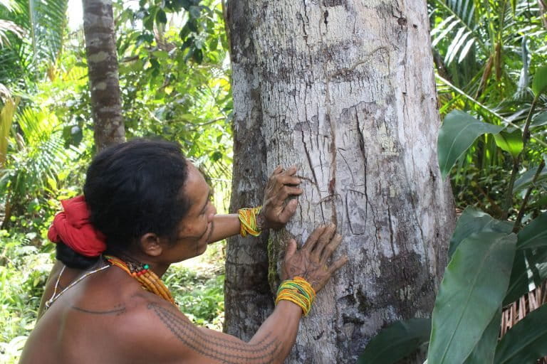
The Ancestral Domain Registration Agency (BRWA), an organization set up by a number of NGOs to pool the results of customary land mapping, has marked out 96,500 square kilometers (37,300 square miles) of indigenous territory. It was a painstaking process undertaken through a participatory method of mapping, in which entire communities were consulted for their approval to get their areas mapped out.
Of that total, some 12,000 square kilometers (4,600 square miles) of land, comprising 51 indigenous territories, have been formally recognized by local governments through bylaws. The process is a tedious and time-consuming one that involves petitioning local councils to pass a bylaw in each of the hundreds of jurisdictions in which indigenous lands occur.
But BRWA head Kasmita Widodo said he had been informed by the office of the president’s chief of staff that maps of indigenous territories would not be a part of the government’s so-called one-map database when it launches later this month.
“How come maps that have been produced by indigenous peoples through such a long process and that have been acknowledged by local bylaws are not included in the one-map database?” he said at a press conference in Jakarta. “While other thematic maps at smaller scales can be included?”
By excluding customary maps from the one-map database, the government is essentially denying the existence of indigenous territories, Kasmita said.
“The joy of the International Day of the World’s Indigenous Peoples will be more complete if, during the launch of the one-map database, the 12,000 square kilometers of indigenous territories that have already been formalized by local regulations can be integrated,” he said.

Resolving land conflicts
The Indigenous Peoples Alliance of the Archipelago (AMAN), the foremost advocacy group of its kind in Indonesia, called the exclusion of customary land maps from the national database contrary to the original premise of the one-map policy, which was to eliminate disparities between the various maps currently in use by different government agencies.
The idea is that by integrating all these different official maps into a unified map, the government can resolve existing land conflicts and avoid future ones.
The lack of a unified map of record has led to conflicts over land ownership, often pitting plantation or mining companies against indigenous communities that have occupied forests and other areas for generations but lack formal title to the land.
“If the customary maps are excluded, then the goal of the one-map policy won’t be met,” Rukka Sombolinggi, AMAN’s secretary general, said on the sidelines of the press conference.
Legal standing
The Ministry of Home Affairs, which serves as the custodian for customary land maps, has said these maps, as well as village border charts, will only be part of the database once they have all been formally recognized at the local level through bylaws.
However, maps of customary forests will be included in the one-map database when it launches, said Aferi S. Fudail, the ministry’s director of village administration and management.
Customary forests are part of customary lands that have received legal recognition from the Ministry of Environment and Forestry, under President Joko “Jokowi” Widodo’s signature social forestry program, which aims to give local communities greater access to 126,000 square kilometers (48,700 square miles) of land.
Unlike other social forestry schemes, where local communities receive permits from the ministry to manage lands for 35 years, the customary forest scheme completely relinquishes the government’s control over a plot of land and hands it over to indigenous peoples without any expiry date.
So far, the forestry ministry has granted a combined 200 square kilometers (77 square miles) of land under the customary forest scheme, to fewer than 20 communities across the country.
“It’s true that during the launch, some thematic maps won’t be part of the one-map database,” Aferi said at the press conference. “Because these maps don’t have legal standing [through local bylaws], we can’t integrate them [into the database].”
Kasmita pointed out that 12,000 square kilometers of the customary maps had already been formalized through local bylaws, but Aferi said even these couldn’t be included because the government considered the number of formalized maps to not be significant enough compared to the total extent of customary lands in Indonesia.
AMAN estimates that indigenous peoples in Indonesia traditionally occupied about 400,000 square kilometers (154,400 square miles) of land, or 30 percent of Indonesia’s total forest area.
Kasmita said it was strange that maps of customary forests, which were a small part of the overall customary maps, could be included in the database if the government’s stated reason for excluding the latter was that they did not cover a significant amount of territory. Aferi countered that in the case of the maps of customary forests, they were included in the one-map database despite their small scope because they had been formally recognized by the forestry ministry.
Easy win
AMAN’s Rukka said the government’s decision to not include the customary maps in the database at its launch was regrettable.
She said the government could actually benefit from having these participatory maps as a reference. She noted that 59,500 square kilometers (23,000 square miles) of the mapped indigenous territory covered areas where no business permits have been granted. This should make it easy to formalize these areas for inclusion into the one-map database.
“The government only needs to verify whether the areas are occupied by indigenous peoples or not,” Rukka said. “If you add the 12,000 square kilometers that have been formalized by local administrations to the 59,500 square kilometers that could easily be formalized, then Jokowi could easily meet more than half of his social forestry target” of distributing 126,000 square kilometers of land to indigenous groups.
Kasmita agreed that this should be an easy win for all sides.
“The government just has to reap the fruit of our hard work, because the data and the formalization are already there,” he said. “So there’s no reason for the government to not integrate [the customary maps into the database].”
Banner image: Dani man in Indonesian Papua. Image by Rhett A. Butler for Mongabay.