
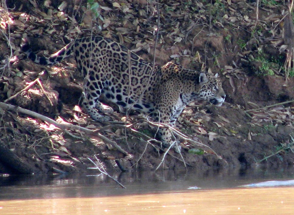
- Researchers enlisted dog sniffing power to locate the scat of five threatened carnivores across an increasingly fragmented Atlantic Forest landscape and identified the animals’ species through genetic analysis.
- The ability to collect and distinguish scat of jaguars, pumas, ocelots, oncillas, and bush dogs enabled the scientists to develop spatial models for species-specific movement corridors that connect the region’s protected areas.
- The researchers combined these species presence models with habitat and human factors to map and propose effective least-cost, multi-species biological corridors.
Large forest carnivores rely on expanses of natural vegetation and enough prey to survive.
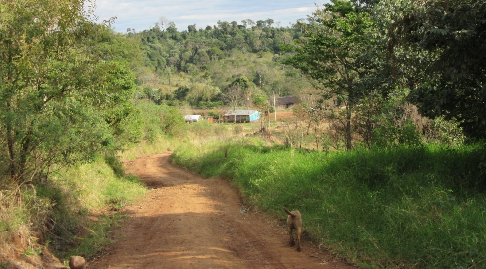
Misiones province of northeastern Argentina has some of the larger remaining tracts of Atlantic Forest, but a low carnivore density. Continuing habitat loss, forest fragmentation from new roads, and wildlife poaching motivated a research team to find out where these species were still present and how to conserve them efficiently. The team combined high-tech and low-tech methods to map conservation corridors for five of the region’s threatened carnivore species and published their results in the journal PLOS One.

“The study details a least-cost plan for the development of a multispecies biological corridor that connects protected areas in the Upper Parana Atlantic Forest Region of Misiones, Argentina,” said lead author Karen DeMatteo, a research scientist at Washington University in Saint Louis.
Verifying species presence through dogs, dung and DNA
The researchers uncovered (literally) the presence of jaguars, pumas, ocelots, oncillas, and bush dogs, using a detection dog trained to find the carnivores’ scat and analyzing the hard-won scat samples using standard genetic analyses.
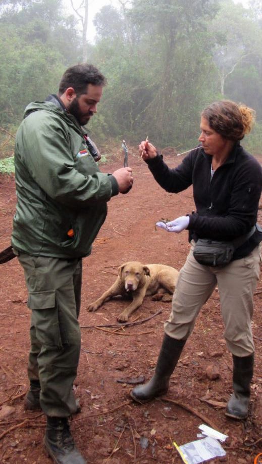
“A dog is able to locate those samples off the road that may not be physically visible,” said DeMatteo in an email to Mongabay-Wildtech. “This means that we can have a more unbiased sampling of the area. For example, perhaps only the largest, male felids walk on the road while the smaller felids or even females walk off the road. A dog can allow one to capture all of these samples.”

The detection dog, named Train, and his handler walked over 1,100 km (690 mi) of survey routes in protected (63%) and unprotected (37%) zones, assessing presence of these otherwise elusive carnivores using the dog’s acute sense of smell to find their scat. Train and other detection dogs are trained to locate samples from several target species, while ignoring samples from nontarget species that may be similar in appearance or composition.
Detection dogs can cover large areas to locate evidence of a species’ presence, and scat provides a noninvasive source of DNA. While valuable, scat and the DNA it contains degrade with time in moist tropical forest, so the handler plays an important role.
DeMatteo explained that, “detection dogs are locating the samples based on olfactory cues, which are subject to age of the sample, wind direction, degree of moisture, sun exposure, insects, and location (e.g., under vegetation or exposed).
“Someone who is handling a detection dog has the primary job of watching the dog at all times,” she continued. “While a dog will not likely find all of the samples, having a dog that covers a large geographic distance in their search pattern and a handler that can catch the changes in behavior that are more subtle can help the dog locate those samples that might be located a little farther, a little older, or more hidden.”
The researchers amplified (copied) the DNA from each scat sample and compared it to a GenBank reference database using the Basic Local Alignment Search Tool (BLAST) “to identify sequences from Neotropical species that had high similarity and closely-matched sample sequences.”
The team analyzed the DNA of 917 scat samples, collected over several summers, and confirmed the species identity of 761. These included 494 (54%) from the small oncilla, 111 (12%) from ocelot, 63 (7%) from jaguar, 59 (6%) from puma, and 34 (4%) from bush dog. Once identified, the scat samples indicate the presence of the animals and provide a semblance of their geographic concentrations in the absence of actual data on their movements.
“We wanted to ensure that the species distributions that we generated from the data accurately reflected the breadth of habitats could potentially be used by a species,” said DeMatteo. “The use of detection dogs allowed to accomplish this because we could go outside of the normal (e.g., protected areas) and survey across habitat types and degree of protection.”
Mapping species, habitats, and human activity
The team used the locations of these confirmed samples to develop maps of the presence of each species in various habitats and with respect to roadways and other human influences.
Each species has its own requirements for habitat and avoidance of human presence, but areas of suitable habitat do overlap. For each species, the scientists combined data on habitat, human activity, and the animal’s presence using the software MaxEnt to identify corridors of sufficient suitable habitat to allow them to move between protected areas in the region.
The scientists combined the data from the five species to identify corridors that provide maximum habitat suitability and connectivity for all species while minimizing the cost of establishing these corridors through privately owned lands and communities. If implemented, the proposed forested corridors would provide sufficient habitat for these animals to move safely between the increasingly isolated reserves and maintain the populations’ genetic diversity.
The team used the resulting maps to prioritize the parcels best suited for carnivore conservation. Most land in the region is privately held, so the team can target only portions of a property for conservation. They and conservation colleagues will use the maps to work with property owners on options for maintaining forest in the corridors.
Combining low-tech and high-tech methods allowed the researchers to efficiently model and map potential corridors. The authors state in their paper, “while independently none of these techniques are new, their combined application has the potential to serve as a model that can extend beyond the borders of Misiones, Argentina.”

Banner image shows Train the detection dog at work. Photo credit: Karen DeMatteo