
- In a new paper, scientists assert that environmental impact assessments (EIAs) for major Brazilian Amazon infrastructure projects often fail in their performance of comprehensive biodiversity evaluations, so underestimate ecosystem risk.
- Their proposed solution is the development and use within EIAs of multiple, complementary scientific methods they say would be cost effective, and make more comprehensive biodiversity assessments possible.
- These methods include satellite imaging, near-infrared reflectance spectroscopy, and DNA metabarcoding to detect a wider range of species. The scientists propose these methods be implemented to improve pre-construction biodiversity surveys and EIAs.
- A major concern by researchers is that Brazil’s Congress is currently considering legislation that would do away with the existing environmental licensing process, and reduce or eliminate existing EIA requirements.
Many dozens of major infrastructure projects — including highways, dams and mines — have been given the green light in the Brazilian Amazon in recent years, and hundreds more are in the pipeline – but how well do their Environmental Impact Assessments (EIAs) perform? Are their projections of harm accurate, and do they sufficiently manage risk?
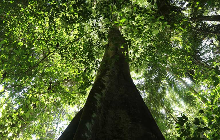
Many projects, such as the Tapajós dam complex, have hit the headlines due to their projected social and ecological impacts, which include deforestation, harm to aquatic and terrestrial species, disruption to flood and nutrient cycles, increased carbon emissions, the flooding of sacred lands and the forced relocation of river communities.
As a guard against these threats, all major development in the Brazilian Amazon requires that an environmental impact assessment (EIA) be carried out as part of the project licensing process. But a recent paper, examining three large infrastructure projects in the region, has found just how ineffective the existing EIA process can be.
As a result, the scientists behind the study are calling for the incorporation of new technology into Brazilian EIAs to more accurately measure biodiversity and habitat quality ahead of construction, allowing a full cost-benefit analysis of development to be carried out.

Inadequate EIAs
The research team, led by Camila Ritter of the University of Gothenburg, Sweden, looked at an existing highway, hydropower dam, and mine:
Paving the BR-319: This Amazon rainforest highway links the cities of Manaus and Porto Velho. Constructed in the 1970s, it fell into disrepair by the late 1980s. An EIA for paving a large, central section was rejected in 2008, but maintenance work — which effectively permits the reconstruction of the BR-319, except for paving itself — was approved in 2016. Although in this case the EIA contributed to the project license being formally rejected (for now) the scientists argue that the assessment fell far short of accurately analyzing the environmental consequences of paving. The improved BR-319 would likely do extensive harm to a highly biodiverse region between the Madeira and Purus rivers, rich in endemic species. Amazon highways, the researchers note, are a key driver of deforestation, with once remote and now newly accessible roadside forests a prime target for exploitation.
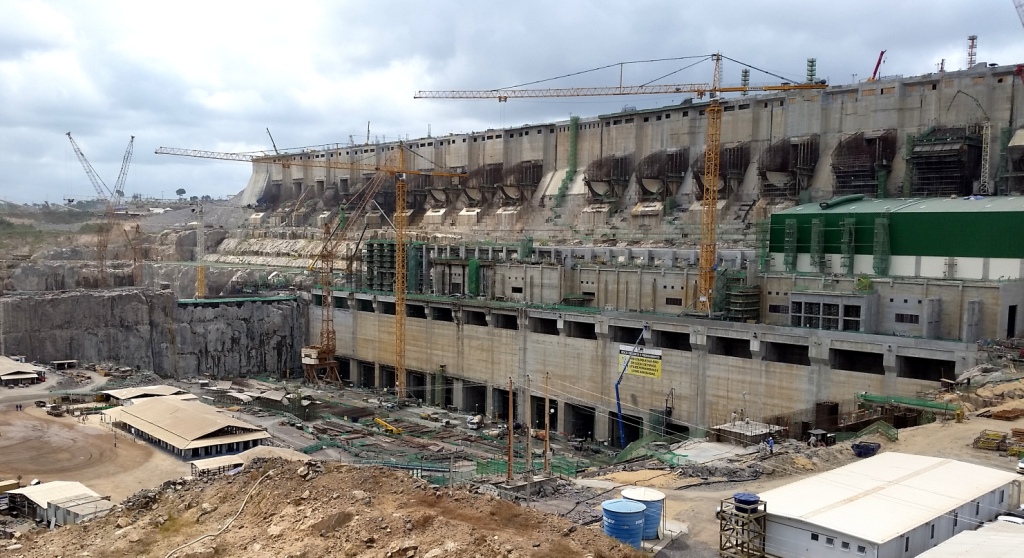
Building the Belo Monte dam: When fully operational, the Belo Monte dam on the Xingu River will be the third largest in the world with an 11,000 megawatt generating capacity. Dogged by controversy and licensing hold-ups, the reservoir was filled in December 2015. The scientists argue that its EIA overlooked the synergistic effects of the dam in combination with other hydropower dams within the watershed. The EIA, they say, failed to fully evaluate the disruption to natural flood cycles, the carbon emissions caused by the reservoir, and also underestimated the dam’s impetus for a rapid increase in the local human population, which impacted the surrounding forest and wildlife. The Belo Monte EIA “is descriptive rather than predictive, and it falls short of proposing mitigating actions,” said the researchers.
The Juruti bauxite mine: In the case of the Juruti bauxite mine, an industrial complex that includes a mine, port and railway on the southern bank of the Amazon River in Pará state, the scientists found that biological sampling for its EIA was inadequate. Not only was biodiversity significantly underestimated, but rare, endemic species were likely to have been missed altogether. This is on top of the “significant and long-lasting environmental changes” that the development is likely to bring to the region.
What all three projects share, the scientists say, is a failure in one of the main components of every good EIA: to properly assess biodiversity. “The most important aspect in the discussion of Brazilian Amazonia EIAs is that we need to obtain better estimates of biological diversity, which translate into better predictions of biological and ecological impacts of these large infrastructural projects,” says Ritter.
The satellite solution
The team recommends that planners look to the skies, and the soil, to get a more complete picture of existing biodiversity, so EIAs can more accurately assess the harm that planned developments might cause.
Their proposed solution is the development and use of multiple, complementary scientific methods that they say would be cost effective, and make more comprehensive biodiversity assessments possible.
This would include techniques such as remote sensing, where satellite images are used to analyze habitat extent and quality, making it possible to “monitor large areas in a consistent manner.” Another remote sensing method, called near-infrared reflectance spectroscopy, offers “enormous but largely unrealized potential” to identify individual tree species from their spectral signature — the way in which they reflect light.
Nathalie Pettorelli, who heads the Environmental Monitoring and Conservation Modelling team at the Zoological Society of London, UK, believes that “satellite remote sensing provides a fantastic opportunity to refine the EIA process.”
“Importantly, these data could be used to learn about likely environmental impacts of various anthropogenic developments, by monitoring environmental changes in places where such developments have already occurred. This could help improve predictive abilities of future EIAs; and this could be particularly true in areas where these data get to be combined with reliable on the ground information,” added Pettorelli, who was not involved in the study.

DNA analysis
On the ground, it could be the soil itself that holds the key: the third method highlighted by Ritter’s team for improving EIA accuracy is DNA metabarcoding — the sequencing of DNA found in soil to identify species and build up a picture of the biodiversity in a local area. Not only does this method have the potential to identify plants, animals, and microorganisms within a particular habitat without needing individual specimens, it also lends itself to repeatable and comparable analysis of regions and impacts.
Douglas Yu, of the University of East Anglia, UK, leads research into metabarcoding methods, and is a co-founder of UK-based NatureMetrics, a company providing metabarcoding services to land managers. He agrees that using multiple methods is the way forward: “I think combining these independent data sources could provide a real boost to informativeness. Earth Observation provides continuous coverage of the environment, and metabarcoding (and other genetic information) could help to interpret those remote images.”
Scientific and political obstacles
But hurdles remain before these methods become mainstream. “The most useful satellite data for biodiversity monitoring in Brazil are not systematically readily available for the moment,” explained Pettorelli. But more important challenges “are linked to capacity, specifically capacity to analyze the available satellite data in a meaningful way,” she said.

For metabarcoding, “[t]he main obstacle would be to build a good DNA sequence reference database of all — or as many as possible — organisms in Brazil and the Amazon,” Ritter said. But, in the meantime, a simplified approach could make use of metabarcoding data to measure and compare diversity without knowing the exact species, she explained.
There is added urgency for this debate: the legislative framework that defines EIAs in Brazil is under attack from proposed legal amendments that “would essentially abolish environmental licensing by making the mere submission of an environmental impact statement an automatic approval to go ahead with construction of the project in question,” said Philip Fearnside, of the National Institute for Research in Amazonia, and co-author of the new study.
Once proposed amendments gutting the environmental licensing process come up for a vote in Brazil’s Congress — something Fearnside says is likely to happen at any time — “their approval is hard to stop due to ruralist control,” he explained, referring to the bancada ruralista, the agribusiness and mining rural lobby that currently wields tremendous power in the legislature and the administration of President Michel Temer.
“The battle is focused on keeping the regulations we have from being abolished,” he added.
But, Fearnside still sees the adoption of cutting edge EIA data gathering methods as a real possibility. “Technological improvements such as these are much more easily incorporated than are changes that require legislation,” he said, noting that similar changes have been made numerous times in EIA methodology over the past 30 years.
Ritter is also optimistic about Brazil’s ability to make these necessary improvements.
“I believe it is indeed possible to combine societal progress and large infrastructural projects with a continued high biodiversity. The money is available, as are the scientific expertise and the methodological progress,” concludes Ritter. “What is lacking, I fear, is the will to make this happen.”
Citation:
Ritter, C. D., McCrate, G., Nilsson, R. H., Fearnside, P. M., Palme, U. and Antonelli, A. 2017. Environmental impact assessment in Brazilian Amazonia: Challenges and prospects to assess biodiversity. Biological Conservation, 206, 161-168
FEEDBACK: Use this form to send a message to the author of this post. If you want to post a public comment, you can do that at the bottom of the page.