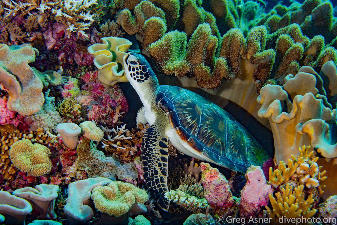
- The Spratly Islands, located in the South China Sea, are an underwater biodiversity hotspot.
- But China’s military base-building on these islands has destroyed huge expanses of coral reef.
- A new study finds up to a 70 percent reduction in coral reef cover on atolls with military bases
As I reached the surface, I could hardly believe my eyes. The black shadow of the vessel turned, revealing its distinct cigar-shaped profile. Seeing a submarine at sea with a scuba tank on your back is like pricking yourself on a needle lost in a very big haystack. But the South China Sea is not your average haystack, and nothing seems to be lost out in its vast expanse.
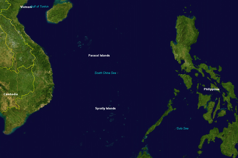
The South China Sea stretches from the coast of mainland China to the shores of Borneo, Vietnam, and Philippines. The southern part is a huge blue water world dotted with remote atolls and islands known as the Spratly Islands, named after whaler Richard Spratly who ‘discovered’ them in 1843. The Spratlys have many other names in the languages of nations that encircle the South China Sea, an expression of the long-standing strain between multiple claimants of the region. Brunei, Malaysia, Philippines, and Vietnam each claim a portion of the Spratly archipelago, and China claims all of it.
The region has also become a hotbed for modern naval activity, owing to critical commercial shipping through its waters, and the oil that underlies its seabed. The U.S. routinely navigates the South China Sea as a demonstration of its naval power, said to ensure right-of-passage, and which China openly views as a threat. And as a result, military base and outpost building continues at a feverish and ecologically destructive pace. Whole coral reef atolls have been dredged to form hard land for military complexes and aircraft runways.
As a global ecologist and conservation scientist, I have long been interested in the Spratlys as a biodiversity hotspot. With its purported 600 coral and 6000 fish species, I had wondered what this ecoregion looks like underwater, and more recently, what the frenzied building of military bases might mean for its sea life. I wondered too if coral reefs of the Spratlys had been impacted by recent hot water events that cause coral bleaching, like that which has devastated the Great Barrier Reef.
There isn’t nearly enough scientific literature on the ecology of the Spratlys, but it has been shown that the atolls are important sources of coral larvae for that part of the South China Sea. Each atoll is a habitat for connected layers of lifeforms ranging from corals and invertebrates to huge schools of hammerhead sharks and bottlenose dolphins. Each layer relies on the presence and health of the next layer, and the coral reefs form a critical core for the regional ecosystem as a whole
In March 2016, Camilo Mora and colleagues published a report on military base building across the Spratlys. In the same month, I was working on the northern tip of Borneo, east of the Spratlys, and I decided to expand our mapping efforts into the archipelago. I wanted to better understand what is being lost with each military base conversion of a Spratly atoll. By May 2016, I got a chance to visit one of the atolls in the southeast corner of the archipelago.
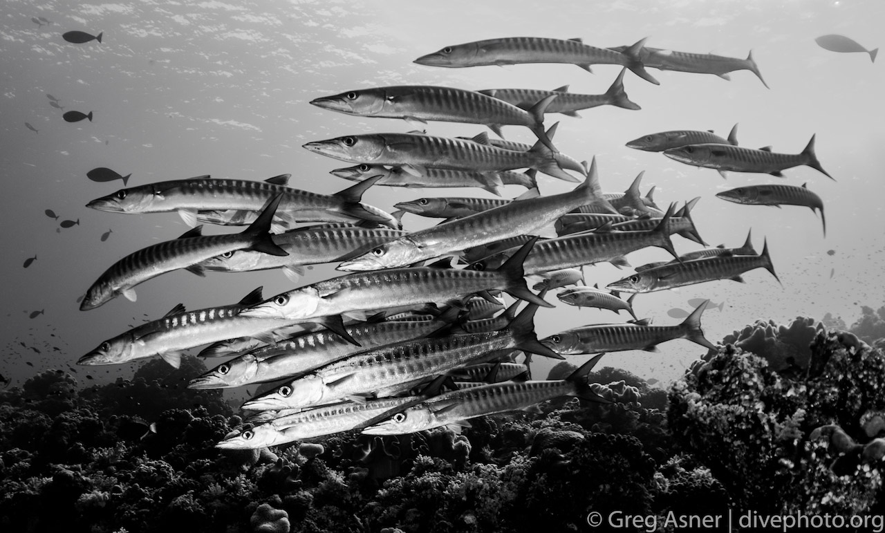
Known as Swallow Reef, or Pulau Layang Layang by the Malaysian government that administers it, the atoll is an amoeba-shaped ring of reef that drops off more than 3000 meters into deep ocean (Fig 2). In one corner of the atoll lies a small Royal Malaysian navy outpost, manned with a few patrol vessels. Alongside the outpost is a place where diehard divers can spend time exploring some of the most unique and endangered coral reef ecosystems on Earth. Moving down in the water column at Swallow Reef is like slicing through a psychedelic layer cake that would impress Willy Wonka lovers. The outer reef is replete with millions and millions of colorful specks of life, hard and soft corals, schools of jacks, batfish, barracuda, and more, each contributing to an ecosystem patrolled by giant mantas and sharks. Picture what you think a perfect coral reef ecosystem might look like, well before the global degradation of reefs that started with the industrial revolution, and that will put you at Swallow Reef.
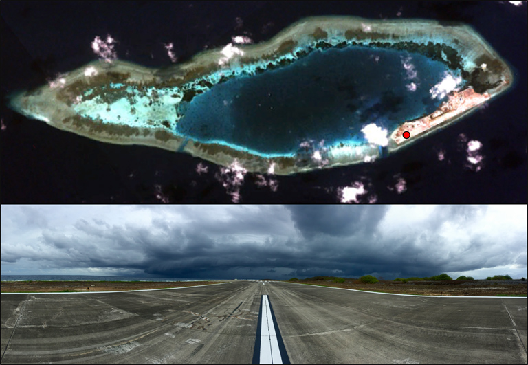
My initial visit to Swallow Reef yielded thousands of photographs and video. It also sparked the idea to combine rapid underwater surveys with a new class of satellite imaging that might give us a fast-track way to assess coral reefs on more atolls than we could possibly visit in the water. To do this, I turned to my colleagues at Planet.com, formerly known as Planet Labs. They operate the world’s largest constellation of small orbiting satellites that can image Earth on a daily basis at about 3 to 5 meter spatial resolution. As one of Planet’s science Ambassadors, I collaborate with the company to apply their satellite data to new environmental challenges, so the Spratlys were a perfect fit.
Planet’s constellation of ‘Dove’ satellites can give us a daily viewing of the South China Sea, which is critical since the region is naturally very cloudy. By selecting cloud-free images that were available shortly before and after my initial visit to Swallow Reef, my collaborators Robin Martin from Carnegie, Joe Mascaro from Planet, and I were able to align the satellite images with our near-realtime understanding of reef composition and condition. Martin and I returned to Swallow Reef in July to complete an intensive series of additional underwater surveys, which when combined with the Planet Dove data in the field, helped us to determine that we can easily map the extent of coral reef. We were also able to map some of the deeper reefs. Our overall mapping accuracy ultimately exceeded 90 percent.
From the Swallow Reef pilot study, we extended the mapping approach to all of the atolls currently occupied by China, Malaysia, Philippines, and Vietnam – the four countries most present throughout the region. We compared the proportion of coral reef on occupied atolls to unoccupied ones, and found up to 70 percent reduction in coral reef cover on those with military bases (Asner et al. 2017). In other words, military base and outpost building has destroyed huge expanses of coral reef, which means that millions of its colorful lifeforms have been wiped off the planet.
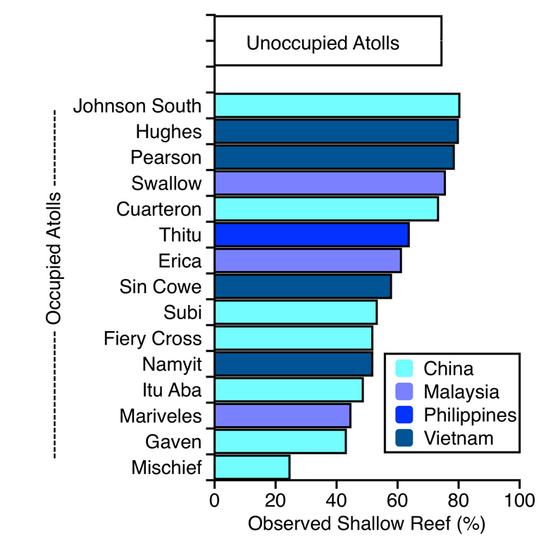
Shockingly, the vast majority of this loss has taken place in just the past three years. Yet promising is the fact that there are still a hundred or so reefs with relatively little human impact, so conservation and management ought to have a chance to make a difference before it is too late. Also promising is the fact that recent coral bleaching events do not seem to have had as large an impact in the South China Sea as we have seen on the Great Barrier Reef. I experienced very little bleaching during our survey dives at Swallow Reef. As Professor John McManus, University of Miami, has long emphasized based on his work in the region, a promising pathway forward to protecting the remaining coral reefs of the South China Sea rests in the development of an international peace park agreement between nations. Based on our recent experience with Planet Dove satellites and diving, time is of the essence to get a park-style accord accomplished.
Notes and References
For more photos of reef inhabitants of the South China Sea, go to http://divephoto.org
Asner, G., Martin, R. & Mascaro, J. Coral reef atoll assessment in the South China Sea using Planet Dove satellites. Remote Sensing in Ecology and Conservation, 1-9, doi:10.1002/res2.42 (2017).
Mora, C., Caldwell, I. R., Birkeland, C. & McManus, J. W. Dredging in the Spratly Islands: Gaining Land but Losing Reefs. PLoS Biol 14, e1002422 (2016).