- The world is in the grips of an infrastructure development boom, which threatens to cause enormous damage to vital ecosystems.
- The “global roadmap” project led by William Laurance aims to show where roadbuilding can have the greatest benefits or the greatest harm.
- Now, researchers are trying to map at a much finer scale in crucial zones in Indonesia, Malaysia and Papua New Guinea.
“Everywhere you look, it’s the infrastructure that’s very often the first stage in complete profound change,” explains William Laurance.
Laurance is a Distinguished Research Professor at James Cook University in Cairns, Australia and holds an Australian Laureate Fellowship, one of Australia’s highest scientific awards. He also holds the Prince Bernhard Chair in International Nature Conservation at Utrecht University, Netherlands, is the founder and director of ALERT—the Alliance of Leading Environmental Researchers & Thinkers, a group that advocates for environmental sustainability, and is a member of Mongabay’s advisory board.
Laurance’s work has spanned topics ranging from climate change to land use change. In the past two decades, though, his research has primarily focused on infrastructure projects.
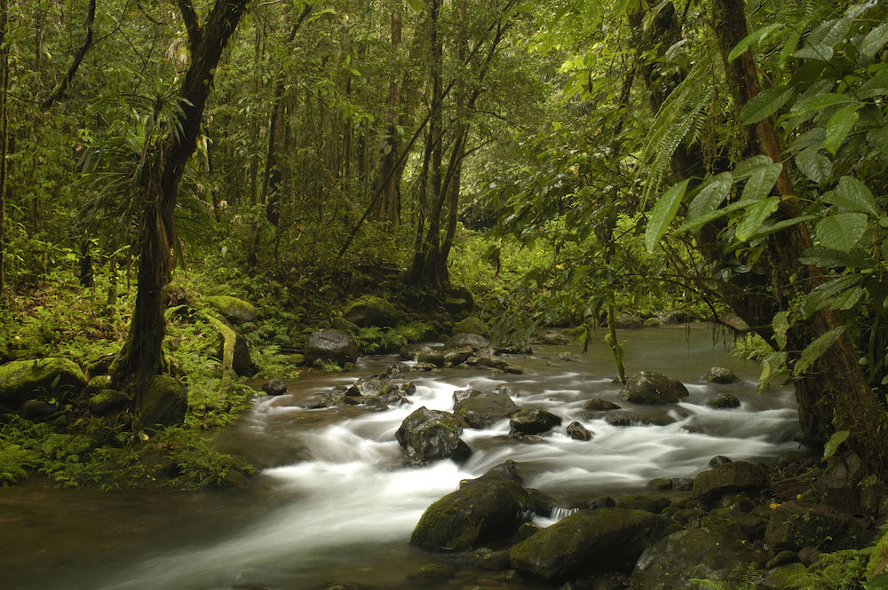
When roads are built in forests – whether for transport, logging, access to mining or hydropower sites – people inevitably follow. During research in the Amazon, Laurance and his colleagues found that 95 percent of forest destruction there occurred within five and a half kilometers of roads. Once the first cut is made, deforestation spreads, and with it fires, hunting and habitat fragmentation.
On the other hand, roads allow people and goods to move freely, and provide access to agricultural land and natural resources that can help boost economic and social wellbeing. The world is currently in the grips of what Laurance calls an “infrastructure tsunami“: Development plans across the globe call for 25 million kilometers (15.5 million miles) of new paved roads, thousands of hydroelectric dams, and hundreds of thousands of mining, oil and gas projects. While they may bring economic benefits, many of these projects pose enormous risks to wildlife and ecosystems.

For years, Laurance has been working to help policymakers make informed choices about the costs and benefits of infrastructure projects. “You can’t, obviously, work in these developing nations and say you’re anti-development, because nobody’s going to listen to you. So, you have to talk about sustainable development,” he explained. “Really, we’re trying to promote an agenda which is trying to optimize benefits for people, but we’re also trying to minimize environmental degradation and impacts. We try to balance those two factors against each other, and that’s one way we can enter into relatively credible conversations with a wide range of stakeholders.”
In a 2014 paper in the journal Nature, a team led by Laurance published a “global roadmap” that aimed to show where roads can achieve the greatest human benefit while causing the least environmental harm — and vice versa. To produce these maps, the researchers first charted areas with particularly high ecological value. They looked at biodiversity, endangered species, rare habitats, critical wilderness areas and vital ecosystem services as well as existing parks and protected areas. Then, they combined that with a road-benefit map, looking at places where roads could have the greatest benefits for human kind, particularly when it comes to food production.
Combining these data sets created a “global roadmap.” Red toned areas are priorities for agriculture: places where intensifying agricultural production – and building the infrastructure to support it – could have huge benefits without major environmental costs. Green areas are the opposite, areas with high environmental value, where building roads would come at an enormous cost and should be avoided. Black signifies “conflict zones,” where environmental and agricultural priorities are likely to clash.

Having developed a global map, the team is now working to map the costs and benefits of roads and other development projects on a much more local scale – and Asia-Pacific is a priority. You may notice that virtually all of Southeast Asia is either green or black in the global roadmap. This, Laurance explained, is due to the region’s extraordinarily high environmental value. “We know global datasets are really unsuitable for trying to do planning, let’s say, at the level of Borneo or Sumatra,” he said. “What we’re trying to do in this next phase is take this general approach and scale it down, using much more accurate and fine-scale information.”
As Laurance launches a major project focusing on the region, he spoke with Mongabay about the team’s plans and goals.
Mongabay.com: As you launch your project in Asia, what areas will you be focusing on and why?
William Laurance: The project is focusing on three countries: Indonesia, Malaysia, and Papua New Guinea, all of which are places that are very, very important environmentally. The main places we’re focusing on are Sumatra, Borneo, Sulawesi and New Guinea — all regions that still have substantial forest areas, but are facing increasing development pressure. There are huge infrastructure projects afoot at all levels, from really large-scale major projects down to the level of a lot of smaller projects in these regions.
At the moment, we’re working in Northern Sumatra. The next priority is Indonesian Papua. We’re probably also going to be working in Sulawesi shortly after that. Then, after that we’ll go on to the next areas — we haven’t quite decided at this point.
We’re in a very steep part of the curve right now. We started out with these large-scale, global models, and then we’ve worked in Africa at a very broad regional scale. Now what we’re really trying to do is scale down very specific regions, which link into what the government is trying to do in terms of infrastructure planning. We are trying to promote a more sustainable approach to infrastructure, which puts equal weight on environmental costs as well as trying to maximize the human benefits.

Mongabay.com: Are there particular projects that have already come onto your radar as being really worthy of attention?
William Laurance: There’s lots of them. What we’re starting with is the national-level strategic projects. For instance, Indonesia has this thing they call the “Six Axes Project,” which is a national infrastructure development plan. But if you look at it, it really spans everything, including a gigantic set of road and highway projects that would span, for instance, Indonesian Papua. These would be massive, multi-million-dollar projects that would be putting roads into some of the remotest areas of that half of the island.
Another big area being developed is Kalimantan (Indonesian Borneo). They want to put major highway networks across Kalimantan. Pretty much everywhere you look. It goes through Java as well as Sumatra. So, this is the national, strategic-level plan. And that then ends up getting developed into more regional or provincial level plans.
Now, we can’t do everything, but I can tell you right now, just looking at Kalimantan, some of these roads in Central and West Kalimantan would have incredible impacts on forests and on migratory wildlife. In places like Borneo you tend to get a number of species that migrate across the island, because you tend to get these patches of food production, different years in different places. The natural biology is to migrate. Spectacled bears migrate across the island, in some cases more than 1,000 kilometers. These migratory paths are being disrupted, chopped up. There are enormous prospects for increasing deforestation. Large areas of still intact forest, particularly in West Kalimantan, would be hugely susceptible to further deforestation and degradation and fragmentation and fires and the whole panoply of the Pandora’s box that we see from that.
In Malaysia, in Northern Borneo, in Sabah and Sarawak, there’s something called the pan-Borneo highway, which is a major network of major highways with a whole set of lateral stems coming off of that. Again, this will be penetrating into some of the major forest-tract regions. And, of course, all of these will have a great dragging effect in terms of bringing in a lot of other developments along with them.

In Peninsular Malaysia, there are gigantic infrastructure projects. There’s a huge project to put a railway system between Kunming in Southern China and Singapore, so it will go all the way through peninsular Malaysia. There are gigantic plans for development projects in southern peninsular Malaysia around Johor Bahru — not just the city, but a much larger zone there. The Chinese also want to build a number of artificial islands, and essentially turn this into, I’m tempted to say, a gigantic Disneyland. It’s basically going to be a whole set of projects around attracting Chinese tourists down into that area, so there’s a lot of interest there among local developers.
Our concern is not so much about those kinds of things. It’s about all the other habitats that would be bisected by these development projects, as well as just the scale of them. There would be enormous demand for timber, concrete and other natural resources.
In Papua New Guinea, there are various things going on. A lot of stuff revolves around mining, natural gas or fossil fuels. There’s the PNG-LNG project, which is a $10 billion project to construct a pipeline from the highlands down into a new port system that they’re developing. In southern Papua New Guinea there are several major Chinese-funded mining projects, some of which are going to be mining the sea floor and others of which are going to be dumping huge amounts of tailings into the ocean. There’s a lot of concern about how would impact reefs. These are some of the most biologically diverse reef systems in the world.
Everywhere you look in that region is a hotspot for new infrastructure projects. So, lots and lots to do. Take our group and multiply by 10 and we’d still be challenged. The problem is there’s so many things happening immediately.
We’re kind of trying to do a rapid triage right now. On one hand, there are projects that are far enough on the horizon that we don’t think are going to happen immediately. On the other hand, some are so written in stone that we don’t see us being able to have an influence. And then, there’s that middle ground of projects that are near-term where we think we can have an influence. So, that’s where we’re focusing immediately.
It’s a learning process. Although we’ve had a reasonably broad sense of things, now the rubber’s really hitting the road. And we really are trying to make progress in this first year, as well as really trying to develop our models at a much finer spatial scale, and that’s bringing with it some interesting challenges. It’s just a bit different than doing the really broad scale stuff we’ve done in the past.

Mongabay.com: What outcomes are you hoping to achieve with this project?
William Laurance: I consider myself a student of these areas. We’ve been working in the Asia-Pacific off-and-on for a while. My first trip to New Guinea goes back into the mid/late 1980s, and also the same thing for different parts of Malaysia and Indonesia, but these are still very dynamic places. There are lots of things going on, multiple layers of government, and the agendas are often not entirely apparent. So, we are approaching this with some level of humility, in the sense that certainly we’re going to do what we can but also realize we’re grappling with about three 900-pound gorillas here. We’ll be learning a heck of a lot as we go through this whole process.
We try to build a broad church, in that we try not just to talk about orangutans and be greenies. We try to talk about benefits for people. We talk a lot about the fact that some of these big projects, which are often driven by foreign investments, can actually have a whole bunch of knock-on effects which are not necessarily obvious to people. There can be a number of not necessarily very positive socioeconomic impacts to some of these projects — that, in fact, can be quite destabilizing, and that are not necessarily widely appreciated. We’re talking a lot about reputational risks to governments, to corporations and to other actors. So, say for multinational corporations that might be heavily investing in a new project, we say: “Look, do you realize you might be severely degrading one of the most important wildernesses in Sumatra? Do you understand that this could have an impact on your market share and your reputation?”

In some cases we may actually advocate closing roads. We might say, “You’ve got this whole network of logging roads, we’re seeing a lot of illegal activities happening here and the governments are being defrauded of their royalties and taxation benefits. This is all illegal. It’s stolen timber, it’s poaching, it’s illegal land colonization. It’s in the interest of the government to try and close down these frontier activities.” Or there might be some critical nexus where if you just remove one bridge, you can in effect close hundreds of kilometers of forest roads in sensitive frontier areas. So, those are the kind of things we’re going to be looking at — a whole range of things to try to optimize, or try to improve, what’s going to be a very difficult and daunting situation.
We try to interface with people everywhere from government to the NGO community to the general public. We basically have the philosophy that — as people working in the tropics who are to some degree experts on these issues — not only do we have the right, but we in many ways have a responsibility to try to tell people about what these consequences can be.
At the same time, we try to be very cognizant of the fact that these are sovereign nations here, and these nations obviously have every right to determine their own development paths and their own priorities. We provide information and we try to make the options clear, and to make the costs and benefits clear. At the end of the day, we have to accept that these are developing nations that have different priorities than I might have, and we just have to accept that they ultimately decide. Although we do find that sometimes we can have an influence on public opinion, on decision makers and others, and try to use that to help guide and inform plans and policies.
Editors notes: William Laurance is a member of Mongabay’s advisory board. This interview has been edited for length and clarity.