- National Geographic Explorers traverse the Okavango Delta to highlight the pristine wilderness in a human context using open-source data, images and social media.
- This is the first time open-source software and hardware applications have been applied to a wilderness expedition and displayed for the public.
- Explorers send real-time data from the field and make it accessible to anyone to use for their own research or projects.
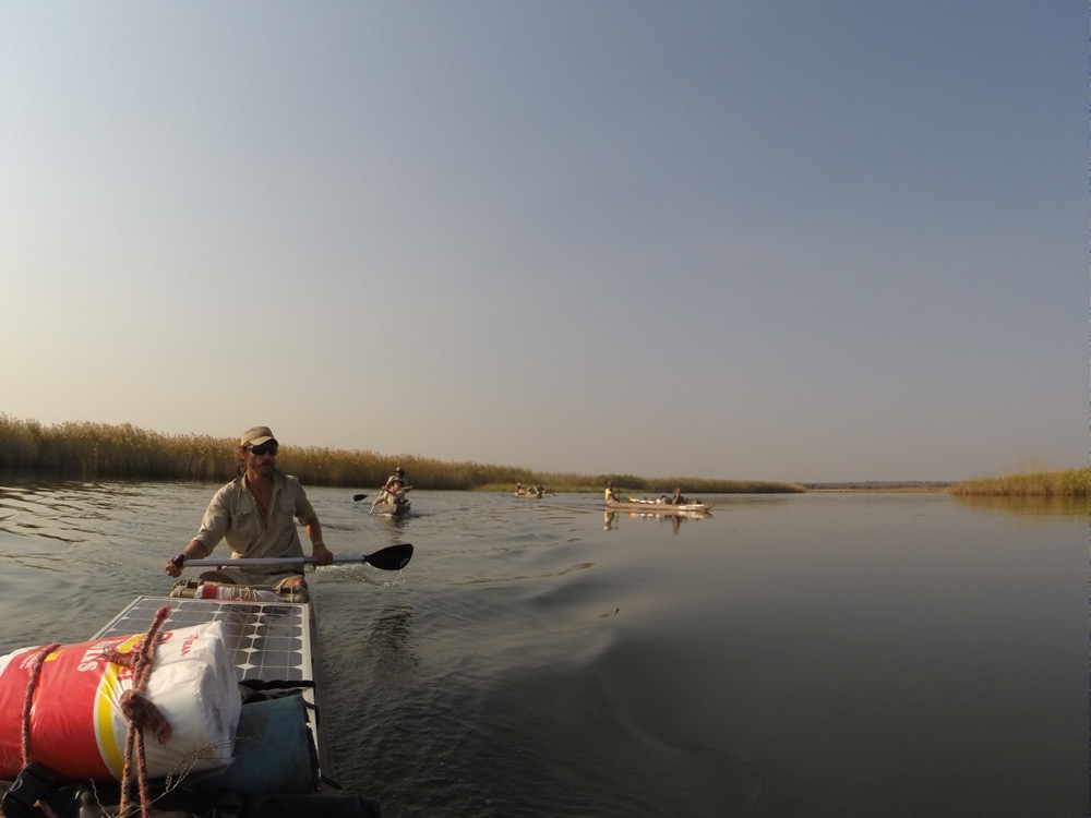
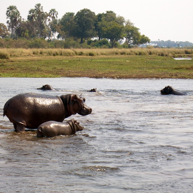
Traveling along a river in a mokoro (a shallow-water canoe propelled using a pole while standing) through one of the numerous channels that make up the alluvial fan that is the Okavango Delta, you will catch glimpses of hippos, crocodiles, elephants, lions and countless other species of birds and mammals, living in Africa’s last remaining wetland wilderness. That is what Steve Boyes, Shah Selbe, Jer Thorp, and other National Geographic Explorers saw as they traversed this truly wild landscape in the summer of 2015 as they journeyed Into the Okavango.
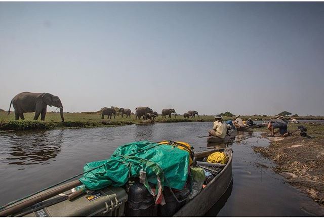
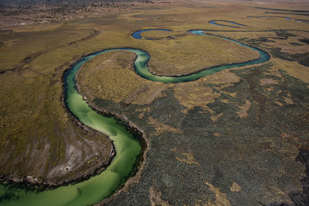
Located in northwestern Botswana, the Okavango Delta is an oasis in the parched landscape of the Kalahari Desert. It is home to some of the largest concentrations of fauna in Africa, including the “largest remaining elephant population on Earth” (Steve Boyes), and became a UNESCO World Heritage Site in 2014.
The group had two missions. First, they hoped to bring real wilderness to the modern world. The Okavango Delta ecosystem supports a huge array of wild flora and fauna that depend on its waters to survive. The Explorers navigated across the delta for 120 days collecting and transmitting open-source data to share their experiences and findings immediately with any interested person that wanted the information – students, teachers, citizen scientists, and the general public – for free.
Second, they aimed to expedite the addition of the headwaters of the Okavango River, in the Angolan highlands, to the existing Okavango Delta World Heritage Site listing and provide data on the Cuito and Okavango rivers and delta to the Angolan government. Land mines left over from Angola’s three-decade long civil war still torment the parts of the watershed and highlands where the Cuito River feeds into the Okavango River and Delta. The presence of these land mines protected the Cuito River and its headwaters from human use and from the removal of the trees necessary for the delta to exist.
When the government removes mines from the land, the displaced local residents are able to move back to their long-abandoned homes and clear trees for small-scale farming, both of which may lead to water pollution. Poor quality of river water and the removal of the trees in Angola could threaten the health of the Delta downstream in Botswana.
Measuring the Heartbeat of the Delta
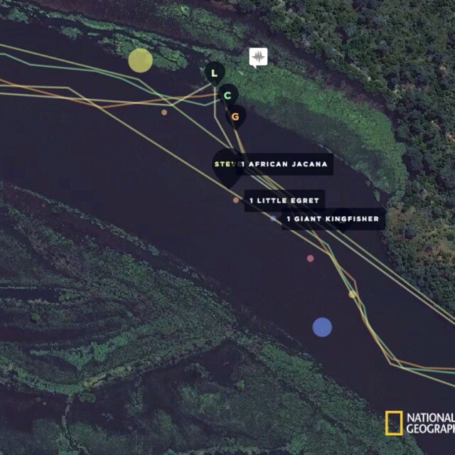
The Expedition team therefore measured and monitored data on the environmental status of the Delta, collecting water quality, pH and temperature data throughout the voyage. The explorers deployed myriad open-data monitoring systems in the Delta, using tiny Raspberry Pi and Arduino computers that transmit data to the Into the Okavango website and back to the team via SMS. They fitted a Raspberry Pi computer into Boyes’ mokoro as a mobile data station to transmit data to a satellite immediately from the field so the public could ‘see’ what the explorers were seeing in near-real time. Jer Thorp, a data artist involved in the Okavango journey, built the Into the Okavango website using open-source tools, such as Leaflet.js, Jquery, Python, SQLite, and Tornado, and Shah Selbe created open-source hardware for the expedition (for more, please see National Geographic’s Shah Selbe Q & A).

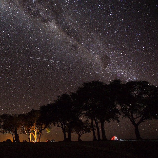
On the 2015 expedition, which began on May 21st, the explorers collected data in a variety of forms. As the team traveled down the river in their mokoros, armed with only spears, cameras and other technology necessary to record their journey, they transformed what they were seeing into images, tweets, audio recordings, even recording their heart rates at particularly tense moments.
The team also deployed stationary, solar-powered sensor platforms that autonomously recorded and transmitted the water’s pH and temperature. The team hopes to soon deploy a network of up to 50 sensors throughout the Delta to help viewers ‘see’ the natural variation in this ecosystem. They even deployed a Data Boat, a mokoro that carried instruments that took water and air quality measurements every 5 minutes throughout their entire journey through the river system.
They transmitted and uploaded the data to the website via satellite within 10 minutes of collection, allowing for near real-time tracking. They reported wildlife sightings using text and an image of the animals on a custom-made Android app built for the expedition, which would send the data to the $30 Raspberry Pi unit fixed to a canoe. The antennae of the Raspberry Pi unit would then transmit the data immediately to the satellite, which would, in turn, upload the data to the website to be viewed by anyone. The sightings sent to the website also included the GPS location data, allowing viewers to track the explorers in real-time on the website’s map. Data that couldn’t be transmitted in real-time were sent over the Internet every night at camp.
This live-data expedition allowed users to follow along and understand data in a more relatable and human context than mere numbers. The team encouraged users to use the data in their publications, create visualizations and correlations—such as comparing the explorers’ heart rates with sightings of large and dangerous animals— or even stream images together to create a flow of life on the Okavango Delta. The expedition team stressed the importance of providing data in real-time and available to anyone to use in any way to encourage learning and sharing of data of this wild and unfamiliar landscape.
The near real-time speed of the transmitted data helped followers understand and feel the time-based nature of the expedition and life in the Delta, from the sparsely populated channels to the rich biodiversity of the central Delta. Users can visit SoundCloud to hear what it’s like to have a close encounter with a herd of elephants or to witness baboons and lions arguing at dawn via uploaded field recordings.
The website features an interactive map that allows users to follow along the journey, reading tweets, images and wildlife sighting recordings from every point along the route. There is also an open API that allows immediate and open access to any user. Users can interact with the complete database using their software.
Integrating different forms of information and putting data into a human context helps us better understand a subject; “it builds empathy for people involved in these systems and that in turn results in a fundamental respect which I believe is missing within a large part of technology”, explains Jer during a TED talk about creating art and understanding from data. In order for conservationists to succeed in conserving the places and species they admire and to change policy to enforce the protection, they need the understanding and support of the public who have the ability to affect change in policy and on the ground. The open-source data on the website that Jer created for the Okavango journey allows users to explore the Delta for themselves, teachers to bring students into the wilderness from the classroom and explorers who can’t afford to venture to this vast wilderness the chance to experience its wonders.
Though the Okavango Delta is protected by the UNESCO World Heritage Site listing, the Angolan highland headwaters where the Okavango River originates is a war-torn region, unprotected from the UNESCO listing. These highlands need to be both appreciated and protected for their essential role in maintaining the health of the Delta ecosystem.