
- A drone is a potentially valuable part of a reserve manager’s toolkit, but its use entails a variety of costs beyond the “bird” that flies overhead
- Your group’s mission should determine which type and model is best suited for a given deployment. In this series, we’ve reduced the possible anti-poaching missions into two broad categories: prevention and response
- • The UAS endurance and equipment required to detect poachers and prevent them from finding their targets is often military-grade and cost-prohibitive.
Drones On Display
The widespread poaching of threatened and endangered species, such as elephants, rhinos, tigers, gorillas, and whales, has brought together conservationists, donors, and technology experts to develop new solutions to the crisis.
All too often, though, a systematic approach for assessing, filtering and testing new systems is disregarded in favor of hasty deployments, without adequate field trials that simulate field and mission conditions day and night, when most poaching occurs. UAVs for anti-poaching require a concerted and systematic approach, with the correct support and logistics management, as well as selection and training of reliable operators to be effective.
Reports from companies, projects, and the media on Unmanned Aircraft Systems (UAS) (a.k.a. Unmanned Aerial Vehicles, UAVs, or drones) to combat poaching frequently fail to critically assess these approaches or ask for data. Assessing the effectiveness and viability of the system being presented requires asking a few simple questions.
To bring light to this issue, we have developed a guided set of preliminary questions that will help wildlife managers and donors to screen manufacturers’ claims before buying from or partnering with them on anti-poaching activities. They have been developed based on years of experience analyzing defense and security systems for military and wildlife conservation clients in many countries, and we hope that they will help you quickly assess the likely effectiveness and viability of a particular UAS product or project in suppressing poaching.
It is important to remember that a UAS is just one component of a complete anti-poaching strategy, including ranger teams, communications, and other sensors which can help detect and pinpoint intruders. The UAS alone will not stop poaching.
Also keep in mind that the use of UASs for conservation is a rapidly developing field, and local conditions (e.g. vegetation type and height, available funding and personnel, poaching methods) unique to your area mean there will be variation in the answers we’ve provided here.
Editor’s Note: This story is part of a series exploring the use of UASs for reducing wildlife poaching. Please read Demystifying Drones for some basics on UAS systems and use for anti-poaching and our first set of InFrequently Asked Questions for help in defining your group’s mission. Check the “UAVs/drones” Forum on wildtech.mongabay.com, where we answer or seek answers to your questions from guest members. Future posts will discuss UAS use for other conservation work.
What is the mission?
Before you reach out to any tech manufacturer, a critical first step in deciding on a UAS, or any new technology, is to define your group’s mission. What will be accomplished by deploying the UAS? How will the system advance your current activity?
Your group’s mission should determine which type and model is best suited for a given deployment. In this series, we’ve reduced the possible anti-poaching missions into two broad categories; To provide the initial identification of an intruder and trigger preventive measures, or to respond to a detection triggered by another source.
The following questions should help you to identify the features you should consider in evaluating various systems, clarify the realistic specifications that a system should meet, and think critically about a manufacturer’s or user’s claims. For background, you can consult one of various forums and articles on general UAS use, including a few related to conservation, to help get you started:
The UAS is a potentially valuable part of a reserve manager’s toolkit, but its use entails a variety of costs beyond the “bird” that flies overhead. Quality and durability, which relate to cost, determine how well the system meets three main challenges: (1) UAS endurance, or flying time, (2) ability to detect target objects from the appropriate range and flight altitude, and (3) the system’s longevity in the field. Prevention generally requires higher-quality equipment than response, so the two terms are treated separately below.
Facts at a Glance:
- It is important to define your mission before selecting a UAS (if one is even needed), as the most suitable system will vary depending on the conditions and the mission.
- More expensive systems will have longer flying time, more rugged, longer-lasting parts and higher-quality sensors that improve object detection and produce clearer images.
- The UAS endurance and equipment required to detect poachers and prevent them from finding their targets is often military-grade and cost-prohibitive.
- A response system integrated with ground personnel and other sensors is most likely to be effective.
- Ask specific questions, test systems under applicable field conditions, and view claims with a critical eye.
- Ask an expert and plan your strategy after evaluating needs and conditions in your specific area.
Read on for details on each of these points.
Questions on specifications:
(Specifications can be determined through the promotional materials or by contacting the company for more information). Please note that most specifications refer to optimistic standard conditions and should be evaluated by an expert.
What UAS model has been recommended to you?
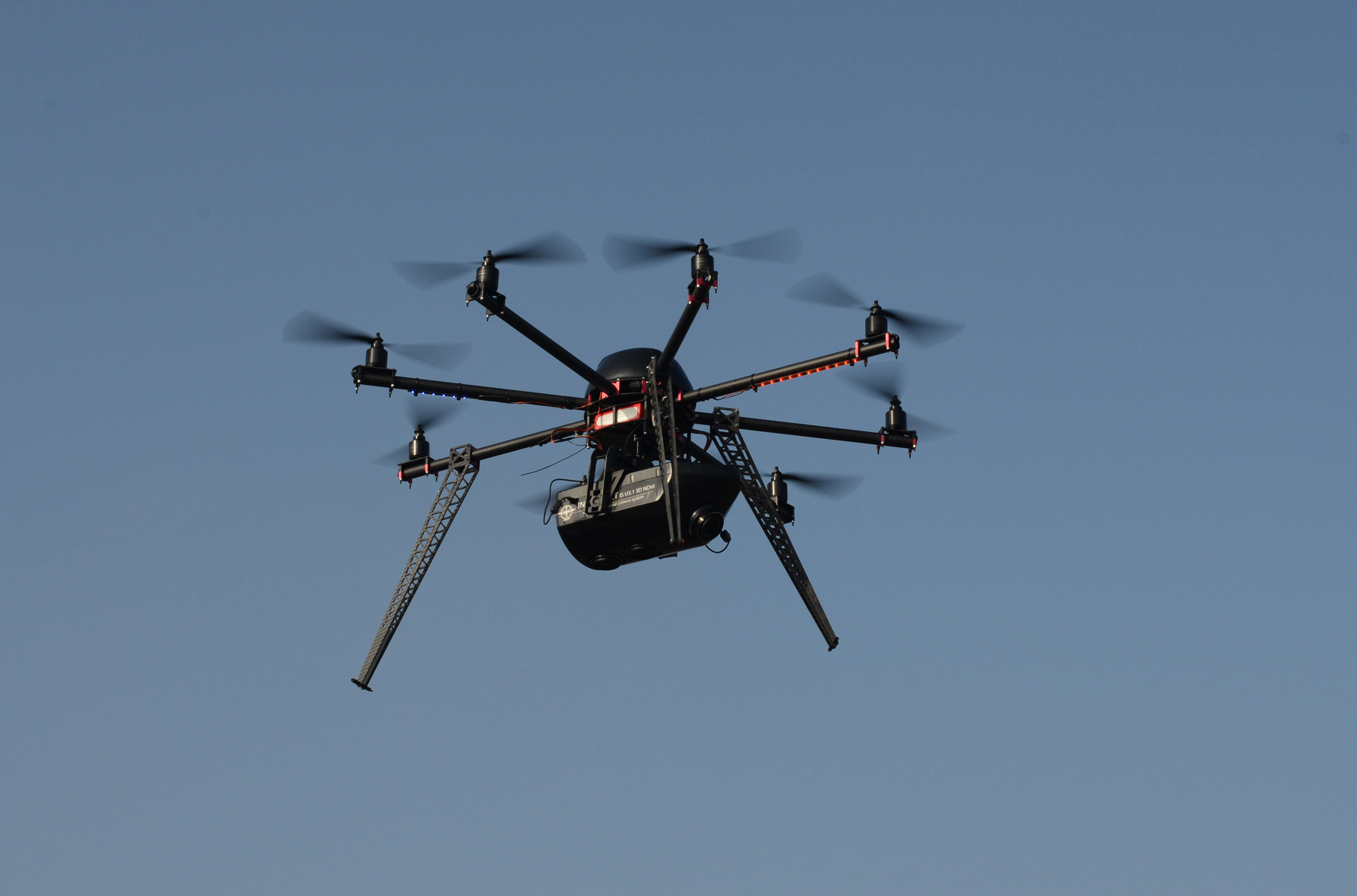
Prevention: This would usually require a fixed-wing, medium- to large-sized UAS (30kg and above). Small UASs have restricted flight time and payload carrying capacity (max weight) that limit their effectiveness in detecting or preventing poaching over large areas. A combination of ground and aerial sensors will be better suited for this purpose, which can be complemented by sending a Responsive UAS to the target location. Preventative systems usually have more complex operations requiring skilled operators, more logistical support and larger payloads that will increase costs for long-term operations.
Response: The requirements for this system fit well with the capabilities of a multi-copter, medium- to small-sized UAV, although some fixed-wing models are also possible to use. Whereas fixed-wing platforms are usually more difficult to directly control and follow a target, multi-copter systems will allow the pilot to hover, reverse directions and to maneuver with finer simpler control, while using built-in GPS and gyroscopes to provide automated stability (e.g. it hovers by itself). For these reasons, Responsive systems are generally simpler to operate than Preventative ones, as they do not require “piloting” skills, making it easier to train rangers to use them. The smaller-sized multi-copter UAVs have reduced payload capacity and, subsequently, smaller sensors with lower resolution images.
What is the flight time?
Prevention: Prevention typically requires that the UAV fly for long periods of time (2+ hours), with the goals being to 1) constantly monitor large areas, 2) investigate suspected activities, and 3) give a location and follow-up when something unusual is detected. Prevention may thus necessitate having several UAVs on site so that one is always in flight.
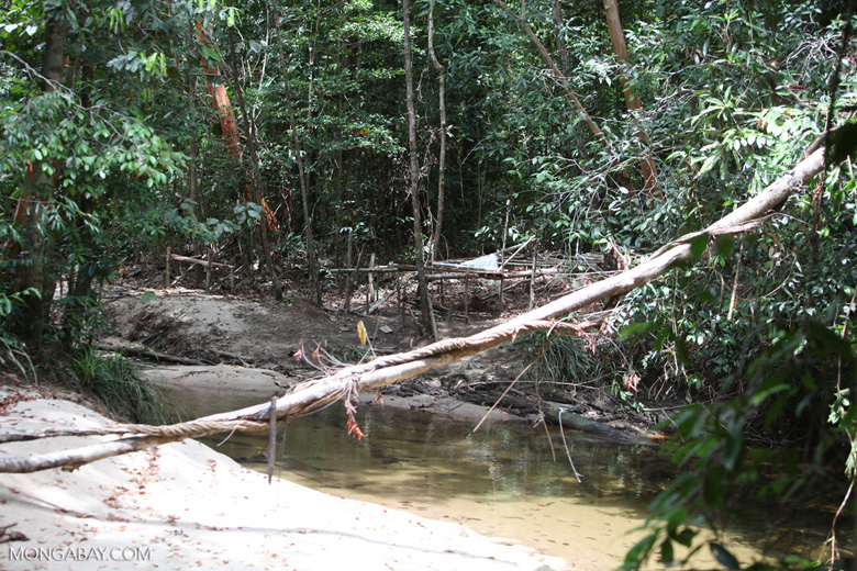
No system will be able to cover an entire park, so the protection team will need to evaluate available intelligence to target flights over higher-risk areas, such as the border of the park or zones with a higher probability of illegal activity. In some places, the mission may involve flying out from the park and scanning travel routes leading to it, depending on known movements of poachers and animals, geological features, and the location of nearby towns.
Response: A Responsive UAS is usually designed for quick, easy deployment and a short flight time – in response to a known threat or an ongoing event. A response system should be able to fly at least 20 minutes and be easily relaunched with additional batteries that can be changed during the mission. The range from the ground control system should also be considered, as this can vary from 0 to 3km and is largely determined by the quality and capabilities of the communication system. Ground and aerial antennae with longer ranges will cost more.
Which sensor systems (i.e. camera) are included in the advertised model?
Prevention: Most UASs are sold with their appropriate payloads and can be customized to meet the user’s exact needs. In the preventative sector these are usually payloads with both visual (EO) and infrared (IR) capabilities. There should be a high-quality gimbaled and stabilized camera which can transmit a live high-resolution video feed back to a base over long distances. An infrared thermal imaging system, like the popular Forward-Looking Infrared, (FLIR) cameras, is also needed for detecting people and animals while flying at night, and the image quality must be high enough to identify certain larger species, including distinguishing people from animals. At this time, there are no commercial solutions for real-time image detection from a drone that can provide a fully automated and reliable way of detecting intruders.
Response: The video output has to be adequate to the conditions in your specific area and in accordance to flight conditions (altitude, vegetation, etc.) As you fly higher and faster, the camera needs to provide higher resolution images that allow you to zoom in on objects of interest. If you are operating at night, you will need to fly with an IR system, which can add additional costs. A combined EO/IR payload provides more information both during the day and at night. Sensors like the FLIR Vue Pro and Tau 2 cameras are beginning to lower the consumer costs for UAV-based thermal imagery, but ITAR restrictions prevent users outside the U.S. from accessing sensors with higher resolution.
How is the drone launched/landed?
Response: Launching and landing with a multi-rotor system can also be automated, and like a helicopter, can take off an land vertically. Small- and mid-range fixed-wing UAVs can be launched by hand or with a bungee or catapult. They can land either on their bellies or with a parachute, which may be needed, as runway landing is usually problematic in the field when you need to respond to unknown events in unplanned areas.
Follow-up questions for a company or project promoting UAV success:
How many different UAV platforms is the group using in its marketing video?
Groups have in the past used the video output of several UAV models to produce one film footage, and the anti-poaching UAV may not actually appear in the video. The camera feed from a fixed-wing UAV is distinct from the images a quadcopter or multi-rotor can produce. If the video changes drastically between aerial shots, assume some of it is not being taken by the anti-poaching UAV.
Remember, a few beautiful minutes of wildlife moving in the frame does not turn this platform into an anti-poaching UAS and does not prove any relevance to mission – response or prevention.
Is the group trying to use the UAS for more than one mission?
With respect to the Prevention and Response systems we’ve outlined above, the answer should be no. There is a discrete difference between these systems, and attempting to use a one-drone-fits-all approach will likely lead to poor results for both missions.
However, these systems can be used for non-security missions, supporting conservation activities in the area. Additional sensors, such as animal tag detectors or multispectral cameras, can be added to UAVs to allow for wildlife, habitat, and environmental monitoring. Head to the forum section if you have more questions about UAVs for vegetation and wildlife monitoring.
How many missions and flight hours has the UAS logged, and what are the results?
Answers will vary, but if a group is claiming significant and long-lasting results, its flight hours and direct results should be representative of this success, and hundreds of hours of flight time is a reasonable minimum.
Manufacturers’ reports should also be clear about whether the highlighted products or applications are still in the testing phase.
Companies and projects using UASs for anti-poaching work can first test the detection capability of the system through a series of standardized, repeated searches for people or objects in a location that is known to the team but unknown to the operator (standardized blind or double blind test). Repeated tests of detection speed and distance between the UAV and the object, under a variety of conditions, will allow a team to know and publicize these features.
How many apprehensions have been made as a direct result of the UAS?
If you hear that a UAS has stopped poaching in an area, you should be asking whether the cease in poaching activity was due to the UAS or any actual apprehensions; otherwise, the decrease may be due to many external factors or deterrence, which alone can be temporary and unsustainable.
Detections of illegal events per flight hour are the best way to measure the success of a system and are the easiest to prove by displaying videos of routine activity. Apprehensions as a direct result of the UAS are rarer but can be proven through footage of the entire process and not just of the moment of apprehension. Regardless of whether a team is flying with a preventative or responsive system, deterrence is a helpful by-product of UAS use but should not be used as the sole metric of success. If the UAS has served as deterrence for poachers without actually contributing to their apprehension, then poachers will eventually lose their fear and return to the area. Such statements should thus be backed up by quantitative data that show that using the UAS continues to dissuade poachers.
Nathan Hahn, Sue Palminteri, and Max Ciaglo helped to research, write, and edit this series.
UAS Glossary
Drone – The most common and most incorrectly used term, adopted to refer to the first-generation of unmanned aircrafts that were used mainly as “simple” flying targets for practice and experimental purposes. As systems evolved to modern-day autonomous levels, the continuous use of the term does a disservice to their character, capabilities and activity.
EO/IR Payloads: This refers to a camera sensor which can deliver standard visual images (EO) and infrared images (IR) in the same payload. This allows a single sensor system to operate in day and night conditions.
Fixed-wing: A term used to describe UAV’s with a permanent wing assembly, like an airplane, requiring continual forward motion (i.e. cannot hover). It commonly provides longer endurance and higher payload capacity, so is designed for longer-range missions.
Gimbal – A stabilizing platform that can pivot and thus allows the rotation of a supported object (a UAV’s payload) on at least one (often 3) designated axes, independent from its support (the platform).
Multi rotor (copter): A term used to describe UAVs that use multiple rotors to provide both vertical lift and horizontal motion. These rotors, similar to single-rotor helicopters, allow the UAV to hover and provide simpler operation and stable images from attached cameras. Commonly used for shorter-endurance and shorter-range missions.
Payload – Equipment carried by the UAV that is utilized to perform a mission (e.g. camera, packages) and not directly related to flight, control or navigation. Higher-quality sensors may require a larger UAV
Platform – A simple term used by professionals when referring to the aerial component of the UAS (“the bird”), commonly referring to the unmanned aircraft that is flying and carrying the components necessary for flight and mission.
Radio Controlled Aircraft (RCA/RC)– A small, operator-controlled aircraft, based on hobbyist-level platforms, that can at times include basic semi-autonomous capabilities and carry small payloads. RCA’s are directly controlled by a person via handheld consoles in direct line of sight and not via an on-board controller, software, or autonomous hardware. The capacity for control is typically limited to flight parameters only, with no autonomous commands, operational oriented design, automatic backup, or safety systems, and they normally include only uplink commands. Some independent manufacturers attach external independent payloads to RCAs, wrongfully designating them as UAVs even though they do not adhere to RPA/UAV characteristics.
Real-time system – One that transmits data, such as images, video, or other remotely sensed information, immediately from the UAV to the operator, allowing real-time search, detection and response.
Remotely Piloted Aircraft (RPA): a RPA is the formal term referring to the platform itself, indicating, in contrast to the RCA, that it is a remotely piloted semi or fully autonomous aircraft, via an onboard software and hardware. Generally RPA’s are reusable aircrafts designed to perform a mission with various payloads and not just for “flight” experience. The definition of the term “piloted” vs. control is essential, referring to command via a semi/full autonomous onboard software and hardware while normally including a conscious ground operator, reviewing flight, sensors, payload and mission data, with uplink commands and ordinarily downlink (or onboard) data. Capabilities and quality vary greatly.
UAS – Unmanned Aircraft System. The coordinated set of modules, including the aerial semi- or fully autonomous vehicle(s), payloads, ground control and communication station, predesigned by the manufacturer to act as a complete operational unit or system to perform a mission.
UAV – Unmanned Aerial Vehicle – The older term for RPA’s. An advanced semi- or fully autonomous remotely piloted aircraft (RPA) – it does not carry a human operator and is controlled from the ground via its autopilot mechanism. The UAV can be preprogrammed for both flight and payload operations prior to launch (non-real-time) or during flight (real-time). It can be operated out of line of sight and at altitudes where a person on the ground cannot readily see it. – Click here for details.