- A team of researchers from the International Potato Center traveled to Tanzania to test a DIY drone for gathering agricultural statistics
- By developing low-cost versions of high-tech tools, organizations and institutions worldwide can reap the benefits available to farmers in industrialized nations
- Another innovation, the orange-fleshed sweet potato (which contains key nutrients lacking in other Tanzanian staples) is also being deployed in the region
A high-pitched hum swept across the Tanzanian sweet potato field.
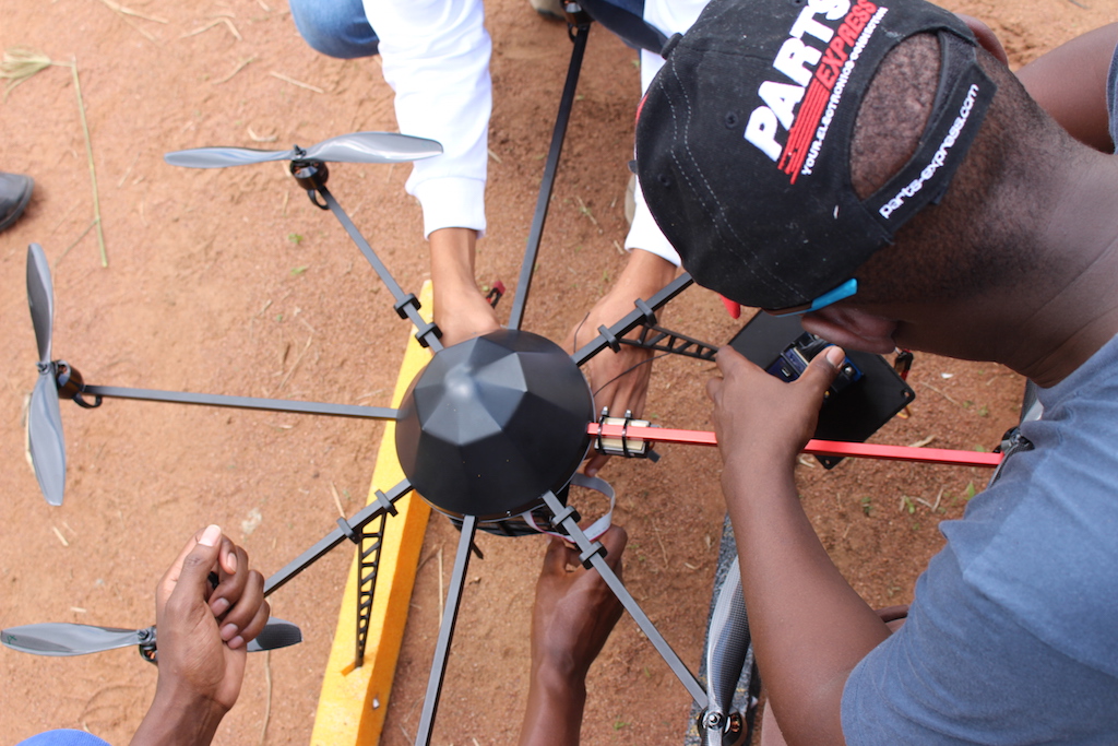
The sound came from above, from a jet-black drone whirring through the sweltering sky. The machine was an instance of high-technology DIY: a sophisticated octocopter capable of carrying a several-kilogram payload. The team-members had assembled the Unmanned Aircraft System (UAS) themselves and programmed it to run on open-source software. They’d created the system’s interchangeable sensor and camera mounts using a 3D printer in Kenya and plans drafted in Peru. The craft flew on eight carbon-fiber propellers, spinning on the ends of eight slender metal arms that radiated, spoke-like, from the machine’s body.
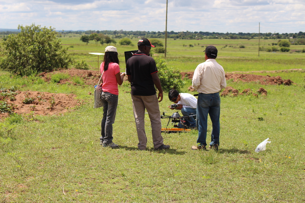
The pilot, Luis Silva, stood on the field’s edge clutching an overgrown remote-controller in his hands. By his side, Susan Palacios murmured the drone’s elevation in quiet Spanish as the craft zoomed through the air.
Silva and Palacios were the Peruvian contingent of a team dispatched to Tanzania by the International Potato Center. CIP, as the center is known by its Spanish acronym, is a research institution dedicated to alleviating food insecurity, poverty and the depletion of natural resources through research on root and tuber crops, and the team had come to Tanzania to iron out the kinks in an ambitious data gathering project. They hoped to collect information on smallholder farming using drones as a platform for remote sensing technologies.
The trip had several key objectives: to create a spectral library of the refractive fingerprints of different plants and soils, to validate in the real world their technique for surveying crops with drones, and to mesh that information with satellite data. Ultimately, they hope to equip agricultural institutions and the farmers they serve with precise, accurate statistics about the quantity and quality of their product.
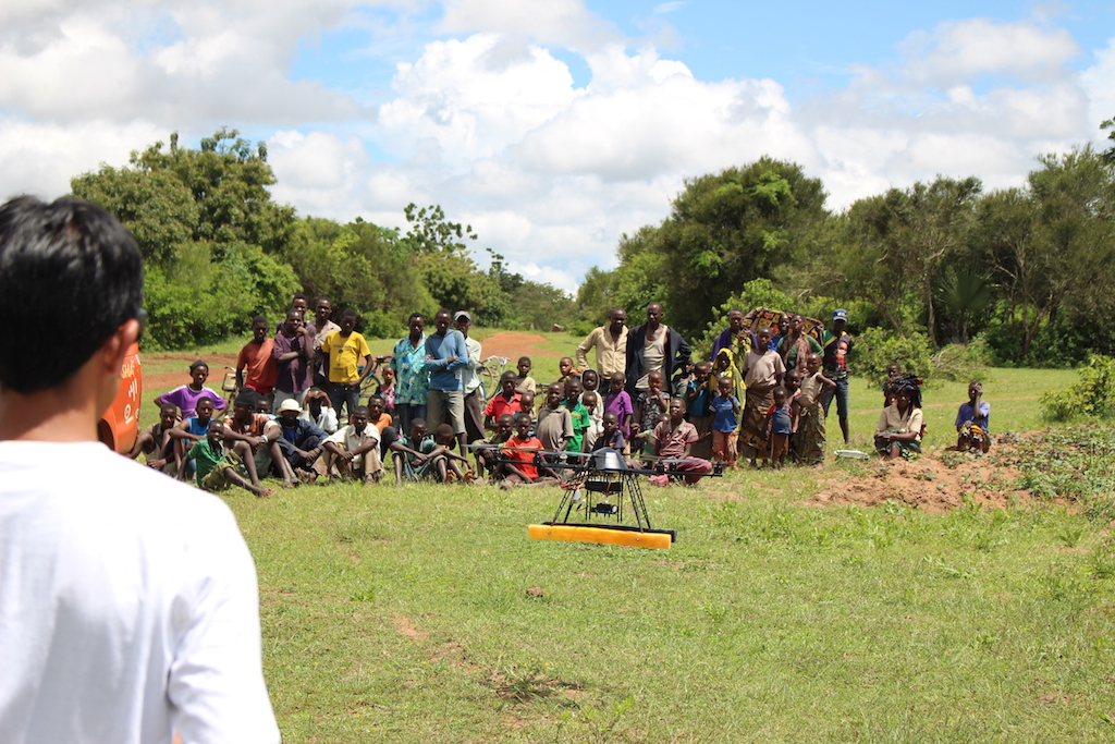
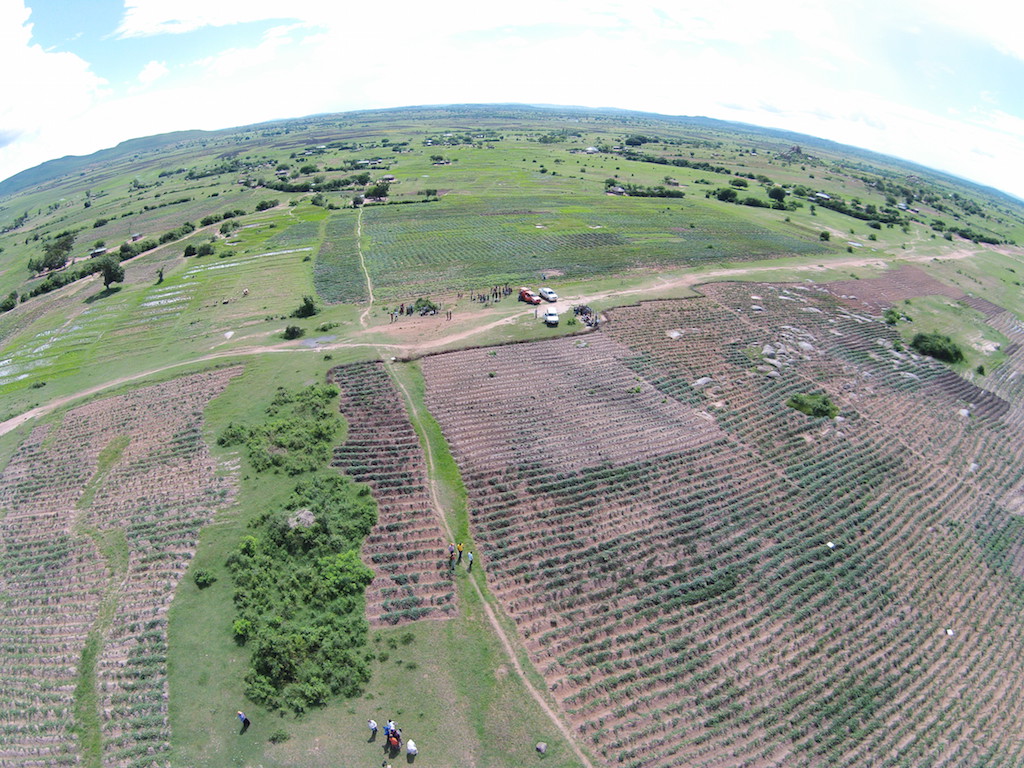
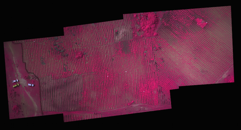
Under Silva’s watchful gaze, the octocopter flew up to 200 meters above the ground and traced a predetermined course over the field below, snapping pictures along the way. The machine looked down on a vast plain ringed by tall, boulder-strewn hills. Directly below, long earthen ridges covered in a vibrant green carpet of sweet potato vines sloped gently to the southwest.
The UAS looked down on other fields — short cotton plants and dried, stunted cornstalks on higher ground and lime-green rice paddies huddled in the sodden lowlands. Everywhere else, as far as the camera could see, was pasture for cattle and goats: close-cropped grasses slowly being overtaken by vicious, thorny bushes that the animals don’t eat.
And the UAS saw humans, sitting outside small homes of adobe bricks and thatched roofs, laboring in the fields with hoes and digging spikes, biking and walking along the rutted dirt road that bisected the landscape. It looked down on Silva and the team of scientists monitoring the UAS’s movements on a laptop and handheld GPS unit. It saw onlookers, too, children, teenagers and adults drawn to the spectacle of foreigners and flying objects, who exclaimed and pointed and craned their heads to the sky and snapped grainy cellphone photos.
Ag from the air
As the price of Unmanned Aircraft Systems (UASs are also known as Unmanned Aerial Vehicles, UAVs, or drones) falls, researchers and tinkerers around the world are attempting to use them for a broad array of applications, from tracking sharks and monitoring wildfires to assessing forest canopies and stopping poachers.
Farmers in industrialized nations are already using UASs in their work, and the role of UASs in agriculture is projected to increase dramatically. By some estimates, in the next decade in the United States, more than 90 percent of economic impact of UASs will be in the agriculture sector. And DJI, the top UAS manufacturer, recently launched a system designed to spray pesticides.

The program at the International Potato Center aims to put that high-tech advantage in the hands of individuals and institutions that might not otherwise be able to afford commercial technologies. The program is part of a Bill and Melinda Gates Foundation project with the Consultative Group for International Agricultural Research consortium, or CGIAR, an organization dedicated to achieving development through agricultural research. Other institutions are also using UASs in development work, such as Digital Democracy’s program helping indigenous groups in Ecuador monitor environmental impacts in the Amazon.
A tool for development
Elijah Cheruiyot is a tall, lanky Kenyan who specializes in remote sensing and GIS at CIP’s Nairobi office. Standing beside the rutted dirt road bisecting the field, he explains the advantages of remote sensing:
“The classical method of collecting data — spectral measurements for instance — you need to pick leaves and take them to the lab and use sophisticated machines like spectrometers to capture the data in the lab,” he said. “Remote sensing is the process of collecting the same information, maybe with less accuracy, but without physical contact — basically using the laws of light, the reflection of light, to capture information from physical objects.” In the case of Elijah’s team, the object of interest is crops, especially sweet potatoes.
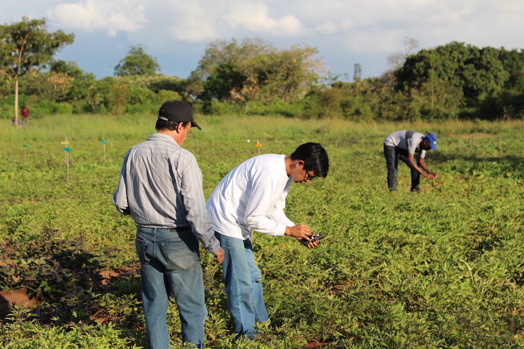
Using UASs as a platform, the team from CIP gathers information from several cameras and sensors, including conventional cameras and a multi-spectral sensor made by tetracam. Multi-spectral images of plants can reveal information unavailable to the human eye, such as water stress or the presence of viruses, by detecting the level of chlorophyll, and therefore the amount of photosynthesis, in a plant.
The farmers and other onlookers watching the scientists gather data — and Tanzania as a whole — are in desperate need of the kind of accurate data the group’s UAS could offer. Nearly half of Tanzania’s GDP is linked to agriculture, and the vast majority of the country’s food comes from smallholder farms like the one Elijah’s team is studying. But productivity remains low, and malnutrition is a persistent problem: about four out of 10 Tanzanian children under the age of 5 experience the deleterious effects of malnutrition.
“The technology CIP is developing is aimed at developing crop statistics that will benefit smallholder farmers through the interventions of national institutions like LZARDI (the Lake Zone Agricultural Research and Development Institute) in Mwanza, or governments.” Elija says. “These institutions need crop statistics in their districts for planning.”
“They need to know how much of the crop is grown in a season, whether there will be enough food in the region for this year, or whether they need to plan for markets for these crops if they have more than enough. Crop statistics are essential, and it’s going to help smallholder farmers in making decisions in what to plant, when to grow, or where to sell their crops based on the information given to them from the institutions.”
A low-cost remote sensing tool would allow institutions to “observe how plant life develops and evolves across landscapes over time through characteristics such as biomass, nutrient content, disease, and water use,” according to a CIP press release. UASs equipped with specialized sensors could fill the gap between satellite images and on-the-ground assessments, especially in areas where satellite images are often obscured by clouds.
A struggling breadbasket
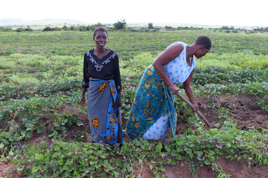
The Mwanza region around Lake Victoria is one of the most fertile and productive in Tanzania, and around 85 percent of the people in the area are smallholder farmers and ranchers. They grow cotton, rice, cassava, corn, sorghum, millet, legumes and sweet potato, or they spend their days tending to goats, cattle and other livestock.
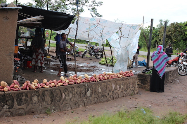
But the sweet potato is a particularly important crop here: the Mwanza region produces about 400,000 tons of the tuber each year, which amounts to the lion’s share of Tanzania’s sweet potato production.
Everina Lukonge is an imposing, unflappable plant breeder at LZARDI, where she specializes in researching cotton and sweet potato. She’s witnessed changes in the region that stress the area’s traditional crops.
“Weather and climate changes have brought challenges, including drought,” she said. “Not much maize, not much rice, sweet potato has to take charge.”
Solving the sweet potato
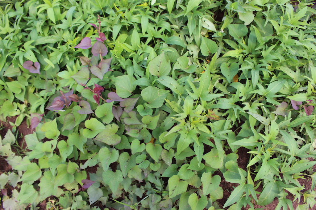
For the past decade and a half, groups in Tanzania have been promoting a tuber variety known as the orange-fleshed sweet potato, or OFSP. The OFSP contains beta carotene, a precursor to vitamin A. In Africa, about 43 million children under the age of 5 face vitamin-A deficiencies, which can cause blindness, disease and death. But the orange-fleshed sweet potato has also been making inroads in countries near Tanzania.
Despite those gains, researchers and development workers face other obstacles in enhancing the role of the sweet potato in Africa, including cultural mores that consider sweet potato to be suitable only for women and children, difficulty storing the tubers, and infrastructure limitations that slow transporting the product to market. And they’re developing techniques to combat sweet potato virus, the most harmful disease affecting sweet potatoes in Africa. By growing virus-free sweet potato stock in net tunnels that protect the plants from flies that transmit the virus, farmers can guarantee that they start out growing disease-free vines.
Upward progress
After returning to Lima and Nairobi, the team from the International Potato Center has worked on processing the data they’d gathered in Tanzania. They’re also developing less expensive sensors by buying cheap cameras and adding custom filters, and they’re refining the software used to recognize images of different crops. Their remote sensing program has come a long way since its inception more than a decade ago, when the researchers first began experimenting with balloon-mounted cameras.
But on that warm day in Tanzania, the team’s field work was not yet finished, and the UAS still zig-zagged through the sky above their heads. Snapping photos, the craft reached the final aerial waypoint. Squinting at the sky, Lucho guided the machine back toward the researchers and the crowd of onlookers. 50 meters… 40… 20… the sound of whirring propellers grew louder until the craft landed with a small bounce in the bare earth beside the sweet potato field.
Although it might not seem so at first glance, both the orange-fleshed sweet potato and the futuristic octopter are the result of years of innovation, and both hold the potential to better the lives of farmers in Tanzania and beyond.
As Everina Lukonge, the LZARDI plant breeder put it, “They say sweet potato is income; sweet potato is medicine. That’s the song for sweet potato.” And someday — once the researchers at CIP finalize and disseminate their drone technologies — a new sound could begin harmonizing with the song of the sweet potato: the persistent hum of drones.