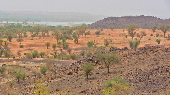
Contrary to conception, the Sahara Desert’s most common feature is really the Hamada, or stone plateaus and gravel plains, which cover over three quarters of its surface, and harbors at great distance the barely visible silhouette of the once-majestic Niger River. Photo by: Linda Leila Diatta.
Severely affected by recent turmoil across its northern frontiers, Nigerien tourism pins hope on river valley attractions to play a major role in rebuilding its tourism industry in the upcoming years. Even though the river itself is threatened.
Located in the heart of the Sahel Region, the vast desert lands of Niger have captivated European tourists seeking a taste of its immensely varied natural landscapes.
As the 22nd largest country in the world, Niger is mostly a storehouse of sea sands, rippling sand dunes and prehistoric remnants, with the legendary Sahara Desert taking up over 70 percent of its territory. Like Egypt, this little known nation is intimately linked to a river – the Niger River, which bears its name. Blessed with stunning land features, Niger abounds with rivers, valleys, mountains, plateaus and a multitude of wildlife species. Certain animals like the white giraffe, the last of its kind, can only be found in this particular part of Western Africa.
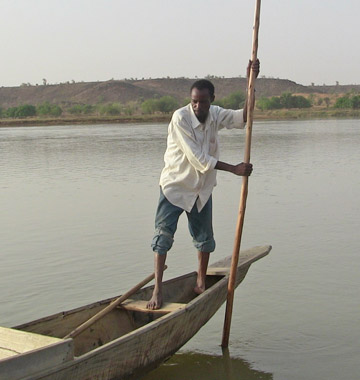 A fisherman embarks on a sunset trip down the Niger River valley on board his only source of income, a pirogue, a wooden canoe made of hollowed tree trunks, usually used for transport, fishing and hunting activities. Photo by: Linda Leila Diatta. |
Once a hot spot for nature lovers and thrill seekers, the Sahara Desert turned up on many bucket lists. Here one can see and explore a great variety of attractions from sand boarding, camel-riding over the dunes to trekking including romantic cruises under the desert skies.
Today, everything has stopped. The recent security situations in the northern part of Niger and its ongoing environmental calamities have drastically reduced the number of travelers, now more reluctant to undertake the unpredictable journey through the Sahara Desert.
With the north off-limits, most of the country’s tourism activities are now concentrated in the southern region around the capital Niamey. As the principal touristic attraction after the Sahara Desert, the Niger River has been an integral element for the advancement of tourism in the Sahel Region. Home to 1.5 million fishermen, cattle grazers and farmers, the river provides drinking water for livestock and people living along the valley. Niger’s economy is centered on riverside farming and animal husbandry activities irrigated by the Niger River, its essential life source.
To revive of its struggling tourism industry, the Ministry of Tourism established touristic attractions inside the river valley, such as the newly renovated Gardens of Rio Bravo.
However, the Niger River is also facing risks of extinction.
Situated 15 km northwest of Niamey, the Gardens of Rio Bravo is the capital’s most fascinating excursion and the most hit by a current dry spell.
When you first enter the tourist site, isolated plateaus and mountains rise above several thorn trees and dried up branches encroached onto grassland plains—a typical landscape of any dust-choked region such as this one.
The small silhouette of a fishermen village stands behind the mountains, with their “pirogues” or outrigger canoes parked alongside the water. And, in the middle, lies the Niger River, an image that never fails to astonish. A single road takes you down the camping site. There you’ll find an open area dominated by barbecues grills, medium-sized traditional tents and the occasional tourist.
Rio Bravo has become a synonym for splendor and tranquility. Visitors are charmed by its rich natural value and quiet atmosphere. People come to Rio Bravo for the adventure, the rustic lifestyle and to appreciate the cool air far off the congested heat of urban areas.
An incredible site with great touristic potential, Rio Bravo offers unmatched opportunities to dazzle your senses and collect everlasting memories. Just take a boat trip down this great river under a colorful sunset and discover why this place has mesmerized tourists for decades.
But all this could soon be history.
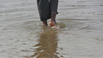 Over the past twenty years, a catastrophic 55 % drop in flow of water was recorded in the drought-plagued valley of Africa’s 3rd largest river—with the Niger expected to shrink considerably by the year 2040. The evidence of this startling phenomenon above is clear. Photo by: Linda Leila Diatta. |
Due to irregular rain falls in the region, the Niger River is turning shallower more rapidly than anticipated. As it slowly dries up, vast sand islands accumulated overtime from nearby hill slopes emerge from the water, making it unsuitable for navigation.
As the closest major source of potable water to the Sahara Desert, the Niger water is a key source of survival for ecosystems, life and the socio-economic development of an area severely stricken by drought and famine.
But by 2040, only heavy silt, sand and vegetation will replace the livelihood of 110 million people living in the West of Africa. There is an urgent need for decision makers both local and international, to take action and reduce the spread of soil erosion, the silting of water courses and the intense desertification in the Sahel region which imperil the river and the people who depend on it.
The whole Sahel region suffers from this widespread environmental degradation. However, the part of the river located in Niger is the one where land degradation proportions are the strongest. For the past fifty years, natural vegetation has almost completely disappeared, severely affecting land productivity and food production including fishing, fluvial transportation and most importantly the overall management of water.
The Niger River is an alarming illustration of the deteriorating state of our ecosystems, worsened by a growing population and changes in climate. One thing for sure is without a strong pledge to save the Niger River by riverside populations and governments residing along its banks, the future of this once-majestic river isn’t looking so bright.
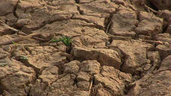
A sprouting plant bakes under the desert sun anchored by dried-up cracking bars of mud and silt deposited over time by Niger River currents. Photo by: Linda Leila Diatta.
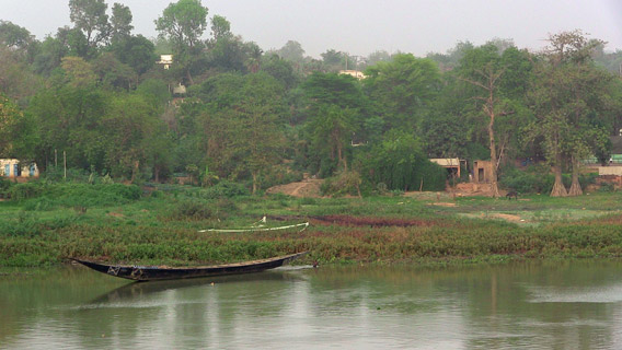
Delimited by dense vegetation and a vivid green tree-lined riverfront, the livelihood of this remote fishermen village strongly depends on the Niger River—the only permanent water source and fertile area in the country. Photo by: Linda Leila Diatta.
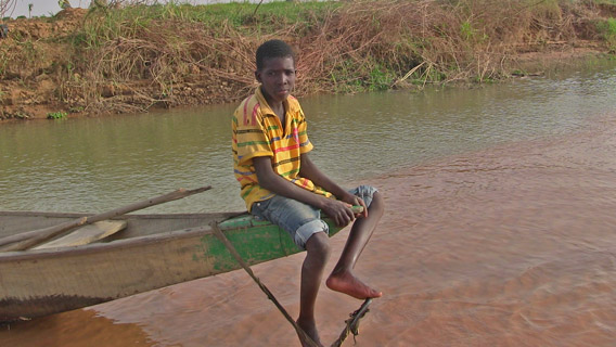
A young fisherman quietly waits on his pirogue, parked around shallow water prairies, as it floats near the edges of a sand island. Photo by: Linda Leila Diatta.
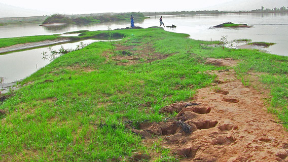
An enthusiastic tourist takes his first walk on a sand island. Photo by: Linda Leila Diatta.
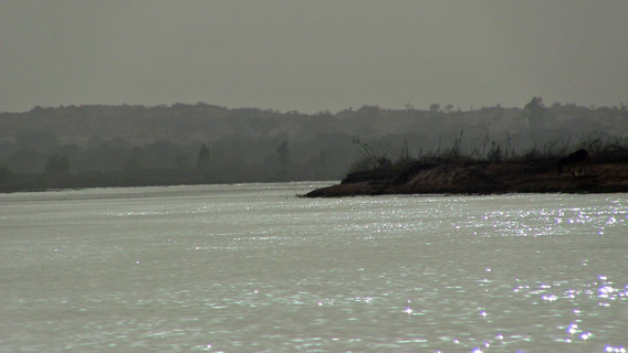
The Niger River—also known as the pulse of West Africa, sparkles under the bright afternoon sun of the Rio Grande camping site. Photo by: Linda Leila Diatta.
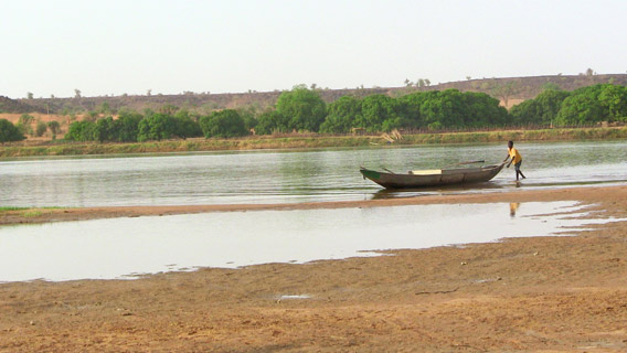
An increasing number of vegetated sand islands dominate the Niger River landscape and shelter countless varieties of aquatic insect communities—the bioindicators of water quality. Photo by: Linda Leila Diatta.
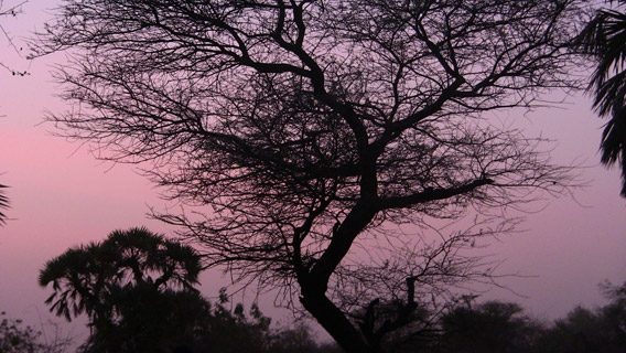
Capturing the last light of an incredibly colored mauve sunset over the Rio Grande gulf in Southern Niger. Photo by: Linda Leila Diatta.
Related articles
‘The real Hunger Games’: a million children at risk as Sahel region suffers punishing drought
(05/09/2012) The UN warns that a million children in Africa’s Sahel region face malnutrition due to drought in region. In all 15 million people face food insecurity in eight nations across the Sahel, a region that is still recovering from drought and a food crisis of 2010. In some countries the situation is worsened by conflict.
15 million facing food shortages in Africa’s Sahel region
(03/29/2012) The UN announced yesterday that food security in the Sahel region is deteriorating, putting over 15 million people at risk. Ongoing drought combined with conflict, has pushed the region into a crisis. The situation appears eerily similar to last year when Somalia was hit by a devastating famine due to drought and political instability; the famine left an estimated 30,000 children dead.
Niger creates desert park bigger than Hungary
(03/07/2012) Yesterday, the Niger government formally created the Termit and Tin Toumma National Nature and Cultural Reserve in the Sahara Desert, reports the Sahara Conservation Fund. The reserve, now one of the largest in Africa, expands existing protected areas to 100,000 square kilometers (38,610 sq. miles), an area bigger than Hungary and nearly twice the size of Costa Rica.
Droughts could push parts of Africa back into famine
(12/19/2011) Drought and erratic rains could lead to further food scarcities in Africa warns the United Nations World Food Program (WFP). The WFP singles out South Sudan, the world’s newest nation, and Niger as nations of particular concern. Earlier this year famine killed scores of people, including an estimated 30,000 children, in Somalia.
Great Green Wall gets go ahead
(02/28/2011) Spanning the entire continent of Africa, including 11 nations, the Great Green Wall (GGW) is an ambitious plan to halt desertification at the Sahara’s southern fringe by employing the low-tech solution of tree planting. While the Great Green Wall was first proposed in the 1980s, the grand eco-scheme is closer to becoming a reality after being approved at an international summit last week in Germany as reported by the Guardian.
Food crisis in Niger occurring “out of the public eye”
(04/26/2010) The West African nation of Niger is facing an increasingly alarming food crisis as the UN announced it would double the number of people it was feeding today despite continuing budget shortfalls in its World Food Program (WFP). Failing rains have caused crop yields in Niger to decline, while food prices are rising and livestock prices falling. Officials say these trends have created a perfect-storm for a crisis in Niger, which according to Amadou Sayo from CARE International, is occurring “out of the public eye.”


