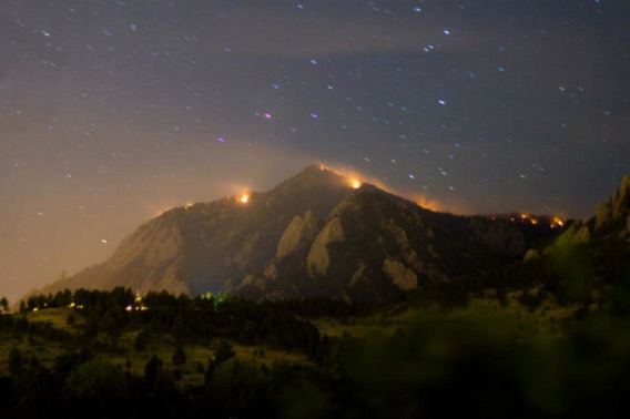
 Wildfires cover the mountain tops just outside of Boulder, Colorado. Photo by Jeffery Hammerton. |
Lightning strikes have blatantly ignored the warnings of park service officials in Colorado, setting off the 87,000+ acre High Park fire, the 20,000+ acre fire near Pagosa Springs, and a more recent wildfire just outside Boulder.
Scientists claim the increasing intensity and amount of wildfires in the Southwest is driven by climate change. There are currently 8 major wildfires burning in Colorado, and more than 20 others throughout the Southwest.
Anthropogenic climate change has contributed to hotter, drier conditions, longer fire seasons and increases in thunderstorms and lightning strikes. As dry, hot conditions persist throughout the Southwest, fire danger has risen significantly.
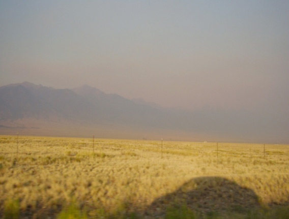
Photo by Ryan King
William Blake famously wrote, “The road of excess leads to the palace of wisdom, for we never know what is enough until we know what is more than enough.”
Here in the Southwest, the road of excess leads directly to smog-shrouded mountains, blazing hilltops, and desiccated farmland. Whatever wisdom there may be to garner from decades of systematic, mass societal apathy and resolute obliviousness on the part of government will be sorted from the ashes by the generation bequeathed a hellish, climate-changed future.
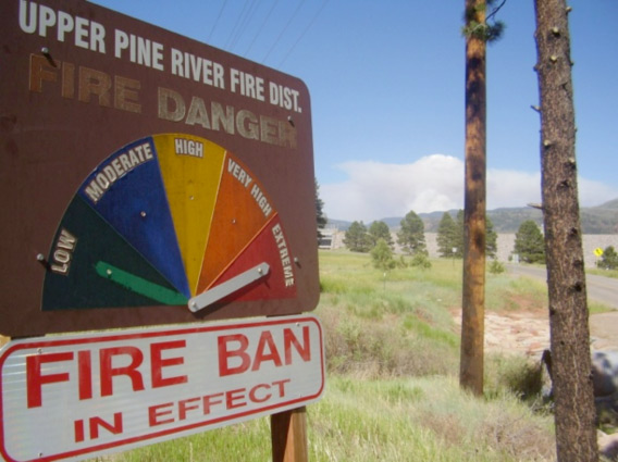
Photo by Ryan King
Climate expert and author Joseph Romm writes, “We’ve only warmed about a degree and a half Fahrenheit in the past century. We are on track to warm five times that or more this century, assuming we keep listening to the do-little or do-nothing crowd. So there will never be a normal to get used to any more. It’ll just keep getting warmer and more extreme through the century. We ain’t seen nothing yet!”
It appears that some of the worst-case scenarios for climate change – widespread drought, megafires, intense storms, ocean acidification, and conflict – portended by decades of scientific research are now underway.
A 15,000+ acre fire near Colorado Springs has forced the evacuation of some 36,000 residents. The Waldo Canyon fire began near popular tourist access points, and has been moving progressively through populated regions of Colorado Springs.
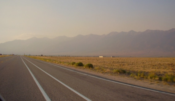
Photo by Ryan King
Mark Stein and family of Morristown, N.J. were taken by surprise by the fire in Colorado Springs. The Stein family had visited Colorado assuming a vacation of sightseeing and river rafting, but instead became active in volunteer efforts to help settle hundreds of evacuees.
Hopefully Mr. Stein’s positive outlook will be more commonly adopted as floods, fires, and climate catastrophes spread: “I think it’s the best vacation ever. This is what the real world is about. There’s a lot of people that need help.”
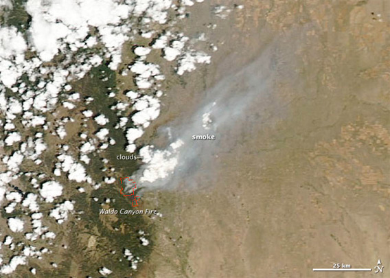
The MODIS instrument on NASA’s Aqua satellite captured an image of the fire on June 26, 2012. Thick smoke, partially obscured by clouds, is visible blowing toward the northeast. The red outlines indicate hotspots where MODIS detected unusually warm surface temperatures associated with fires. (Credit: NASA’s MODIS Rapid Response Team)
Related articles