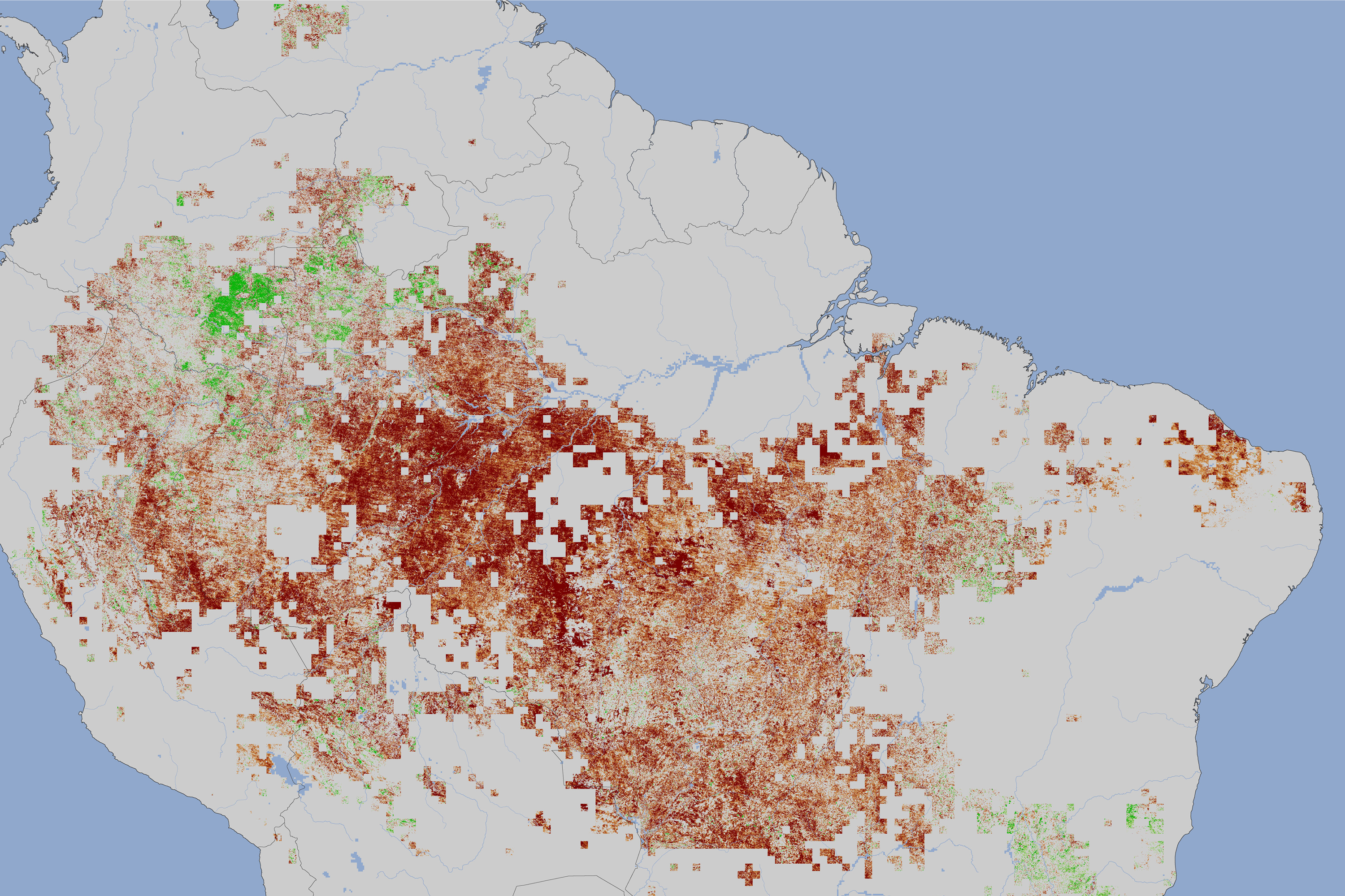
From NASA: image from the Moderate Resolution Imaging Spectroradiometer (MODIS) on NASA’s Terra satellite, the image shows vegetation ‘greenness’ during the 2010 drought, between July and September, compared to average conditions for the same period between 2000 and 2009 (except for 2005, the other drought year). The redder the image the less ‘green’ the forest. The “greenness index” measures how much photosynthesis could be happening based on how much leafy vegetation the satellite sees. In 2010, the vegetation index recorded lower values than in previous years, an indication that trees under drought stress either produced fewer leaves or the chlorophyll content of leaves was lower, or both. Image courtesy of NASA.
Click to enlarge.
NASA has revealed a satellite image of the crippling effect of last year’s record-breaking drought on the Amazon ecosystem. For those of you counting, that’s two record droughts in the Amazon Basin in 5 years.
The 2010 drought appears more extreme then the drought of 2005 according to recent research, including satellite imagery. A new study in Geophysical Research Letters, found nearly a million square miles (2.5 million square kilometers) saw reduced greenness in 2010. This is more than four times the area impacted by the 2005. Adding in signs of drought stress the total impact of the 2010 drought spreads over 1.68 million square miles (4.35 million square kilometers).
Scientists are concerned that increasing droughts could turn the Amazon rainforest from a vast carbon sink into a carbon source, emitting excessive carbon due to increased wood rot during drought conditions.
The Intergovernmental Panel on Climate Change’s (IPCC) has argued, and top tropical scientists have concurred, that climate change in combination with deforestation and fire could ‘flip’ around 40% of the Amazon from tropical rainforest to savannah.
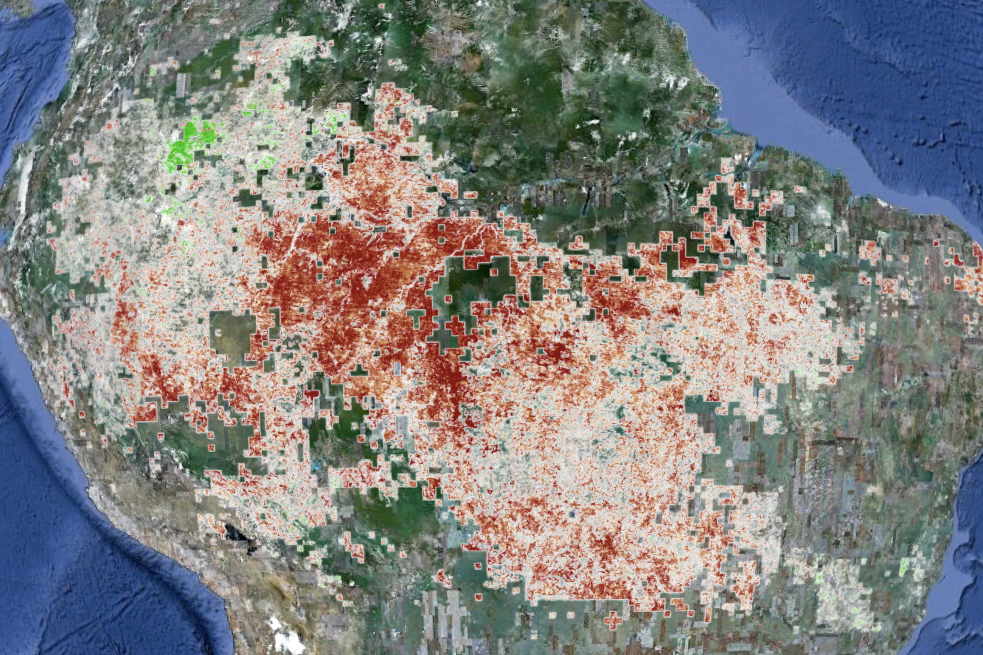
2010 Amazon drought as seen through Google Earth. For more detail see above. Image courtesy of NASA. Click to enlarge.
Related articles
Last year’s drought hit Amazon hard: nearly a million square miles impacted
(03/29/2011) A new study on its way to being published shows that the Amazon rainforest suffered greatly from last year’s drought. Employing satellite data and supercomputing technology, researchers have found that the Amazon was likely hit harder by last year’s drought than a recent severe drought from 2005. The droughts have supported predictions by the Intergovernmental Panel on Climate Change’s (IPCC) that climate change, among other impacts, could push portions of the Amazon to grasslands, devastating the world’s greatest rainforest. “The greenness levels of Amazonian vegetation—a measure of its health—decreased dramatically over an area more than three and one-half times the size of Texas and did not recover to normal levels, even after the drought ended in late October 2010,” explains the study’s lead author Liang Xu of Boston University.
Two massive droughts evidence that climate change is ‘playing Russian roulette’ with Amazon
(02/03/2011) In 2005 the Amazon rainforest underwent a massive drought that was labeled a one-in-100 year event. The subsequent die-off of trees from the drought released 5 billion tons of CO2. Just five years later another major drought struck. The 2010 drought, which desiccated entire rivers, may have been even worse according to a new study in Science, adding on-the-ground evidence to fears that climate change may inevitably transform the world’s greatest rainforest.
Amazon suffers worst drought in decades
(10/24/2010) The worst drought since 1963 has created a regional disaster in the Brazilian Amazon. Severely low water levels have isolated communities dependent on river transport. Given a worsening situation, Brazil announced on Friday an emergency package of $13.5 million for water purification, tents, and food airdrops.