Google Earth has updated satellite imagery for areas most affected by the March 11, 2011 earthquake and tsunami. The images reveal large-scale devastation of coastal areas in the Sendai region of Japan.
“Today, we’ve published imagery of the Sendai region at even higher resolution, which we collected on Sunday and Monday,” wrote Keiichi Kawai, Senior Product Manager, on the official Google Blog. “The new Sendai imagery, along with satellite imagery from throughout the area, is now live in the base imagery layer of Google Earth and will soon be visible in Google Maps.”
Google says it will continue acquiring updated images and posting them on Google Earth to facilitate post-tsunami recovery efforts.
“We hope our effort to deliver up-to-date imagery provides the relief organizations and volunteers working around the clock with the data they need to better understand the current conditions on the ground,” continued Kawai. “We also hope these tools help our millions of users—both those in Japan and those closely watching and sending their support from all over the globe—to find useful information about the affected areas.”
The 9.0 earthquake and subsequent earthquake killed more than 10,000 people. Damages may top $300 billion, making it the costliest natural disaster on record.
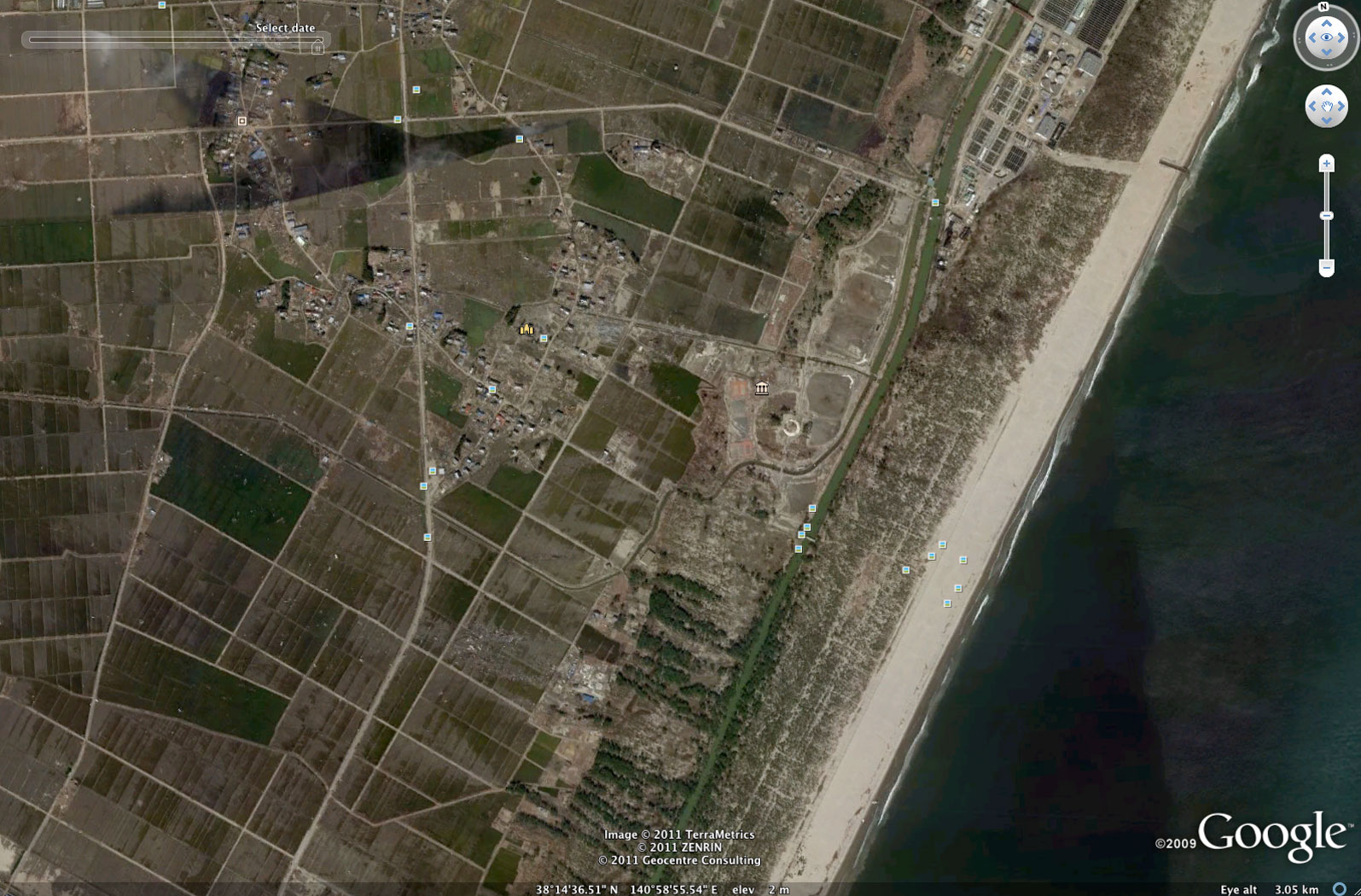
Sedai coast in March 2011, after the tsunami
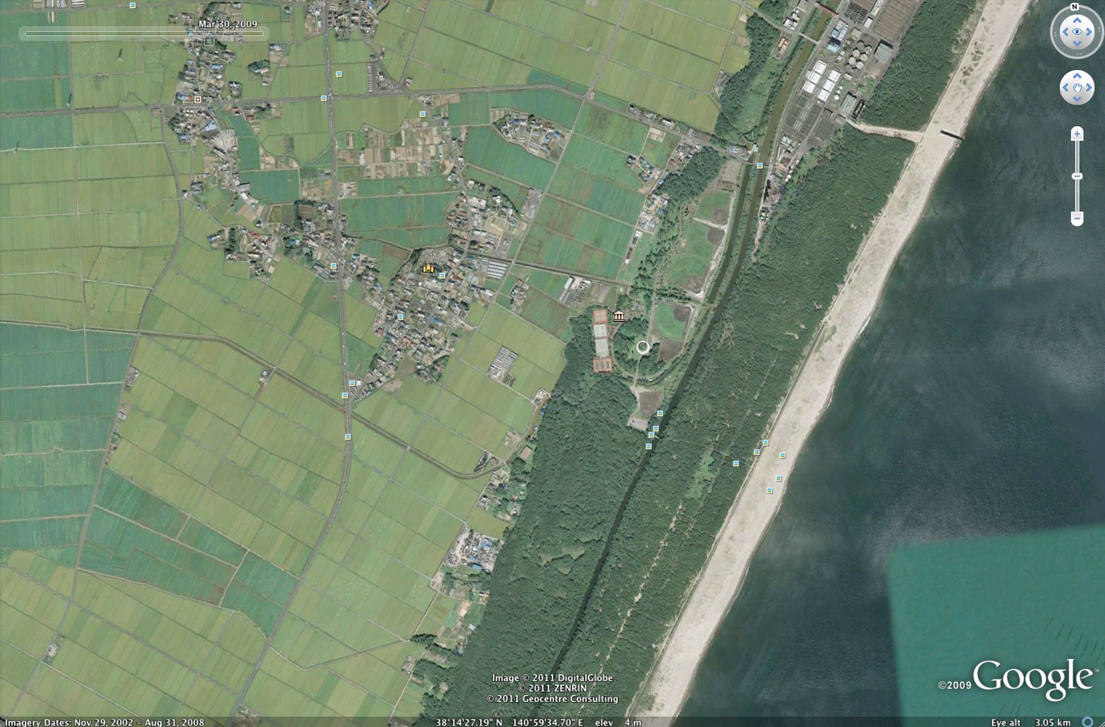
Sedai coast before the tsunami
Sedai coast in March 2011, after the tsunami

Sedai coast in 2004, before the tsunami

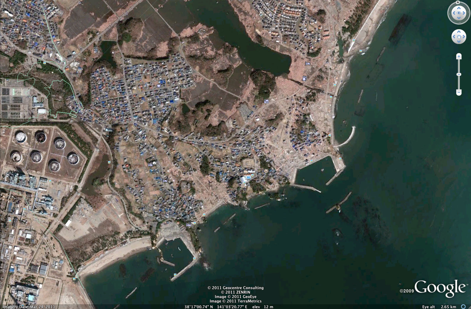
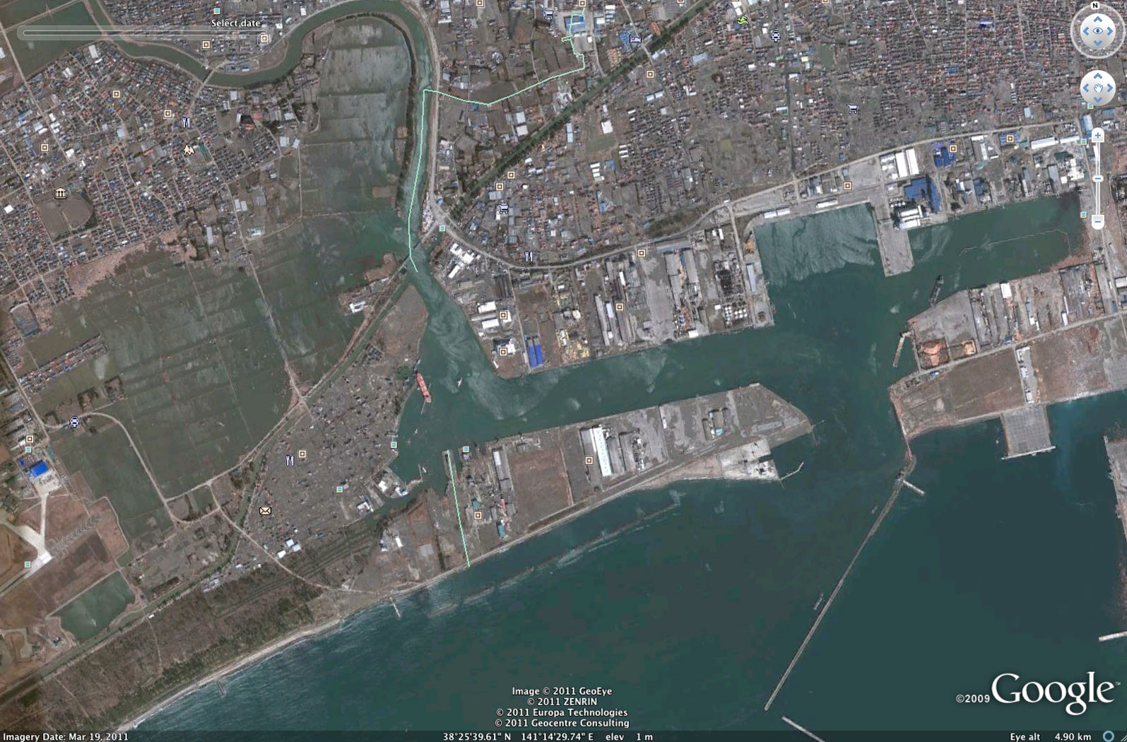
Sedai coast in March 2011, after the tsunami
Sedai coast in July 2004, before the tsunami
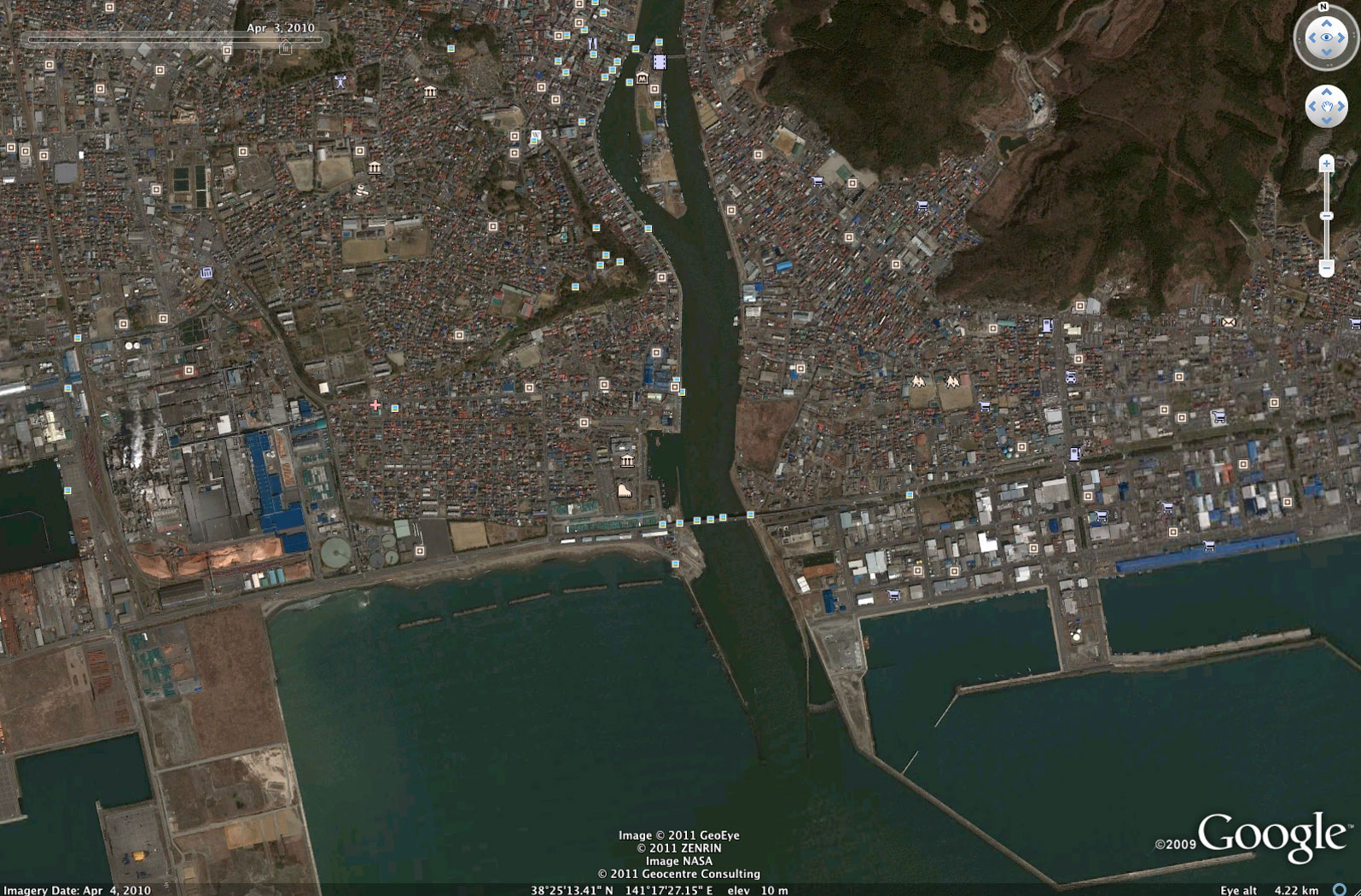
Sedai coast in March 2011, after the tsunami
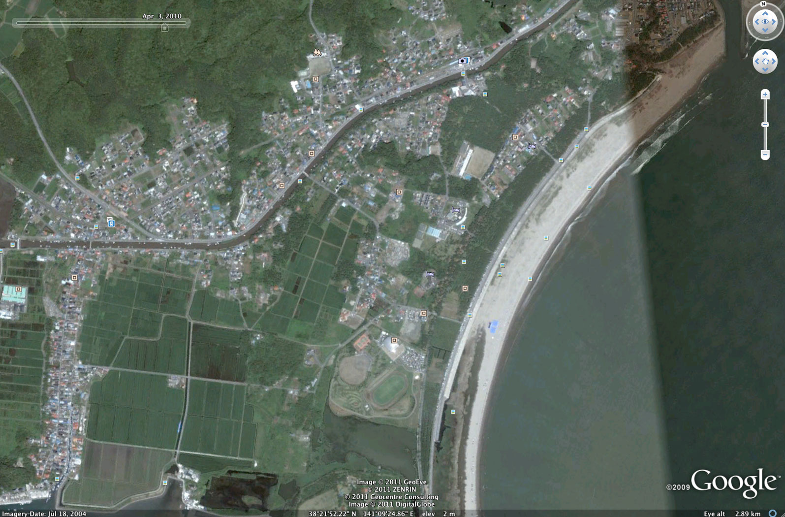
Sedai coast in April 2010, before the tsunami

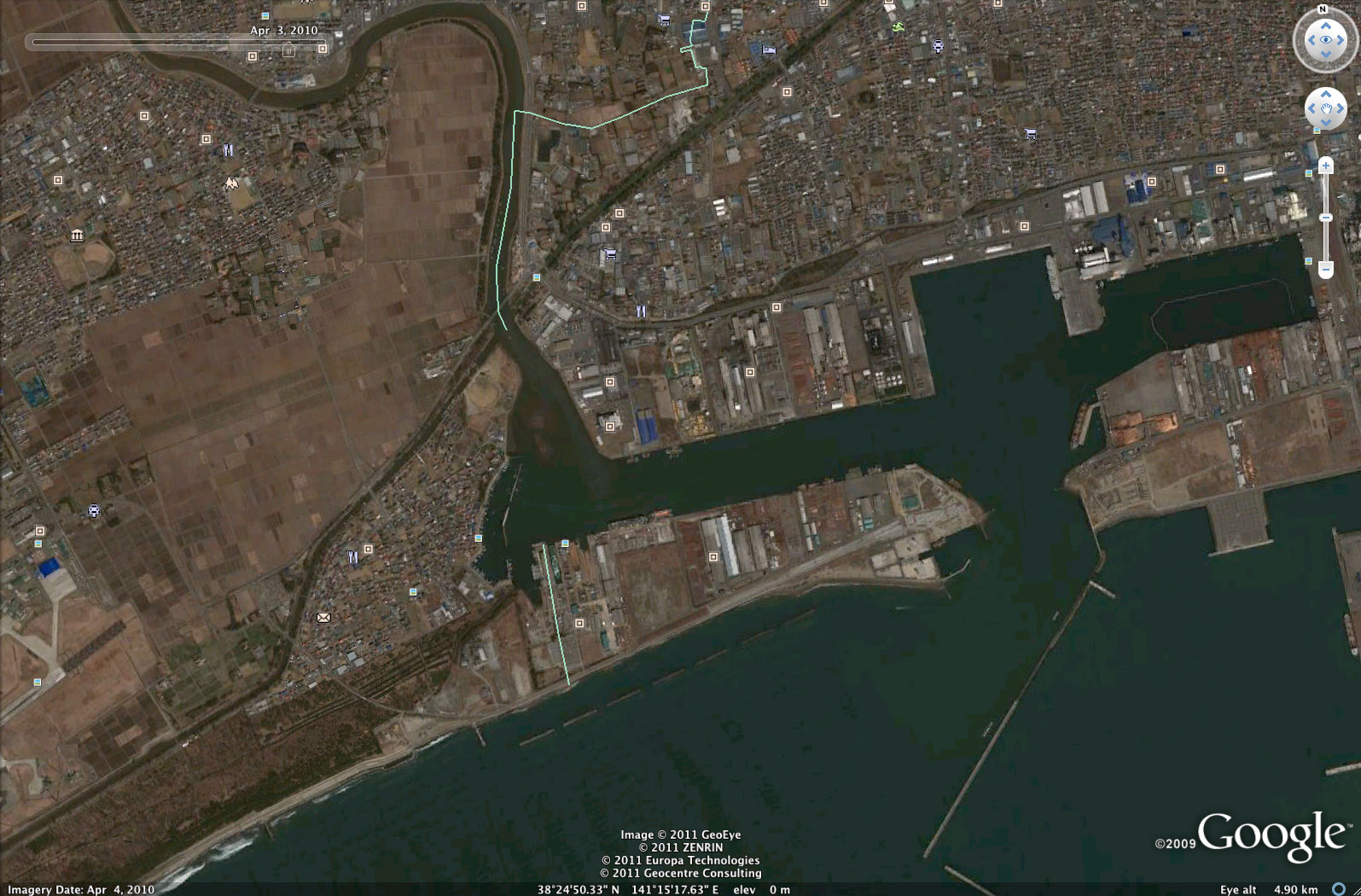
Sedai coast in March 2011, after the tsunami
Sedai coast in April 2010, before the tsunami. Images courtesy of Google Earth.
For more images, use Google Earth to visit the Sedai region of Japan (eastern coast of Honshu island).
Related articles
Pictures of tsunami devastation, including a house floating in the open ocean
(03/17/2011) The U.S. Navy released shocking pictures showing widespread devastation in Japan following last week’s 9.0-magnitude earthquake and accompanying tsunami. The photos include a house floating in the open ocean, scenes of destruction in Ofunato, and piles of vehicles and debris, among others.
Japan’s earthquake disaster may boost rainforest logging in Borneo
(03/13/2011) Malaysian loggers say Japan’s recovery from last week’s devastating earthquake and tsunami will boost demand for rainforest timber, reports the Borneo Post.
Is Japan’s tsunami linked to climate change?
(03/11/2011) Could the earthquake that triggered Japan’s devastating tsunami be linked to climate change? The short answer is probably not, but recent research suggests that changing climate has the potential to influence earthquakes in some parts of the world