Google released satellite images revealing the devastation in Sendai caused by the March 11 tsunami and earthquake.
The satellite images are available on Google Earth and Google Maps.
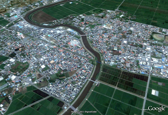
Sendai Yamoto 2004. Satellite picture courtesy of Google Earth / GeoEye.
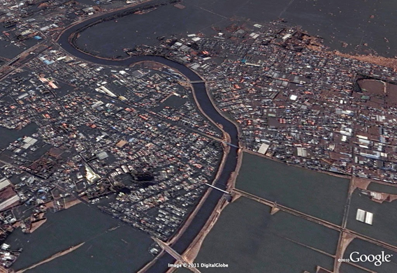
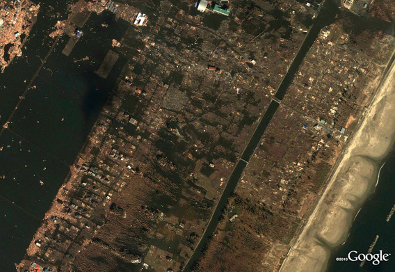
Sendai Yamoto after the March 11, 2011 Sendai earthquake and tsunami. Satellite picture courtesy of Google Earth / GeoEye.
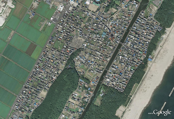
Sendai Terashima 2003. Satellite picture courtesy of Google Earth / GeoEye.
Sendai Terashima after the March 11, 2011 Sendai earthquake and tsunami. Satellite picture courtesy of Google Earth / GeoEye.
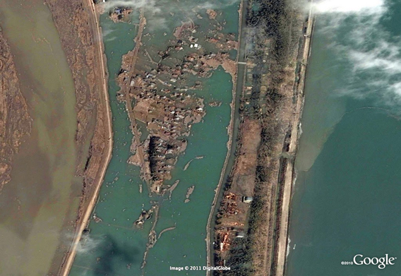
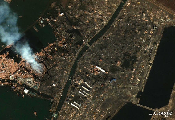
Sendai Arahama after the March 11, 2011 Sendai earthquake and tsunami. Satellite picture courtesy of Google Earth / GeoEye.
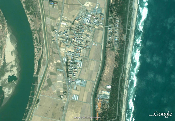
Sendai Arahama 2008. Satellite picture courtesy of Google Earth / GeoEye.
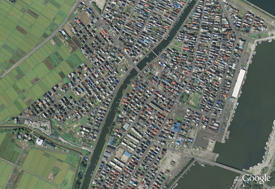
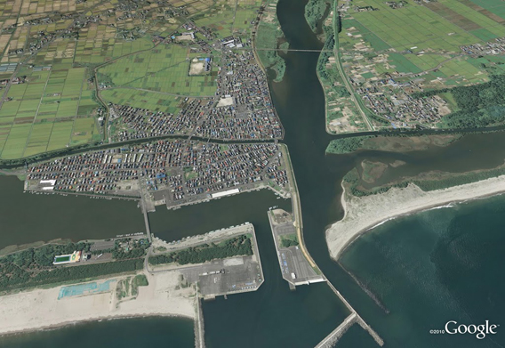
Sendai Yuriage neighborhood detail 2008. Satellite picture courtesy of Google Earth / GeoEye.
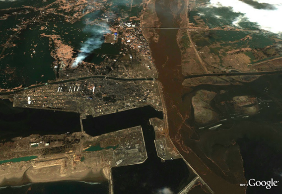
Sendai Yuriage neighborhood detail after the March 11, 2011 Sendai earthquake and tsunami. Satellite picture courtesy of Google Earth / GeoEye.
Sendai Yuriage neighborhood looking west 2008. Satellite picture courtesy of Google Earth / GeoEye.
Sendai Yuriage neighborhood looking west after the March 11, 2011 Sendai earthquake and tsunami. Satellite picture courtesy of Google Earth / GeoEye.
next