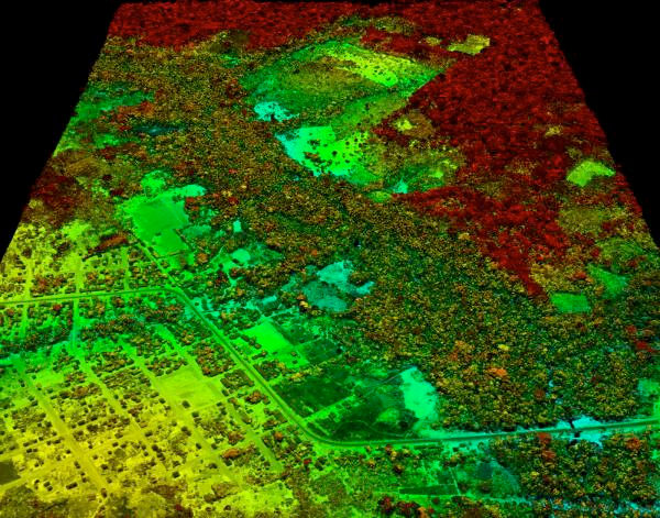
A new high-resolution airborne and satellite mapping approach provides detailed information on carbon stocks in Amazonia. This image shows an area of road building and development adjacent to primary forest in red tones, and secondary forest regrowth in green tones. Image from the Carnegie Airborne Observatory, Carnegie Institution for Science.
Scientists using a combination of satellite imagery, airborne-laser technology, and ground-based plot surveys to create three-dimensional high resolution carbon maps of the Amazon rainforest have documented a surge in emissions from deforestation and selective logging following the paving of the Trans-Oceanic Highway in Peru.
The study, published this week in the early edition of the Proceedings of the National Academy of Sciences, reveals that selective logging and other forms of forest degradation in Peru account for nearly a third of emissions compared to deforestation alone. The findings, which demonstrate the feasibility of using LiDAR and satellite imagery over large areas of tropical forest, have important implications for monitoring, reporting, and verifying emissions reductions under proposed Reduced Emissions from Deforestation and Degradation (REDD) programs, which could compensate developing countries for protecting and sustainability managing their forests.
Peru’s rainforest highway triggers surge in deforestation, according to new 3D forest mapping