Carbon for forest conservation concept faces challenges but offers big payoff
Carbon credits for forest conservation concept faces challenges
But initiative could save forests and alleviate rural poverty:
An interview with Indonesian forest expert Ketut Deddy
Rhett A. Butler, mongabay.com
November 27, 2007
While environmentalists, scientists, development exports, and policymakers across the political spectrum are enthusiastic about the idea of offsetting carbon emissions by preventing deforestation (a concept known as “avoided deforestation” or Reduced Emissions from Deforestation and Degradation (REDD)), the concept still faces many challenges, especially in implementation. Issues range from “permanence” (whether a county can ensure that forest carbon savings are permanent) to “leakage” (what happens when carbon conservation in one area drives deforestation in another?) to baseline data establishment (how does one measure historic deforestation to establish a baseline for calculating reduction?). Further questions over land rights (will REDD trigger a land rush by industrial agriculture giants and forestry firms?) as well as how local communities will benefit (the cost of registering and establishing a REDD project may top $50,000, a nearly insurmountable sum for communities and small-scale forest holders in some of the world’s poorest countries) are also valid. Still, with deforestation and land use change accounting for as much as 20 percent of global greenhouse gas emissions–more than the entire transportation sector–many agree that REDD will be an important part of a global climate change mitigation strategy. With its carbon-rich forests and peatlands, Indonesia is widely seen as having the best potential for REDD initiatives.
 Ketut Deddy |
Working to address these issues is SEKALA (www.sekala.net), an Indonesia-based NGO that was formed in 2005. Through community training, remote sensing and spatial analysis work, and land-use planning, SEKALA aims to develop “realistic, tangible and innovative solutions” for environmental problems. SEKALA has been particularly active in working through the realities of REDD in remote, but threatened forests in Papua, on the island of New Guinea, and Kalimantan, on the island of Borneo.
In a November 2007 interview with mongabay.com, Ketut Deddy, director of SEKALA, said he is optimistic that REDD can deliver benefits to rural populations while protecting forests and their resident biodiversity.
“REDD has the possibility to mobilize unprecedented funding and technical assistance for initiatives seeking to reduce deforestation and forest degradation in Indonesia,” Ketut Deddy told mongabay.com. “If successful, these initiatives will not only benefit the global community who will be affected by climate change, but also benefit conservation initiatives seeking to conserve Indonesia’s rich biodiversity, particularly in the increasingly threatened lowland forests of Sumatra and Kalimantan.”
INTERVIEW WITH SEKALA’S KETUT DEDDY
Mongabay: What does Sekala do?
Ketut Deddy Muliastra: Sekala aims to develop realistic, tangible and innovative solutions for environmental problems. It also aims to offer balanced solutions that bring benefits for local people and the environment.
Expertise
Sekala specializes in good forest governance, community mapping, land use planning, Geographic Information Systems (GIS) and remote sensing in Indonesia. It has extensive expertise on critical forestry issues, such as illegal logging and forest conversion, and works on initiatives that seek to reduce carbon emissions through avoided deforestation.
Training and internships
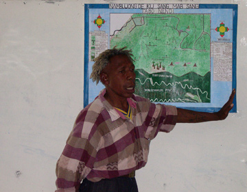 Community mapping in Papua. Photo taken by Mac Chapin |
Sekala provides training and internships on Geographic Information Systems, satellite image processing and remote sensing to various stakeholders, including the Indonesian Ministry of Forestry, provincial governments and NGOs. Some of these training workshops are linked to the Ministry of Forestry’s Forest Monitoring and Assessment System (FOMAS) and aim to initiate discussion among civil society and local forestry offices about data availability, information sharing mechanisms, standards, metadata and analysis. These training sessions also seek to increase awareness about the need for transparency and to mobilize a constituency committed to sharing forest data and information. Other training workshops are more technical in nature and aim to increase capacity to improve data and to do GIS analysis.
Remote sensing and spatial analysis lab
Sekala has established a GIS lab in Bali. The lab is equipped with state of the art equipment (including a plotter, GIS software and hardware), qualified GIS technicians and a vast database of spatial data. The lab provides high and low resolution satellite imagery for the Indonesian archipelago, and offers a suite of image processing and printing services.
Mongabay: How many people are involved?
Ketut Deddy Muliastra: Sekala has a small core staff of 5 people, however, it draws upon the expertise of at least 15 Indonesian and international professionals to implement projects it is involved in.
Mongabay: What regions do you cover?
Ketut Deddy Muliastra: Sekala primarily works in Papua and Kalimantan where it has extensive experience in community mapping, conservation management, threat analysis, spatial analysis, conflict resolution and spatial planning.
Mongabay: Who do you work with?
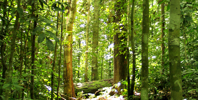 Forest in Kalimantan. Photo by Ketut Deddy |
Ketut Deddy Muliastra: Sekala works with many organizations, including the Indonesian Ministry of Forestry, the World Resources Institute, the World Bank, Fauna and Flora International, Telapak, Forest Watch Indonesia, the Samdhana Institute, the Nordic Consulting Group, the Papuan Civil Strengthening Foundation (PCSSF), South Dakota State University and the Nature Conservancy.
REDD
Mongabay: What REDD projects are you involved in?
Ketut Deddy Muliastra: Sekala is supporting forest carbon initiatives at three different scales.
- National: Sekala is working with a range of partners including the Ministry of Forestry, World Resources Institute and the World Bank to develop a Forest Monitoring and Assessment system, known as FOMAS. FOMAS aims to collect, improve, archive and disclose accurate, reliable and up-to-date data on Indonesia’s forest resources. This data can be used to monitor forest cover change and associated carbon emissions.
- Regional: Sekala is leading a consortium of organizations to carry out a Strategic Environmental Assessment for spatial planning in Papua province which will assess Papua’s development needs and identify conversion forest areas which can be slated for carbon storage. Sekala is also working with Fauna and Flora International, the Papuan Civil Society Strengthening Foundation (PCSSF) and Telapak Indonesia to assist the Governors of Papua and West Papua to select potential sites for avoided deforestation in Papua. Eleven sites with a total of 1.4 million ha of forest have already been selected based on the level of threat (all include conversion forests planned for plantation development and face illegal/unsustainable logging practices) and the extent of primary forest cover.
- Local: Sekala has developed participatory community mapping techniques that can resolve conflicts and be used to negotiate land rights with government and local communities. These techniques can be applied to initiatives undertaken under the auspices of REDD to ensure that local people are: adequately consulted in carbon storage programs; able to participate in projects that seek to avoid deforestation; and are adequately rewarded for protecting forest resources from encroachment. They can also be used to ensure that future developments moved onto degraded lands do not adversely affect local communities.
Mongabay: What’s your outlook on REDD?
Ketut Deddy Muliastra: REDD has the possibility to mobilize unprecedented funding and technical assistance for initiatives seeking to reduce deforestation and forest degradation in Indonesia. If successful, these initiatives will not only benefit the global community who will be affected by climate change, but also benefit conservation initiatives seeking to conserve Indonesia’s rich biodiversity, particularly in the increasingly threatened lowland forests of Sumatra and Kalimantan.
Mongabay: What are the challenges facing implementation of REDD on the ground?
Ketut Deddy Muliastra: While REDD offers many potential benefits, it also faces many challenges. These challenges need to be recognized and adequately addressed in order to deliver an effective avoided deforestation program that delivers large carbon sequestration benefits and effectively handles payments for reduced carbon emissions. Some of the most notable challenges are:
Permanence: How can Indonesia ensure that avoided deforestation and related carbon dioxide emissions are permanent? In other words, how can Indonesia ensure that forests conserved for payments are not cut down later on or converted to other land uses? Buyers of forest carbon tend to want permanent agreements not temporary ones. This is because mitigating climate change requires stabilizing CO2 concentrations over the long-term. However, it is almost impossible to guarantee that forests will be permanently conserved. Forests can burn down, even without human intervention, and climate change may imperil tropical forests if temperatures rise and rainfall decreases. Land-owners may also not want to sign into permanent conservation agreements because such agreements may close off future options that arise from technological innovations, market changes and expanded transportation networks.
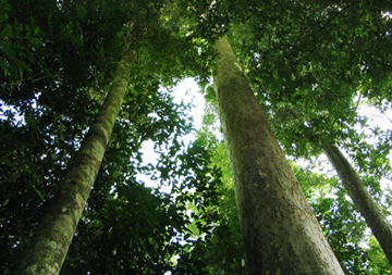 Forest in Kalimantan. Photo by Ketut Deddy |
Nevertheless, emission reduction from avoided deforestation is useful, even if it is not permanent, because it will help to ensure that high concentrations of carbon are not released into the atmosphere over a short time period. Avoided deforestation may also buy time for the world to improve emission reducing technologies that can more permanently abate global warming.
Leakages: What will happen if one area of the country is able to apply policies and measures to reduce deforestation and degradation, but the problem shifts to another part of the country where deforestation and degradation increases? Or, what will happen if carbon is stored and conserved in protected areas but released on a large-scale in production or conversion forest lands? This will mean that the carbon benefit will be offset, or possibly become zero or negative. REDD needs to result in real, measurable, and long-term benefits related to the mitigation of climate change to have a significant impact on climate change. National strategies will need to be put in place to promote a nationwide approach to avoided deforestation to minimize leakages.
Complexity of deforestation: Deforestation is a complex condition with multiple economic, socio-political, demographic and environmental origins. These include direct causes such as logging, agricultural expansion and infrastructure development; and underlying causes such as policy and institutional failures, economic factors and cultural factors. An avoided deforestation scheme would have to address a wide variety of issues and make use of cross-sectoral approaches such as good governance, institutional strengthening, better communication, and improved livelihood conditions for local communities.
Baseline data establishment: An avoided deforestation scheme needs to have accurate baseline data and include a comprehensive monitoring system. Such a system would rely on sophisticated science to determine:
- Changes in forest and vegetation cover, including deforestation and forest degradation.
- Changes in carbon stocks.
- Estimates of emissions.
Some of these measurements would require ground-truthing which will be expensive and time-consuming. This is particularly the case for forest degradation, which may be more difficult and expensive to be monitor with remote sensing. Measuring changes in carbon stocks will also be challenging as it takes considerable effort to measure the amount of carbon in a tree, let alone an entire forest. The carbon content of forests also varies significantly depending on the density, age and type of trees, and the soils.
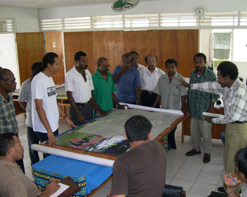 Community mapping in Papua. Photo taken by Mac Chapin |
Adequate incentives for avoided deforestation: How can Indonesia ensure that payments provided for carbon emission reductions resulting from deforestation offset the benefits of logging or clearing forests for commercial crops, such as oil palm? Carbon payments will need to be competitive and able to accommodate fluctuating global price changes to adequately address this issue.
Payment distribution: How can Indonesia ensure that payments for carbon emission reductions are equitably disbursed to reward those who have protected forests and reduced deforestation rates, most notably local communities? Comprehensive payment schemes will need to be put in place to ensure that payments adequately address the agents of forest change and reward those who protect forest resources.
Mongabay: How can local people benefit from REDD?
Ketut Deddy Muliastra: Local people can potentially benefit from REDD by being rewarded for conserving and sustainably managing forests for carbon storage.
Papua
Mongabay: How big a threat is oil palm in Papua’s forests?
Ketut Deddy Muliastra: Indonesia has established around 6.2 million ha of oil palm and is expected to establish another 6-7 million hectares of oil palm over the next 13 years. Most of this expansion is expected to first occur in Sumatra and Kalimantan followed by Papua. The Indonesian government is keen to develop oil palm plantations in Papua and is offering investors the opportunity to establish up to 200,000 ha of oil palm rather than just 100,000 ha in Sumatra and Kalimantan. Over 50,000 ha of oil palm has been planted in Papua and permits have already been allocated to develop another 500,000 ha. According to land suitability maps, around 2.8 million ha of land is suitable for oil palm in Papua, while around 1 million ha of land is suitable for oil palm in West Papua.
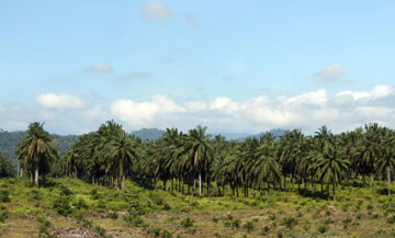 Oil palm in Malaysia. Photo by Rhett A. Butler. |
While oil palm is able to confer important economic benefits in terms of foreign exchange, revenue and employment it is a source of concern because it results in outright forest conversion, biodiversity loss and carbon emissions.
At this stage, Papua is unlikely to become an oil palm hub (like Riau), because it is more expensive to establish oil palm in Papua than in well-established regions such as Riau and North Sumatra.
Nevertheless, concessions allocated for oil palm developments are likely to result in forest clearing and the process of allocating permits for oil palm developments in Papua needs to be reviewed in the immediate future.
Mongabay: What’s your outlook for the forests of Papua?
Ketut Deddy Muliastra: Recent modis satellite imagery analysis conducted by the South Dakota State University’s Geographic Information Science Centre of Excellence in partnership with the Indonesian Ministry of Forestry, the World Resources Institute, Sekala and the United States Geological Survey has revealed that deforestation has been minimal in Papua over the period 2000-2006.
The island groups featuring the most change continue to be Sumatra and Kalimantan. Over 94% of Indonesia’s deforestation occurred on these two islands between 2000 and 2006.
While deforestation in Papua has been limited in comparison to Kalimantan and Sumatra, numerous threats are emerging. Three of the main threats are logging, mining and oil palm.
Logging
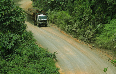 Logging truck in Kalimantan. Photo by Ketut Deddy |
The great majority of Papua’s production forests have been allocated to around 60 large-scale timber concessions which cover over 13 million ha of production forests. A number of new logging models have also emerged over the last decade. So too has illegal logging.
Mining
Papua has large potential reserves of gold, copper, natural gas and oil and up to 14 million ha of forested land has already been allocated to mining companies for exploration and mining.
Oil palm
As mentioned above, over 50,000 ha of oil palm has been planted in Papua and permits have already been allocated to development another 500,000 ha. Areas slated for oil palm developments are likely to result in outright forest clearing unless the permit allocation process can be reviewed in spatial plans.
Mongabay: Compared with Borneo and Sumatra, is fire a significant risk in Papua?
Ketut Deddy Muliastra: Risk of fire in Papua is relatively low compared to Sumatra and Kalimantan. This is because degraded forest areas are more susceptible to fire than primary forests. Peat lands (which store large quantities of carbon ~ 60 Kg/m3) are also more susceptible to fire after they have been drained to make way for large scale oil palm or industrial timber plantations.
Forest assessment and monitoring
Mongabay: Can you describe what your role is in the Ministry of Forestry’s forest assessment and monitoring system?
Ketut Deddy Muliastra: In Indonesia, most stakeholders generally agree that a lack of reliable information on forest and timber resources is a major obstacle to good forest governance in Indonesia.
Following an extensive multi-stakeholder consultation process, the Indonesian Ministry of Forestry (MoF) launched a forest monitoring and assessment system known as FOMAS in early 2006.
FOMAS aims to promote good forest governance by making relevant, reliable, accurate and up-to-date forest sector information continuously available to decision makers and the general public.
Sekala and its partners are assisting the Ministry of Forestry to:
- Collect, digitize, improve and archive spatial data on the legal boundaries and licenses of large-scale concessions, industrial timber plantations, tree crop plantations and national parks.
- Adjust spatial data on the legal boundaries and licenses of forest enterprises into a new Ministry of Forestry base map.
- Produce up-to-date forest change maps for Indonesia’s forest estate.
When this process has been completed the Ministry of Forestry will have an up-to-date geographic database of maps. These maps can be analyzed and used to improve decision-making processes, develop effective policies and reforms that can mitigate deforestation, detect illegal logging and forest conversion, and inform spatial planning processes. They can also be used to monitor forest cover change and carbon emissions.
Mongabay: How do you use remote sensing and GIS in your work?
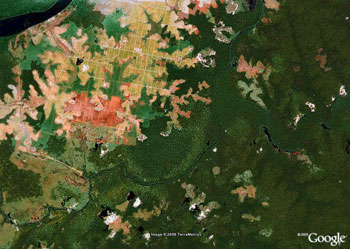 Oil-palm plantations in and around Tanjung Puting National Park in Kalimantan, Indonesian Borneo. Satellite image courtesy of Google Earth. |
Ketut Deddy Muliastra: We use remote sensing and GIS in our work to improve spatial data, assess spatial plans, analyze forest activities, detect illegal logging and forest clearing and to monitor forest cover change and associated carbon emissions. We are also using it to support community mapping and to develop different development scenarios for the province of Papua.
Mongabay: What other projects do you run?
Ketut Deddy Muliastra:
Strategic Environmental Assessment of Papua province
Sekala is leading a consortium of organizations to carry out a Strategic Environmental Assessment (SEA) for spatial planning in Papua province. The SEA will assist Papua province to develop its spatial plan by assessing the economic, social and environmental consequences of different development scenarios. It will also build the capacity of the Papua provincial government to integrate environmental and social concerns into development planning. The SEA was directly requested by the Papua provincial government to help them with spatial planning.
Fire assessment for biodiversity conservation
Sekala is currently putting together a spatial fire database that includes the geographic extent of Borneo, Sulawesi and Papua for the Nature Conservancy (TNC). This database will be used to determine the vulnerability of conservation areas located on the islands of Borneo, Sulawesi and Papua to fire and fire-related threats. This database will also be used to better prevent, detect and control damaging wildfires on these three islands.
International assistance
Mongabay: What’s the best way for people in Indonesia and abroad to help your efforts?
Ketut Deddy Muliastra: We are currently seeking financial support to:
- Assist West Papua province to carry out a Strategic Environmental Assessment. This will be undertaken after we have completed the Strategic Environmental Assessment for Papua province in July 2008.
- Assist provincial and district forestry offices to improve their spatial databases and to use accurate, reliable and up-to-date forest sector information in spatial planning and decision making.
- Provide training and internships to provincial and district forestry officers and NGOs on spatial planning, GIS and remote sensing.
- Support community mapping processes in Kalimantan and Papua.
- Assist the Indonesian Ministry of Forestry to collect and improve up-to-date spatial forest sector data.