JAKARTA — In wildlife conservation management, the best species to focus on to maximize protection of a region’s biodiversity aren’t necessarily the most charismatic ones, a new study from Indonesia’s…
There’s good news and bad news for the Javan rhino, one of the most threatened large mammals on Earth. The recent sighting of a mother-and-calf pair in Indonesia’s Ujung Kulon…
ATHENS — From April 15-17, state delegates, organization representatives, academics and philanthropists met at the 9th Our Ocean Conference (OOC) in Athens to discuss the protection of the world’s oceans…
The new extractive reserves allow resident populations to engage in traditional and sustainable extractive practices such as fishing and hunting, while keeping out big businesses, such as commercial aquaculture or logging.
The Philippines’ southern region of Mindanao has a history of war and armed conflict going back more than 400 years. The contemporary conflict’s origin in this region of 26.3 million…
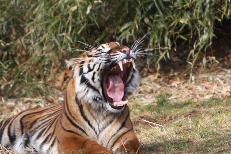
JAKARTA — The Indonesian government has rolled out what it calls a “biodiversity management master plan” amid mounting criticism of the environmental and social threats posed by the construction of…
Forest clearing detected by Brazil's deforestation alert system fell to the lowest level in nearly five years, according to data released last week by the country's space agency, INPE. INPE's…
When around 70,000 Indigenous Maasai were expelled from their lands in northern Tanzania in 2022, it didn’t happen in a vacuum. For years, the Tanzanian government has systematically attacked Maasai…
In eastern Sierra Leone, straddling the border of Liberia, lies Gola Rainforest National Park, one of the last remaining intact tracts of the tropical Upper Guinean forests in West Africa.…
Indigenous organizations from Peru and Brazil are joining forces to push their respective governments to safeguard a 16-million-hectare (39.5-million-acre) territorial corridor in the Amazon that stretches from the Tapiche River…
The concrete industry is a major carbon emitter and polluter, with severe human health impacts. But circular solutions, including electrifying cement plants, making low-carbon cement, and bio-architecture could offer relief.
BLANTYRE — Police and wildlife department officials in Malawi have arrested two men suspected of having killed an elephant in Kasungu National Park in the country’s west. In July 2022,…
The US food and drink giant PepsiCo has been linked through its supply chain to Amazon deforestation and the invasion of Indigenous lands in Peru, the Bureau of Investigative Journalism…
How do you identify sick oaks? For a long time, detecting unhealthy oaks and identifying the disease afflicting them required a lot of manual labor. Scientists often looked out of…
When he was a teenager at the end of the 1980s, Evanildo Sena would come back from a day of fishing dragging 5 or 6 tons of fish with his…
Indigenous peoples and local communities are already feeling the impacts of climate change, according to firsthand accounts documented in a new study. The authors of the paper, published in the…
Clothing giants H&M and Zara have been linked to large-scale illegal deforestation, land-grabbing, violence and corruption in the Brazilian Cerrado, according to an investigation by Earthsight. Using satellite images, court…
Plans to relocate an Indigenous community from a tiny Caribbean island off Panama to the country’s mainland to escape rising seas have been delayed due to administrative issues, previous COVID-19-related…
The mood is tense. After months of delays, the EU will soon vote on a long-awaited piece of legislation that will require European companies to integrate environmental and human rights…
The petroleum industry has a long history of operational calamities, large and small, that has created an equally long history of efforts to manage the environmental and social liabilities that…
Living deep in the Peruvian Amazon, the Kukama Kukamiria Indigenous community have spent generations with their feet in the Marañón, the river emerging from the Andes that provides the main…
SOUTH PESISIR, Indonesia — Bendri lived with his wife and child just 80 meters, or 260 feet, back from the Surantih Mudiak Dalam River, which flows from Sumatra’s Barisan Mountains…
JAKARTA — South Korean automobile giant Hyundai has ended an agreement with Adaro Minerals, a subsidiary of Indonesia’s second-largest coal miner, PT Adaro Energy, to procure aluminum for its electric…
PHNOM PENH — New data published by the University of Maryland on April 4 and available through satellite monitoring platform Global Forest Watch show continued forest loss across Cambodia last…
Dahr Jamail was working in Alaska’s Denali National Park in the early 2000s when he decided to travel to Iraq to better cover the U.S.-led invasion of the region, on…
In 2015, smelly mats of a brown macroalgae called sargassum piled as high as 1.2 meter (4 feet) on the beaches of Barbados, recalls Joshua Forte. It was the fourth…
Measures throughout 2023 to curb the illegal gold trade in Brazil led to a 20% drop in the country’s exports of the precious metal.
ATHENS — The world is currently undergoing its fourth global bleaching event, with coral bleaching occurring in the territorial waters of more than 50 countries, according to scientists at the…
Even if everything goes well and the targets set by the Paris Agreement are met, average temperatures are expected to rise by 2.7° Celsius (4.86° Fahrenheit) this century, according to…
Bolivia is racing to attract foreign investment in its massive, untapped lithium reserves, with plans to expand operations and build new processing plants. But residents living near the lithium deposits…